
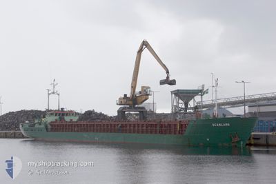
SCANLARK
General Cargo
Current Trip
| Trip Time | 12 days |
|---|---|
| Trip Distance | 1982.06 nm |
| AVG Speed | 8 Knop |
| MAX Speed | 11.1 Knop |
| Djupgående | 3.9 m |
| AVG Wind | 13.4 knots |
| MAX Wind | 27.1 knots |
| MIN Temp | 0.7°C / 33.26°F |
| MAX Temp | 16.4°C / 61.52°F |
| Position mottagen | 3 m sen |
Current Position
| Longitud | 4.66708° |
|---|---|
| Latitude | 52.47124° |
| Status | Moored |
| Fart | |
| Kurs | 328° |
| Område | North Sea |
| Station | T-AIS |
| Position mottagen | 3 m sen |
Info
Information
The current position of SCANLARK is in North Sea with coordinates 52.47124° / 4.66708° as reported on 2024-04-25 01:53 by AIS to our vessel tracker app. The vessel's current speed is 0 Knop and is currently inside the port of BEVERWIJK.
The vessel SCANLARK (IMO: 8505915, MMSI: 375354000) is a General Cargo that was built in 1985 ( 39 År gammal ). It's sailing under the flag of [VC] St Vincent Grenadines.
In this page you can find informations about the vessels current position, last detected port calls, and current voyage information. If the vessels is not in coverage by AIS you will find the latest position.
The current position of SCANLARK is detected by our AIS receivers and we are not responsible for the reliability of the data. The last position was recorded while the vessel was in Coverage by the Ais receivers of our vessel tracking app.
The current draught of SCANLARK as reported by AIS is 3.9 meters
Weather
| Temperature | 4.4°C / 39.92°F |
|---|---|
| Wind Speed | 6 knots |
| Direction | 324° NW |
| Pressure | 1007.7 hPa |
| Humidity | 80.7 % |
| Cloud Coverage | 100 % |
Featured Company
Last Port Calls
| Port | Arrival | Departure | Time In Port |
|---|---|---|---|
| 2024-04-24 23:46 | |||
| 2024-04-11 09:09 | 2024-04-12 16:46 | 1 d | |
| 2024-04-04 18:05 | 2024-04-05 22:51 | 1 d | |
| 2024-03-15 23:43 | 2024-03-20 13:56 | 4 d | |
| 2024-03-13 02:15 | 2024-03-14 17:16 | 1 d | |
| 2024-03-07 22:53 | 2024-03-08 05:17 | 6 h | |
| 2024-03-03 11:05 | 2024-03-05 15:18 | 2 d | |
| 2024-02-24 12:59 | 2024-02-25 14:27 | 1 d | |
| 2024-02-19 15:11 | 2024-02-20 15:45 | 1 d | |
| 2024-02-16 18:14 | 2024-02-17 00:43 | 6 h |
Last Trips
| Origin | Departure | Destination | Arrival | Distance | |
|---|---|---|---|---|---|
| 2024-04-12 17:46 | 2024-04-25 01:46 | 1982.06 nm | |||
| 2024-04-06 01:51 | 2024-04-11 10:09 | 941.03 nm | |||
| 2024-03-20 14:56 | 2024-04-04 21:05 | 713.29 nm | |||
| 2024-03-14 18:16 | 2024-03-16 00:43 | 254.48 nm | |||
| 2024-03-08 06:17 | 2024-03-13 03:15 | 635.77 nm | |||
| 2024-03-05 15:18 | 2024-03-07 23:53 | 140.12 nm | |||
| 2024-02-25 16:27 | 2024-03-03 11:05 | 939.17 nm | |||
| 2024-02-20 16:45 | 2024-02-24 14:59 | 615.56 nm | |||
| 2024-02-17 01:43 | 2024-02-19 16:11 | 184.81 nm | |||
| 2024-02-13 20:37 | 2024-02-16 19:14 | 390.83 nm |
Events
| Tid | Event | Detaljer | Position / Dest | Information |
|---|---|---|---|---|
| 2024-04-25 00:05 | Status ändrad | Moored Under way using engine |
52.47125 / 4.66709
[NL] BEVERWIJK
|
Fart: Kurs: 327° |
| 2024-04-24 23:59 | STOPPAR förflyttning |
52.47119 / 4.66702
[NL] BEVERWIJK
|
Fart: 0.2 kn Kurs: 333° |
|
| 2024-04-24 23:46 | ANLÄNDER HAMN |
|
52.46239 / 4.66244
[NL] BEVERWIJK
|
Fart: 4.6 kn Kurs: 45° |
| 2024-04-24 23:25 | STARTAR förflyttning | 0.53 nm, East of IJMUIDEN |
52.46593 / 4.60201
NLBEV
|
Fart: 3.1 kn Kurs: 100° |
| 2024-04-24 23:10 | STOPPAR förflyttning | 0.42 nm, East of IJMUIDEN |
52.46591 / 4.59888
NLBEV
|
Fart: 0.3 kn Kurs: 97° |
| 2024-04-24 21:28 | Status ändrad | Under way using engine Default |
52.47802 / 4.27462
NLBEV
|
Fart: 7.5 kn Kurs: 104° |
| 2024-04-24 21:09 | Status ändrad | Default Under way using engine |
52.48667 / 4.21080
NLBEV
|
Fart: 7.4 kn Kurs: 99.1° |
| 2024-04-24 20:27 | Byter havsområde | Dutch part of the North Sea Danish part of the North Sea |
52.54585 / 4.10986
North Sea
NLBEV
|
Fart: 8.7 kn Kurs: 157.4° |
| 2024-04-24 20:27 | Status ändrad | Under way using engine Default |
52.54622 / 4.10963
NLBEV
|
Fart: 8.7 kn Kurs: 156° |
| 2024-04-24 20:27 | I täckningsområde |
52.54585 / 4.10986
North Sea
NLBEV
|
Fart: 8.7 kn Kurs: 157.4° |