
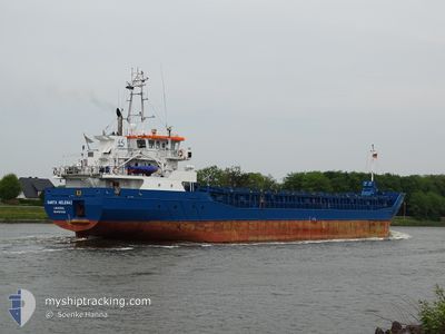
SANTA HELENA 1
General Cargo
Current Trip
| Time Travelled | 2 days |
|---|---|
| Remaining Time | 1 day |
| Distance Travelled | 146.74 nm |
| Remaining Distance | 238.17 nm |
| AVG Speed | 6 Knop |
| MAX Speed | 9.6 Knop |
| AVG Wind | 21.3 knots |
| MAX Wind | 29 knots |
| MIN Temp | 5.4°C / 41.72°F |
| MAX Temp | 9°C / 48.2°F |
| Djupgående | 3.4 m |
| Position mottagen | Nu |
Current Position
| Longitud | 7.16545° |
|---|---|
| Latitude | 55.57700° |
| Status | Under way using engine |
| Fart | 7.9 Knop |
| Kurs | 15.5° |
| Område | North Sea |
| Station | T-AIS |
| Position mottagen | Nu |
Info
Information
The current position of SANTA HELENA 1 is in North Sea with coordinates 55.57700° / 7.16545° as reported on 2024-04-20 14:42 by AIS to our vessel tracker app. The vessel's current speed is 7.9 Knop and is heading at the port of FREDERIKSHAVN. The estimated time of arrival as calculated by MyShipTracking vessel tracking app is 2024-04-21 21:03 LT
The vessel SANTA HELENA 1 (IMO: 9617325, MMSI: 210075000) is a General Cargo that was built in 2012 ( 12 År gammal ). It's sailing under the flag of [CY] Cyprus.
In this page you can find informations about the vessels current position, last detected port calls, and current voyage information. If the vessels is not in coverage by AIS you will find the latest position.
The current position of SANTA HELENA 1 is detected by our AIS receivers and we are not responsible for the reliability of the data. The last position was recorded while the vessel was in Coverage by the Ais receivers of our vessel tracking app.
The current draught of SANTA HELENA 1 as reported by AIS is 3.4 meters
Weather
| Temperature | 5.9°C / 42.62°F |
|---|---|
| Wind Speed | 23 knots |
| Direction | 328° NNW |
| Pressure | 1019.4 hPa |
| Humidity | 63.8 % |
| Cloud Coverage | 99 % |
Featured Company
Last Port Calls
| Port | Arrival | Departure | Time In Port |
|---|---|---|---|
| 2024-04-09 18:41 | 2024-04-18 02:54 | 8 d | |
| 2024-04-05 02:53 | 2024-04-08 10:28 | 3 d | |
| 2024-04-03 06:20 | 2024-04-04 15:19 | 1 d | |
| 2024-04-01 10:18 | 2024-04-01 22:09 | 11 h | |
| 2024-03-28 18:44 | 2024-03-29 20:09 | 1 d | |
| 2024-03-24 05:25 | 2024-03-26 18:33 | 2 d | |
| 2024-03-21 16:21 | 2024-03-23 16:52 | 2 d | |
| 2024-03-19 05:55 | 2024-03-20 12:43 | 1 d | |
| 2024-03-14 00:26 | 2024-03-15 15:43 | 1 d | |
| 2024-03-08 03:49 | 2024-03-11 18:43 | 3 d |
Most Visited Ports (Last year)
| Port | Arrivals | |
|---|---|---|
| 10 | ||
| 6 | ||
| 4 | ||
| 4 | ||
| 4 | ||
| 3 |
Last Trips
| Origin | Departure | Destination | Arrival | Distance | |
|---|---|---|---|---|---|
| 2024-04-08 12:28 | 2024-04-09 20:41 | 241.76 nm | |||
| 2024-04-04 17:19 | 2024-04-05 04:53 | 96.65 nm | |||
| 2024-04-02 00:09 | 2024-04-03 08:20 | 233.13 nm | |||
| 2024-03-29 21:09 | 2024-04-01 12:18 | 190.11 nm | |||
| 2024-03-26 18:33 | 2024-03-28 19:44 | 287.54 nm | |||
| 2024-03-23 16:52 | 2024-03-24 05:25 | 105.79 nm | |||
| 2024-03-20 12:43 | 2024-03-21 16:21 | 235.32 nm | |||
| 2024-03-15 16:43 | 2024-03-19 05:55 | 709.16 nm | |||
| 2024-03-11 19:43 | 2024-03-14 01:26 | 532.91 nm | |||
| 2024-03-06 11:41 | 2024-03-08 04:49 | 338.47 nm |
Events
| Tid | Event | Detaljer | Position / Dest | Information |
|---|---|---|---|---|
| 2024-04-20 13:22 | Destination ändrad | DKFDH DKFDN |
55.40156 / 7.07354
DKFDH
|
Fart: 8.8 kn Kurs: 12.4° |
| 2024-04-20 12:28 | Byter havsområde | Danish part of the North Sea German part of the North Sea |
55.27156 / 7.01382
North Sea
DKFDN
|
Fart: 9 kn Kurs: 17.1° |
| 2024-04-20 12:14 | I täckningsområde |
55.24451 / 6.99956
North Sea
DKFDN
|
Fart: 9.3 kn Kurs: 21° |
|
| 2024-04-20 06:56 | Status ändrad | Default Under way using engine |
54.46167 / 6.52333
DKFDN
|
Fart: 8.2 kn Kurs: 14.4° |
| 2024-04-20 06:53 | UTANFÖR täckningsområde |
54.45572 / 6.52033
North Sea
DKFDN
|
Fart: 8.2 kn Kurs: 14.4° |
|
| 2024-04-19 22:53 | Byter havsområde | German part of the North Sea Dutch part of the North Sea |
53.69070 / 6.40435
North Sea
DKFDN
|
Fart: 5.7 kn Kurs: 5.4° |
| 2024-04-19 21:17 | Byter havsområde | Dutch part of the North Sea German part of the North Sea |
53.61424 / 6.52808
North Sea
DKFDN
|
Fart: 7.1 kn Kurs: 271.4° |
| 2024-04-19 20:55 | Byter havsområde | German part of the North Sea Dutch part of the North Sea |
53.59914 / 6.58613
North Sea
DKFDN
|
Fart: 6 kn Kurs: 303.8° |
| 2024-04-19 20:47 | Byter havsområde | Dutch part of the North Sea German part of the North Sea |
53.58812 / 6.60873
North Sea
DKFDN
|
Fart: 7.5 kn Kurs: 311.7° |
| 2024-04-19 19:50 | Byter havsområde | German part of the North Sea Dutch part of the North Sea |
53.51492 / 6.77708
North Sea
DKFDN
|
Fart: 7.4 kn Kurs: 310.6° |