
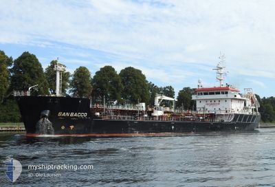
SAN BACCO
Tanker
Current Trip
| Time Travelled | 1 day |
|---|---|
| Remaining Time | 1 day |
| Distance Travelled | 345.93 nm |
| Remaining Distance | 470.42 nm |
| AVG Speed | 13.4 Knop |
| MAX Speed | 15.7 Knop |
| AVG Wind | 19.7 knots |
| MAX Wind | 23.8 knots |
| MIN Temp | 3.8°C / 38.84°F |
| MAX Temp | 8.1°C / 46.58°F |
| Djupgående | 5.1 m |
| Position mottagen | 1 m sen |
Current Position
| Longitud | 1.09210° |
|---|---|
| Latitude | 50.88668° |
| Status | Under way using engine |
| Fart | 13.7 Knop |
| Kurs | 230.9° |
| Område | English Channel |
| Station | T-AIS |
| Position mottagen | 1 m sen |
Info
Information
The current position of SAN BACCO is in English Channel with coordinates 50.88668° / 1.09210° as reported on 2024-04-24 02:58 by AIS to our vessel tracker app. The vessel's current speed is 13.7 Knop and is heading at the port of DONGES. The estimated time of arrival as calculated by MyShipTracking vessel tracking app is 2024-04-25 17:55 LT
The vessel SAN BACCO (IMO: 9753818, MMSI: 256831000) is a Tanker It's sailing under the flag of [MT] Malta.
In this page you can find informations about the vessels current position, last detected port calls, and current voyage information. If the vessels is not in coverage by AIS you will find the latest position.
The current position of SAN BACCO is detected by our AIS receivers and we are not responsible for the reliability of the data. The last position was recorded while the vessel was in Coverage by the Ais receivers of our vessel tracking app.
The current draught of SAN BACCO as reported by AIS is 5.1 meters
Weather
| Temperature | 5.1°C / 41.18°F |
|---|---|
| Wind Speed | 13 knots |
| Direction | 334° NNW |
| Pressure | 1018.1 hPa |
| Humidity | 83.2 % |
| Cloud Coverage | 100 % |
Featured Company
Last Port Calls
| Port | Arrival | Departure | Time In Port |
|---|---|---|---|
| 2024-04-21 10:54 | 2024-04-23 01:41 | 1 d | |
| 2024-04-18 16:20 | 2024-04-19 21:16 | 1 d | |
| 2024-04-16 11:56 | 2024-04-17 06:30 | 18 h | |
| 2024-04-11 17:06 | 2024-04-12 18:18 | 1 d | |
| 2024-04-11 08:03 | 2024-04-11 08:54 | 50 m | |
| 2024-04-08 11:51 | 2024-04-09 05:47 | 17 h | |
| 2024-04-05 21:43 | |||
| 2024-04-04 17:53 | |||
| 2024-04-04 17:53 | |||
| 2024-04-04 17:45 |
Last Trips
| Origin | Departure | Destination | Arrival | Distance | |
|---|---|---|---|---|---|
| 2024-04-19 23:16 | 2024-04-21 11:54 | 393.72 nm | |||
| 2024-04-17 07:30 | 2024-04-18 18:20 | 400.38 nm | |||
| 2024-04-12 20:18 | 2024-04-16 12:56 | 401.33 nm | |||
| 2024-04-11 10:54 | 2024-04-11 19:06 | 48.59 nm | |||
| 2024-04-09 08:47 | 2024-04-11 10:03 | 655.97 nm | |||
| 2024-04-05 23:43 | 2024-04-08 14:51 | 715.37 nm | |||
| 2024-04-04 11:51 | 2024-04-04 19:53 | 49.10 nm | |||
| 2024-04-04 11:51 | 2024-04-04 19:45 | 48.76 nm | |||
| 2024-04-02 08:39 | 2024-04-04 11:08 | 654.54 nm | |||
| 2024-03-29 20:22 | 2024-04-01 14:17 | 713.60 nm |
Events
| Tid | Event | Detaljer | Position / Dest | Information |
|---|---|---|---|---|
| 2024-04-24 01:34 | Byter havsområde | United Kingdom part of the English Channel United Kingdom part of the North Sea |
51.07749 / 1.45212
English Channel
FRDON
|
Fart: 12.1 kn Kurs: 232.9° |
| 2024-04-23 20:28 | Status ändrad | Under way using engine Default |
51.96150 / 2.56809
FRDON
|
Fart: 15.4 kn Kurs: 183° |
| 2024-04-23 19:52 | Status ändrad | Default Under way using engine |
52.11833 / 2.58500
FRDON
|
Fart: 15.6 kn Kurs: 184.6° |
| 2024-04-23 19:49 | Status ändrad | Under way using engine Default |
52.13055 / 2.58752
FRDON
|
Fart: 15.7 kn Kurs: 186° |
| 2024-04-23 19:47 | Status ändrad | Default Under way using engine |
52.13745 / 2.58853
FRDON
|
Fart: 15.8 kn Kurs: 185° |
| 2024-04-23 19:11 | Status ändrad | Under way using engine Default |
52.29245 / 2.61410
FRDON
|
Fart: 15.4 kn Kurs: 184° |
| 2024-04-23 19:06 | I täckningsområde |
52.29245 / 2.61410
North Sea
FRDON
|
Fart: 15.5 kn Kurs: 186.1° |
|
| 2024-04-23 12:19 | Status ändrad | Default Under way using engine |
53.73167 / 2.64500
FRDON
|
Fart: 13.1 kn Kurs: 135.4° |
| 2024-04-23 11:41 | UTANFÖR täckningsområde |
53.81093 / 2.45976
North Sea
FRDON
|
Fart: 13.1 kn Kurs: 135.4° |
|
| 2024-04-23 09:50 | ETA ändrat | 2024/04/25 20:00 2024/04/25 15:00 |
54.05906 / 1.89968
FRDON
|
Fart: 13.9 kn Kurs: 109.8° |