
RWS 26
Other Type
Current Trip
RWS 26 is out of coverage. Learn how you can join the community and extend the coverage to your area by clicking here!
Unknown
Destination Port
ETA*
---
| Time Travelled | 6 days |
|---|---|
| Remaining Time | --- |
| Distance Travelled | 42.57 nm |
| Remaining Distance | --- |
| AVG Speed | 12 Knop |
| MAX Speed | 23.2 Knop |
| AVG Wind | 9.1 knots |
| MAX Wind | 11.2 knots |
| MIN Temp | 9.6°C / 49.28°F |
| MAX Temp | 15.3°C / 59.54°F |
| Djupgående | 0 m |
| Position mottagen | 3 d sen |
Current Position
| Longitud | 4.82838° |
|---|---|
| Latitude | 51.69979° |
| Status | Under way using engine |
| Fart | 9.9 Knop |
| Kurs | 167.8° |
| Område | North Sea |
| Station | T-AIS |
| Position mottagen | 3 d sen |
Info
info
Information
The current position of RWS 26 is in North Sea with coordinates 51.69979° / 4.82838° as reported on 2024-04-13 07:44 by AIS to our vessel tracker app. The vessel's current speed is 9.9 Knop
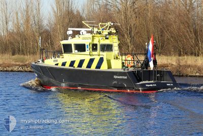
The vessel RWS 26 (MMSI: 244010943) is a Other Type It's sailing under the flag of [NL] Netherlands.
In this page you can find informations about the vessels current position, last detected port calls, and current voyage information. If the vessels is not in coverage by AIS you will find the latest position.
The current position of RWS 26 is detected by our AIS receivers and we are not responsible for the reliability of the data. The last position was recorded while the vessel was in Coverage by the Ais receivers of our vessel tracking app.
Weather
| Temperature | 14.3°C / 57.74°F |
|---|---|
| Wind Speed | 8 knots |
| Direction | 216° SW |
| Pressure | 1025.1 hPa |
| Humidity | 84.6 % |
| Cloud Coverage | 100 % |
Featured Company
Limited time offer - Install a base station receiver to your area and list your company on MyShipTracking Free forever!
Last Port Calls
| Port | Arrival | Departure | Time In Port |
|---|---|---|---|
| 2024-04-10 07:43 | 2024-04-10 08:12 | 29 m | |
| 2024-04-03 08:31 | 2024-04-03 09:08 | 36 m | |
| 2024-04-01 11:16 | 2024-04-01 11:22 | 5 m | |
| 2024-04-01 11:04 | 2024-04-01 11:11 | 6 m | |
| 2024-04-01 08:56 | 2024-04-01 09:58 | 1 h | |
| 2024-03-31 08:35 | 2024-03-31 09:30 | 55 m | |
| 2024-03-29 08:07 | 2024-03-29 08:21 | 14 m | |
| 2024-03-25 07:17 | 2024-03-25 07:42 | 25 m | |
| 2024-03-22 16:56 | 2024-03-22 17:54 | 57 m | |
| 2024-03-21 16:34 | 2024-03-21 16:43 | 9 m |
Most Visited Ports (Last year)
| Port | Arrivals | |
|---|---|---|
| 51 | ||
| 17 | ||
| 13 | ||
| 11 | ||
| 9 | ||
| 9 |
Last Trips
| Origin | Departure | Destination | Arrival | Distance | |
|---|---|---|---|---|---|
| 2024-04-03 11:08 | 2024-04-10 09:43 | 62.37 nm | |||
| 2024-04-01 13:22 | 2024-04-03 10:31 | 21.27 nm | |||
| 2024-04-01 13:11 | 2024-04-01 13:16 | 0.50 nm | |||
| 2024-04-01 11:58 | 2024-04-01 13:04 | 7.46 nm | |||
| 2024-03-31 11:30 | 2024-04-01 10:56 | 35.76 nm | |||
| 2024-03-29 09:21 | 2024-03-31 10:35 | 25.09 nm | |||
| 2024-03-25 08:42 | 2024-03-29 09:07 | 47.53 nm | |||
| 2024-03-22 18:54 | 2024-03-25 08:17 | 22.85 nm | |||
| 2024-03-21 17:43 | 2024-03-22 17:56 | 44.20 nm | |||
| 2024-03-19 17:48 | 2024-03-21 17:34 | 32.64 nm |
Events
| Tid | Event | Detaljer | Position / Dest | Information |
|---|---|---|---|---|
| 2024-04-13 07:44 | UTANFÖR täckningsområde |
51.69979 / 4.82838
North Sea
|
Fart: 9.9 kn Kurs: 167.8° |
|
| 2024-04-13 07:28 | I täckningsområde |
51.71167 / 4.83608
North Sea
|
Fart: 23.2 kn Kurs: 259.2° |
|
| 2024-04-12 00:34 | UTANFÖR täckningsområde |
51.50528 / 5.49648
North Sea
|
Fart: Kurs: 511° |
|
| 2024-04-12 00:34 | I täckningsområde |
51.50528 / 5.49648
North Sea
|
Fart: Kurs: 511° |
|
| 2024-04-11 07:05 | UTANFÖR täckningsområde |
51.59751 / 5.55254
North Sea
|
Fart: 6.8 kn Kurs: 128.7° |
|
| 2024-04-11 06:19 | Status ändrad | Under way using engine Moored |
51.62710 / 5.49670
|
Fart: 5.9 kn Kurs: 113.5° |
| 2024-04-11 06:04 | STARTAR förflyttning | 3.22 nm, North West of VEGHEL |
51.64717 / 5.45008
|
Fart: 5.9 kn Kurs: 113.5° |
| 2024-04-10 10:49 | Status ändrad | Moored Under way using engine |
51.64769 / 5.44679
|
Fart: 0.1 kn Kurs: 511° |
| 2024-04-10 10:46 | I täckningsområde |
51.64771 / 5.44677
North Sea
|
Fart: 0.1 kn Kurs: 511° |
|
| 2024-04-10 08:38 | UTANFÖR täckningsområde |
51.65859 / 5.40827
North Sea
|
Fart: 6.5 kn Kurs: 132.8° |