
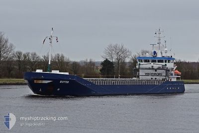
RUYTER
General Cargo
Current Trip
| Trip Time | 8 h, 46 mins |
|---|---|
| Trip Distance | 87.23 nm |
| AVG Speed | 10.4 Knop |
| MAX Speed | 12.8 Knop |
| Djupgående | 3.6 m |
| AVG Wind | 10.6 knots |
| MAX Wind | 15 knots |
| MIN Temp | 6.9°C / 44.42°F |
| MAX Temp | 8.7°C / 47.66°F |
| Position mottagen | 3 m sen |
Current Position
| Longitud | 5.42554° |
|---|---|
| Latitude | 53.18501° |
| Status | Moored |
| Fart | |
| Kurs | 56° |
| Område | North Sea |
| Station | T-AIS |
| Position mottagen | 3 m sen |
Info
Information
The current position of RUYTER is in North Sea with coordinates 53.18501° / 5.42554° as reported on 2024-04-18 14:22 by AIS to our vessel tracker app. The vessel's current speed is 0 Knop and is currently inside the port of HARLINGEN.
The vessel RUYTER (IMO: 9374674, MMSI: 244130641) is a General Cargo that was built in 2006 ( 18 År gammal ). It's sailing under the flag of [NL] Netherlands.
In this page you can find informations about the vessels current position, last detected port calls, and current voyage information. If the vessels is not in coverage by AIS you will find the latest position.
The current position of RUYTER is detected by our AIS receivers and we are not responsible for the reliability of the data. The last position was recorded while the vessel was in Coverage by the Ais receivers of our vessel tracking app.
The current draught of RUYTER as reported by AIS is 3.6 meters
Weather
| Temperature | 8.2°C / 46.76°F |
|---|---|
| Wind Speed | 14 knots |
| Direction | 284° WNW |
| Pressure | 1019.1 hPa |
| Humidity | 65.5 % |
| Cloud Coverage | 100 % |
Featured Company
Last Port Calls
| Port | Arrival | Departure | Time In Port |
|---|---|---|---|
| 2024-04-17 19:14 | |||
| 2024-04-16 23:14 | 2024-04-17 10:28 | 11 h | |
| 2024-04-15 16:47 | 2024-04-16 22:49 | 1 d | |
| 2024-03-30 16:20 | 2024-04-04 14:50 | 4 d | |
| 2024-03-26 12:48 | 2024-03-27 12:01 | 23 h | |
| 2024-03-24 06:04 | 2024-03-26 07:20 | 2 d | |
| 2024-03-20 13:18 | 2024-03-22 23:09 | 2 d | |
| 2024-03-18 11:54 | 2024-03-19 14:03 | 1 d | |
| 2024-03-14 21:19 | 2024-03-15 19:10 | 21 h | |
| 2024-03-12 09:31 | 2024-03-14 07:14 | 1 d |
Last Trips
| Origin | Departure | Destination | Arrival | Distance | |
|---|---|---|---|---|---|
| 2024-04-17 12:28 | 2024-04-17 21:14 | 87.23 nm | |||
| 2024-04-17 00:49 | 2024-04-17 01:14 | 1.35 nm | |||
| 2024-04-04 16:50 | 2024-04-15 18:47 | 1350.13 nm | |||
| 2024-03-27 13:01 | 2024-03-30 17:20 | 736.06 nm | |||
| 2024-03-26 08:20 | 2024-03-26 13:48 | 14.58 nm | |||
| 2024-03-22 23:09 | 2024-03-24 07:04 | 304.72 nm | |||
| 2024-03-19 14:03 | 2024-03-20 13:18 | 149.15 nm | |||
| 2024-03-15 20:10 | 2024-03-18 11:54 | 483.61 nm | |||
| 2024-03-14 08:14 | 2024-03-14 22:19 | 159.05 nm | |||
| 2024-03-09 22:50 | 2024-03-12 10:31 | 501.26 nm |
Events
| Tid | Event | Detaljer | Position / Dest | Information |
|---|---|---|---|---|
| 2024-04-17 20:19 | Status ändrad | Moored Under way using engine |
53.18557 / 5.42697
[NL] HARLINGEN
|
Fart: Kurs: 57° |
| 2024-04-17 19:31 | STOPPAR förflyttning |
53.18490 / 5.42642
[NL] HARLINGEN
|
Fart: 0.3 kn Kurs: 57° |
|
| 2024-04-17 19:14 | ANLÄNDER HAMN |
|
53.17656 / 5.40374
[NL] HARLINGEN
|
Fart: 4.6 kn Kurs: 142° |
| 2024-04-17 16:02 | Status ändrad | Under way using engine Default |
53.19446 / 4.75148
HARLINGEN
|
Fart: 11.2 kn Kurs: 27° |
| 2024-04-17 15:43 | Status ändrad | Default Under way using engine |
53.14242 / 4.70500
HARLINGEN
|
Fart: 11.6 kn Kurs: 26.1° |
| 2024-04-17 15:27 | Status ändrad | Under way using engine Default |
53.09791 / 4.66620
HARLINGEN
|
Fart: 11 kn Kurs: 28° |
| 2024-04-17 14:59 | Status ändrad | Default Under way using engine |
53.01667 / 4.59333
HARLINGEN
|
Fart: 11.3 kn Kurs: 17.2° |
| 2024-04-17 11:56 | STARTAR förflyttning | 0.41 nm, East of IJMUIDEN |
52.46590 / 4.59868
HARLINGEN
|
Fart: 3.2 kn Kurs: 269° |
| 2024-04-17 11:14 | STOPPAR förflyttning | 0.61 nm, East of IJMUIDEN |
52.46570 / 4.60406
HARLINGEN
|
Fart: 0.3 kn Kurs: 281° |
| 2024-04-17 10:28 | AVGÅTT HAMN |
|
52.43174 / 4.73625
HARLINGEN
|
Fart: 9.3 kn Kurs: 281° |