
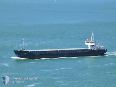
RURIK
General Cargo
Current Trip
GBLIV
| Time Travelled | 1 day |
|---|---|
| Remaining Time | --- |
| Distance Travelled | 115.80 nm |
| Remaining Distance | --- |
| AVG Speed | 6.6 Knop |
| MAX Speed | 9.5 Knop |
| AVG Wind | 12.6 knots |
| MAX Wind | 18.1 knots |
| MIN Temp | 2.7°C / 36.86°F |
| MAX Temp | 11.1°C / 51.98°F |
| Djupgående | 4.1 m |
| Position mottagen | 1 h, 25 m sen |
Current Position
| Longitud | -5.22281° |
|---|---|
| Latitude | 52.84106° |
| Status | Under way using engine |
| Fart | 7.4 Knop |
| Kurs | 204.4° |
| Område | Irish Sea and St. George's Channel |
| Station | T-AIS |
| Position mottagen | 1 h, 25 m sen |
Info
Information
The current position of RURIK is in Irish Sea and St. George's Channel with coordinates 52.84106° / -5.22281° as reported on 2024-04-18 22:47 by AIS to our vessel tracker app. The vessel's current speed is 7.4 Knop
The vessel RURIK (IMO: 9375795, MMSI: 275496000) is a General Cargo that was built in 2006 ( 18 År gammal ). It's sailing under the flag of [LV] Latvia.
In this page you can find informations about the vessels current position, last detected port calls, and current voyage information. If the vessels is not in coverage by AIS you will find the latest position.
The current position of RURIK is detected by our AIS receivers and we are not responsible for the reliability of the data. The last position was recorded while the vessel was in Coverage by the Ais receivers of our vessel tracking app.
The current draught of RURIK as reported by AIS is 4.1 meters
Weather
| Temperature | 10.3°C / 50.54°F |
|---|---|
| Wind Speed | 16 knots |
| Direction | 279° W |
| Pressure | 1020.5 hPa |
| Humidity | 87.1 % |
| Cloud Coverage | 90 % |
Featured Company
Last Port Calls
| Port | Arrival | Departure | Time In Port |
|---|---|---|---|
| 2024-04-13 21:15 | 2024-04-17 20:37 | 3 d | |
| 2024-04-12 00:18 | 2024-04-13 01:51 | 1 d | |
| 2024-04-11 07:34 | 2024-04-11 18:11 | 10 h | |
| 2024-04-07 18:55 | 2024-04-09 18:44 | 1 d | |
| 2024-04-02 20:44 | 2024-04-05 15:19 | 2 d | |
| 2024-03-24 23:49 | 2024-03-27 00:24 | 2 d | |
| 2024-03-19 22:28 | 2024-03-20 21:11 | 22 h | |
| 2024-03-05 17:59 | 2024-03-07 13:10 | 1 d | |
| 2024-03-01 19:48 | 2024-03-03 17:13 | 1 d | |
| 2024-02-08 22:18 | 2024-02-08 22:52 | 34 m |
Most Visited Ports (Last year)
| Port | Arrivals | |
|---|---|---|
| 14 | ||
| 10 | ||
| 5 | ||
| 4 | ||
| 4 | ||
| 3 |
Last Trips
| Origin | Departure | Destination | Arrival | Distance | |
|---|---|---|---|---|---|
| 2024-04-13 02:51 | 2024-04-13 22:15 | 131.95 nm | |||
| 2024-04-11 19:11 | 2024-04-12 01:18 | 17.72 nm | |||
| 2024-04-09 19:44 | 2024-04-11 08:34 | 277.67 nm | |||
| 2024-04-05 17:19 | 2024-04-07 19:55 | 354.07 nm | |||
| 2024-03-27 00:24 | 2024-04-02 22:44 | 326.91 nm | |||
| 2024-03-20 21:11 | 2024-03-24 23:49 | 707.35 nm | |||
| 2024-03-07 13:10 | 2024-03-19 22:28 | 1203.42 nm | |||
| 2024-03-03 18:13 | 2024-03-05 17:59 | 344.24 nm | |||
| 2024-02-08 23:52 | 2024-03-01 20:48 | 984.18 nm | |||
| 2024-02-07 17:32 | 2024-02-08 23:18 | 213.93 nm |
Events
| Tid | Event | Detaljer | Position / Dest | Information |
|---|---|---|---|---|
| 2024-04-18 22:54 | Status ändrad | Default Under way using engine |
52.82697 / -5.23299
GBLIV
|
Fart: 7.4 kn Kurs: 204.4° |
| 2024-04-18 22:47 | UTANFÖR täckningsområde |
52.84106 / -5.22281
Irish Sea and St. George's Channel
|
Fart: 7.4 kn Kurs: 204.4° |
|
| 2024-04-18 22:47 | Status ändrad | Under way using engine Default |
52.84166 / -5.22236
GBLIV
|
Fart: 7.1 kn Kurs: 203° |
| 2024-04-18 22:31 | I täckningsområde |
52.84106 / -5.22281
Irish Sea and St. George's Channel
|
Fart: 7.4 kn Kurs: 204.4° |
|
| 2024-04-18 19:40 | Status ändrad | Default Under way using engine |
53.15224 / -5.06128
GBLIV
|
Fart: 4.5 kn Kurs: 200° |
| 2024-04-18 19:28 | UTANFÖR täckningsområde |
53.16748 / -5.05332
Irish Sea and St. George's Channel
|
Fart: 4.5 kn Kurs: 198.2° |
|
| 2024-04-18 14:25 | Status ändrad | Under way using engine Default |
53.49653 / -4.78782
GBLIV
|
Fart: 5 kn Kurs: 220° |
| 2024-04-18 14:20 | Status ändrad | Default Under way using engine |
53.50180 / -4.78052
GBLIV
|
Fart: 5 kn Kurs: 218.4° |
| 2024-04-18 14:19 | Status ändrad | Under way using engine Default |
53.50289 / -4.77904
GBLIV
|
Fart: 5.1 kn Kurs: 218° |
| 2024-04-18 14:12 | I täckningsområde |
53.50289 / -4.77904
Irish Sea and St. George's Channel
|
Fart: 5 kn Kurs: 218.4° |