
ROZA A
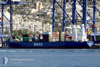
Container Ship
Current Trip
| Time Travelled | 2 days |
|---|---|
| Remaining Time | --- |
| Distance Travelled | 640.08 nm |
| Remaining Distance | --- |
| AVG Speed | 10.4 Knop |
| MAX Speed | 16.2 Knop |
| AVG Wind | 11 knots |
| MAX Wind | 27 knots |
| MIN Temp | 12.6°C / 54.68°F |
| MAX Temp | 23.3°C / 73.94°F |
| Djupgående | 6.8 m |
| Position mottagen | 21 h, 22 m sen |
Current Position
| Longitud | 40.59473° |
|---|---|
| Latitude | 42.17694° |
| Status | Under way using engine |
| Fart | 14.8 Knop |
| Kurs | 91° |
| Område | Black Sea |
| Station | T-AIS |
| Position mottagen | 21 h, 22 m sen |
Info
Information
The current position of ROZA A is in Black Sea with coordinates 42.17694° / 40.59473° as reported on 2024-04-24 03:00 by AIS to our vessel tracker app. The vessel's current speed is 14.8 Knop
The vessel ROZA A (IMO: 9126742, MMSI: 271001057) is a Container Ship that was built in 1997 ( 27 År gammal ). It's sailing under the flag of [TR] Turkey.
In this page you can find informations about the vessels current position, last detected port calls, and current voyage information. If the vessels is not in coverage by AIS you will find the latest position.
The current position of ROZA A is detected by our AIS receivers and we are not responsible for the reliability of the data. The last position was recorded while the vessel was in Coverage by the Ais receivers of our vessel tracking app.
The current draught of ROZA A as reported by AIS is 6.8 meters
Weather
| Temperature | 21.2°C / 70.16°F |
|---|---|
| Wind Speed | 27 knots |
| Direction | 91° E |
| Pressure | 1010.3 hPa |
| Humidity | 45.8 % |
| Cloud Coverage | 19 % |
Featured Company
Last Port Calls
| Port | Arrival | Departure | Time In Port |
|---|---|---|---|
| 2024-04-21 10:45 | 2024-04-22 00:23 | 13 h | |
| 2024-04-20 16:31 | 2024-04-21 10:34 | 18 h | |
| 2024-04-16 21:31 | |||
| 2024-04-13 11:39 | 2024-04-14 01:55 | 14 h | |
| 2024-04-12 06:43 | 2024-04-13 11:27 | 1 d | |
| 2024-04-08 15:25 | 2024-04-09 20:20 | 1 d | |
| 2024-03-28 10:57 | 2024-03-29 21:29 | 1 d | |
| 2024-03-25 07:36 | 2024-03-27 08:53 | 2 d | |
| 2024-03-24 19:48 | 2024-03-25 02:12 | 6 h | |
| 2024-03-22 10:04 | 2024-03-23 20:09 | 1 d |
Most Visited Ports (Last year)
| Port | Arrivals | |
|---|---|---|
| 21 | ||
| 16 | ||
| 15 | ||
| 10 | ||
| 4 | ||
| 3 |
Last Trips
| Origin | Departure | Destination | Arrival | Distance | |
|---|---|---|---|---|---|
| 2024-04-21 13:34 | 2024-04-21 13:45 | 0.31 nm | |||
| 2024-04-21 13:34 | 2024-04-20 19:31 | 0.31 nm | |||
| 2024-04-14 04:55 | 2024-04-17 01:31 | 636.14 nm | |||
| 2024-04-13 14:27 | 2024-04-13 14:39 | 0.32 nm | |||
| 2024-04-10 00:20 | 2024-04-12 09:43 | 634.55 nm | |||
| 2024-03-29 23:29 | 2024-04-08 19:25 | 1104.76 nm | |||
| 2024-03-27 10:53 | 2024-03-28 12:57 | 276.47 nm | |||
| 2024-03-25 04:12 | 2024-03-25 09:36 | 0.65 nm | |||
| 2024-03-23 22:09 | 2024-03-24 21:48 | 277.19 nm | |||
| 2024-03-21 04:21 | 2024-03-22 12:04 | 389.04 nm |
Events
| Tid | Event | Detaljer | Position / Dest | Information |
|---|---|---|---|---|
| 2024-04-24 06:36 | STOPPAR förflyttning | 1.91 nm, West of POTI |
42.15107 / 41.60752
GEPTI
|
Fart: 0.3 kn Kurs: 98° |
| 2024-04-24 03:06 | Status ändrad | Default Under way using engine |
42.17703 / 40.62758
GEPTI
|
Fart: 14.8 kn Kurs: 91° |
| 2024-04-24 03:00 | UTANFÖR täckningsområde |
42.17694 / 40.59473
Black Sea
GEPTI
|
Fart: 14.8 kn Kurs: 91° |
|
| 2024-04-24 02:54 | Status ändrad | Under way using engine Default |
42.17765 / 40.56535
GEPTI
|
Fart: 14.8 kn Kurs: 94° |
| 2024-04-24 02:40 | Status ändrad | Default Under way using engine |
42.18156 / 40.48789
GEPTI
|
Fart: 14.6 kn Kurs: 94.1° |
| 2024-04-24 00:47 | Status ändrad | Under way using engine Default |
42.18585 / 39.86991
GEPTI
|
Fart: 14.4 kn Kurs: 89° |
| 2024-04-24 00:24 | Status ändrad | Default Under way using engine |
42.18553 / 39.74982
GEPTI
|
Fart: 14.4 kn Kurs: 89.9° |
| 2024-04-24 00:06 | Byter havsområde | Georgian part of the Black Sea Turkish part of the Black Sea |
42.18528 / 39.64956
Black Sea
GEPTI
|
Fart: 14.4 kn Kurs: 89.8° |
| 2024-04-24 00:06 | Status ändrad | Under way using engine Default |
42.18528 / 39.64956
GEPTI
|
Fart: 14.2 kn Kurs: 90° |
| 2024-04-23 23:49 | I täckningsområde |
42.18528 / 39.64956
Black Sea
GEPTI
|
Fart: 14.4 kn Kurs: 89.8° |