
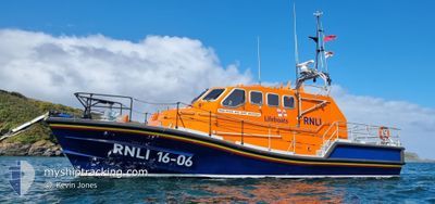
RNLI LIFEBOAT 16-06
Search and Rescue vessel
Current Trip
| Trip Time | 54 days |
|---|---|
| Trip Distance | 152.53 nm |
| AVG Speed | 15.6 Knop |
| MAX Speed | 15.6 Knop |
| Djupgående | 1.4 m |
| AVG Wind | 11.1 knots |
| MAX Wind | 24 knots |
| MIN Temp | 4.6°C / 40.28°F |
| MAX Temp | 11°C / 51.8°F |
| Position mottagen | 16 h, 24 m sen |
Current Position
| Longitud | 1.75247° |
|---|---|
| Latitude | 52.47224° |
| Status | Under way using engine |
| Fart | |
| Kurs | --- |
| Område | North Sea |
| Station | T-AIS |
| Position mottagen | 16 h, 24 m sen |
Info
Information
The current position of RNLI LIFEBOAT 16-06 is in North Sea with coordinates 52.47224° / 1.75247° as reported on 2024-04-19 13:26 by AIS to our vessel tracker app. The vessel's current speed is 0 Knop and is currently inside the port of LOWESTOFT.
The vessel RNLI LIFEBOAT 16-06 (MMSI: 235030386) is a Search and Rescue vessel It's sailing under the flag of [GB] United Kingdom.
In this page you can find informations about the vessels current position, last detected port calls, and current voyage information. If the vessels is not in coverage by AIS you will find the latest position.
The current position of RNLI LIFEBOAT 16-06 is detected by our AIS receivers and we are not responsible for the reliability of the data. The last position was recorded while the vessel was in Coverage by the Ais receivers of our vessel tracking app.
The current draught of RNLI LIFEBOAT 16-06 as reported by AIS is 1.4 meters
Weather
| Temperature | 9°C / 48.2°F |
|---|---|
| Wind Speed | 23 knots |
| Direction | 342° NNW |
| Pressure | 1014.9 hPa |
| Humidity | 68.5 % |
| Cloud Coverage | 73 % |
Featured Company
Events
| Tid | Event | Detaljer | Position / Dest | Information |
|---|---|---|---|---|
| 2024-04-19 13:26 | UTANFÖR täckningsområde |
52.47224 / 1.75247
North Sea
[GB] LOWESTOFT
|
Fart: Kurs: 215.2° |
|
| 2024-04-19 08:15 | I täckningsområde |
52.47218 / 1.75249
North Sea
[GB] LOWESTOFT
|
Fart: Kurs: 141.6° |
|
| 2024-04-18 15:23 | UTANFÖR täckningsområde |
52.47221 / 1.75239
North Sea
[GB] LOWESTOFT
|
Fart: Kurs: 209.5° |
|
| 2024-04-18 07:54 | I täckningsområde |
52.47216 / 1.75246
North Sea
[GB] LOWESTOFT
|
Fart: Kurs: 185.8° |
|
| 2024-04-17 15:40 | UTANFÖR täckningsområde |
52.47217 / 1.75243
North Sea
[GB] LOWESTOFT
|
Fart: Kurs: 261.2° |
|
| 2024-04-17 08:16 | I täckningsområde |
52.47216 / 1.75247
North Sea
[GB] LOWESTOFT
|
Fart: Kurs: 98° |
|
| 2024-04-16 15:47 | UTANFÖR täckningsområde |
52.47222 / 1.75244
North Sea
[GB] LOWESTOFT
|
Fart: Kurs: 355.5° |
|
| 2024-04-16 08:13 | I täckningsområde |
52.47217 / 1.75242
North Sea
[GB] LOWESTOFT
|
Fart: 0.1 kn Kurs: 216° |
|
| 2024-04-15 14:50 | UTANFÖR täckningsområde |
52.47219 / 1.75243
North Sea
[GB] LOWESTOFT
|
Fart: 0.1 kn Kurs: 144.2° |
|
| 2024-04-15 08:19 | I täckningsområde |
52.47217 / 1.75248
North Sea
[GB] LOWESTOFT
|
Fart: 0.1 kn Kurs: 17.8° |