
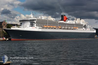
QUEEN MARY 2
Passengers Ship
Current Trip
ZA CPT > NA WVB
| Time Travelled | 4 days |
|---|---|
| Remaining Time | --- |
| Distance Travelled | 2363.45 nm |
| Remaining Distance | --- |
| AVG Speed | 22.5 Knop |
| MAX Speed | 24 Knop |
| AVG Wind | 12.7 knots |
| MAX Wind | 18.9 knots |
| MIN Temp | 16°C / 60.8°F |
| MAX Temp | 29.4°C / 84.92°F |
| Djupgående | 10.2 m |
| Position mottagen | 6 d sen |
Current Position
| Longitud | 18.12530° |
|---|---|
| Latitude | -33.63457° |
| Status | Under way using engine |
| Fart | 23.9 Knop |
| Kurs | 321.3° |
| Område | South Atlantic Ocean |
| Station | T-AIS |
| Position mottagen | 6 d sen |
Info
Information
The current position of QUEEN MARY 2 is in South Atlantic Ocean with coordinates -33.63457° / 18.12530° as reported on 2024-04-14 02:03 by AIS to our vessel tracker app. The vessel's current speed is 23.9 Knop
The vessel QUEEN MARY 2 (IMO: 9241061, MMSI: 310627000) is a Passengers Ship that was built in 2003 ( 21 År gammal ). It's sailing under the flag of [BM] Bermuda.
In this page you can find informations about the vessels current position, last detected port calls, and current voyage information. If the vessels is not in coverage by AIS you will find the latest position.
The current position of QUEEN MARY 2 is detected by our AIS receivers and we are not responsible for the reliability of the data. The last position was recorded while the vessel was in Coverage by the Ais receivers of our vessel tracking app.
The current draught of QUEEN MARY 2 as reported by AIS is 10.2 meters
Weather
| Temperature | 29.2°C / 84.56°F |
|---|---|
| Wind Speed | 11 knots |
| Direction | 199° SSW |
| Pressure | 1008.4 hPa |
| Humidity | 77.5 % |
| Cloud Coverage | 60 % |
Featured Company
Last Port Calls
| Port | Arrival | Departure | Time In Port |
|---|---|---|---|
| 2024-04-15 09:05 | 2024-04-15 18:50 | 9 h | |
| 2024-04-12 02:52 | 2024-04-14 00:57 | 1 d | |
| 2024-04-09 02:40 | 2024-04-09 17:36 | 14 h | |
| 2024-04-05 02:37 | 2024-04-05 14:55 | 12 h | |
| 2024-03-31 00:53 | 2024-03-31 16:01 | 15 h | |
| 2024-03-24 22:09 | 2024-03-25 14:56 | 16 h | |
| 2024-03-21 22:02 | 2024-03-23 12:02 | 1 d | |
| 2024-03-12 21:35 | 2024-03-14 12:55 | 1 d | |
| 2024-03-08 23:26 | 2024-03-09 10:22 | 10 h | |
| 2024-02-25 18:03 | 2024-02-27 08:56 | 1 d |
Last Trips
| Origin | Departure | Destination | Arrival | Distance | |
|---|---|---|---|---|---|
| 2024-04-14 02:57 | 2024-04-15 11:05 | 723.06 nm | |||
| 2024-04-09 19:36 | 2024-04-12 04:52 | 828.53 nm | |||
| 2024-04-05 18:55 | 2024-04-09 04:40 | 1561.57 nm | |||
| 2024-03-31 21:31 | 2024-04-05 06:37 | 2108.11 nm | |||
| 2024-03-25 22:56 | 2024-03-31 06:23 | 1410.74 nm | |||
| 2024-03-23 20:02 | 2024-03-25 06:09 | 460.05 nm | |||
| 2024-03-14 20:55 | 2024-03-22 06:02 | 1763.61 nm | |||
| 2024-03-09 18:22 | 2024-03-13 05:35 | 1528.85 nm | |||
| 2024-02-27 19:56 | 2024-03-09 07:26 | 3322.09 nm | |||
| 2024-02-24 17:37 | 2024-02-26 05:03 | 606.80 nm |
Events
| Tid | Event | Detaljer | Position / Dest | Information |
|---|---|---|---|---|
| 2024-04-15 18:50 | AVGÅTT HAMN |
|
-22.92845 / 14.49737
ZA CPT > NA WVB
|
Fart: 8.2 kn Kurs: 3° |
| 2024-04-15 18:38 | STARTAR förflyttning |
-22.95039 / 14.49359
[NA] WALVIS BAY
|
Fart: 4 kn Kurs: 54° |
|
| 2024-04-15 09:25 | STOPPAR förflyttning |
-22.95107 / 14.49571
[NA] WALVIS BAY
|
Fart: 0.2 kn Kurs: 228° |
|
| 2024-04-15 09:05 | ANLÄNDER HAMN |
|
-22.93455 / 14.49699
[NA] WALVIS BAY
|
Fart: 10.9 kn Kurs: 183° |
| 2024-04-14 02:09 | Status ändrad | Default Under way using engine |
-33.60401 / 18.09528
ZA CPT > NA WVB
|
Fart: 23.9 kn Kurs: 321.3° |
| 2024-04-14 02:03 | UTANFÖR täckningsområde |
-33.63457 / 18.12530
South Atlantic Ocean
ZA CPT > NA WVB
|
Fart: 23.9 kn Kurs: 321.3° |
|
| 2024-04-14 02:01 | Status ändrad | Under way using engine Default |
-33.64408 / 18.13444
ZA CPT > NA WVB
|
Fart: 23.8 kn Kurs: 320° |
| 2024-04-14 01:57 | Status ändrad | Default Under way using engine |
-33.66576 / 18.15581
ZA CPT > NA WVB
|
Fart: 23.8 kn Kurs: 320.9° |
| 2024-04-14 00:57 | AVGÅTT HAMN |
|
-33.89760 / 18.43767
ZA CPT > NA WVB
|
Fart: 6.9 kn Kurs: 4° |
| 2024-04-14 00:52 | STARTAR förflyttning |
-33.90534 / 18.43611
[ZA] CAPE TOWN
|
Fart: 3.1 kn Kurs: 22° |