
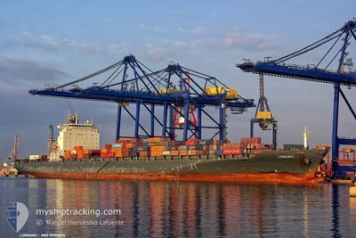
QUEBEC EXPRESS
Container Ship
Current Trip
| Time Travelled | 7 days |
|---|---|
| Remaining Time | --- |
| Distance Travelled | 2160.42 nm |
| Remaining Distance | 1436.83 nm |
| AVG Speed | 13.2 Knop |
| MAX Speed | 18.1 Knop |
| AVG Wind | 11.5 knots |
| MAX Wind | 30 knots |
| MIN Temp | 2.1°C / 35.78°F |
| MAX Temp | 13°C / 55.4°F |
| Djupgående | 10.2 m |
| Position mottagen | 4 d sen |
Current Position
| Longitud | -4.51255° |
|---|---|
| Latitude | 58.73950° |
| Status | Under way using engine |
| Fart | 11.2 Knop |
| Kurs | 269.5° |
| Område | North Atlantic Ocean |
| Station | T-AIS |
| Position mottagen | 4 d sen |
Info
Information
The current position of QUEBEC EXPRESS is in North Atlantic Ocean with coordinates 58.73950° / -4.51255° as reported on 2024-04-20 04:59 by AIS to our vessel tracker app. The vessel's current speed is 11.2 Knop and is heading at the port of MONTREAL. The estimated time of arrival as calculated by MyShipTracking vessel tracking app is 2024-04-29 04:00 LT
The vessel QUEBEC EXPRESS (IMO: 9294836, MMSI: 310760000) is a Container Ship that was built in 2006 ( 18 År gammal ). It's sailing under the flag of [BM] Bermuda.
In this page you can find informations about the vessels current position, last detected port calls, and current voyage information. If the vessels is not in coverage by AIS you will find the latest position.
The current position of QUEBEC EXPRESS is detected by our AIS receivers and we are not responsible for the reliability of the data. The last position was recorded while the vessel was in Coverage by the Ais receivers of our vessel tracking app.
The current draught of QUEBEC EXPRESS as reported by AIS is 10.2 meters
Weather
| Temperature | 12.7°C / 54.86°F |
|---|---|
| Wind Speed | 14 knots |
| Direction | 164° SSE |
| Pressure | 1028.5 hPa |
| Humidity | 98.5 % |
| Cloud Coverage | 100 % |
Featured Company
Last Port Calls
| Port | Arrival | Departure | Time In Port |
|---|---|---|---|
| 2024-04-16 18:44 | 2024-04-17 21:45 | 1 d | |
| 2024-04-12 02:29 | 2024-04-13 00:37 | 22 h | |
| 2024-04-10 05:28 | 2024-04-10 21:10 | 15 h | |
| 2024-03-26 08:40 | 2024-03-29 12:16 | 3 d | |
| 2024-03-11 04:25 | 2024-03-12 11:01 | 1 d | |
| 2024-03-07 20:37 | 2024-03-08 19:47 | 23 h | |
| 2024-03-05 23:55 | 2024-03-06 20:22 | 20 h | |
| 2024-02-20 06:27 | 2024-02-23 13:26 | 3 d | |
| 2024-02-06 12:26 | 2024-02-07 16:50 | 1 d | |
| 2024-02-02 17:14 | 2024-02-03 09:53 | 16 h |
Most Visited Ports (Last year)
| Port | Arrivals | |
|---|---|---|
| 11 | ||
| 10 | ||
| 10 | ||
| 10 |
Last Trips
| Origin | Departure | Destination | Arrival | Distance | |
|---|---|---|---|---|---|
| 2024-04-13 02:37 | 2024-04-16 20:44 | 554.36 nm | |||
| 2024-04-10 22:10 | 2024-04-12 04:29 | 284.23 nm | |||
| 2024-03-29 08:16 | 2024-04-10 06:28 | 3157.51 nm | |||
| 2024-03-12 12:01 | 2024-03-26 04:40 | 3839.50 nm | |||
| 2024-03-08 20:47 | 2024-03-11 05:25 | 463.72 nm | |||
| 2024-03-06 20:22 | 2024-03-07 21:37 | 280.65 nm | |||
| 2024-02-23 08:26 | 2024-03-05 23:55 | 3167.07 nm | |||
| 2024-02-07 17:50 | 2024-02-20 01:27 | 3628.02 nm | |||
| 2024-02-03 10:53 | 2024-02-06 13:26 | 592.47 nm | |||
| 2024-01-31 17:48 | 2024-02-02 18:14 | 314.99 nm |
Events
| Tid | Event | Detaljer | Position / Dest | Information |
|---|---|---|---|---|
| 2024-04-20 05:04 | Status ändrad | Default Under way using engine |
58.73963 / -4.54268
CAMTR
|
Fart: 11.2 kn Kurs: 269.5° |
| 2024-04-20 04:59 | UTANFÖR täckningsområde |
58.73950 / -4.51255
North Atlantic Ocean
CAMTR
|
Fart: 11.2 kn Kurs: 269.5° |
|
| 2024-04-20 02:08 | Byter havsområde | United Kingdom part of the North Atlantic Ocean United Kingdom part of the North Sea |
58.75097 / -3.42377
North Atlantic Ocean
CAMTR
|
Fart: 13.4 kn Kurs: 281.1° |
| 2024-04-19 23:51 | Byter havsområde | United Kingdom part of the North Sea Norwegian part of the North Sea |
58.60851 / -2.48500
North Sea
CAMTR
|
Fart: 10.2 kn Kurs: 271.8° |
| 2024-04-19 23:51 | Status ändrad | Under way using engine Default |
58.60851 / -2.48500
CAMTR
|
Fart: 10.2 kn Kurs: 270° |
| 2024-04-19 23:34 | I täckningsområde |
58.60851 / -2.48500
North Sea
CAMTR
|
Fart: 10.2 kn Kurs: 271.8° |
|
| 2024-04-18 22:30 | UTANFÖR täckningsområde |
56.74690 / 3.92288
North Sea
CAMTR
|
Fart: 10.6 kn Kurs: 315° |
|
| 2024-04-18 20:11 | Byter havsområde | Norwegian part of the North Sea Danish part of the North Sea |
56.42659 / 4.44577
North Sea
CAMTR
|
Fart: 12 kn Kurs: 320.1° |
| 2024-04-18 14:02 | Byter havsområde | Danish part of the North Sea German part of the North Sea |
55.52158 / 5.85340
North Sea
CAMTR
|
Fart: 12.2 kn Kurs: 342.8° |
| 2024-04-18 10:17 | I täckningsområde |
54.80888 / 6.24238
North Sea
CAMTR
|
Fart: 11.9 kn Kurs: 353.7° |