
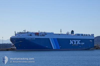
PROMETHEUS LEADER
Vehicles Carrier
Current Trip
| Time Travelled | --- |
|---|---|
| Remaining Time | --- |
| Distance Travelled | --- |
| Remaining Distance | --- |
| AVG Speed | --- |
| MAX Speed | --- |
| AVG Wind | --- |
| MAX Wind | --- |
| MIN Temp | --- |
| MAX Temp | --- |
| Djupgående | 7.5 m |
| Position mottagen | 2 d sen |
Current Position
| Longitud | 77.46439° |
|---|---|
| Latitude | 7.29089° |
| Status | Under way using engine |
| Fart | 17 Knop |
| Kurs | 132.3° |
| Område | Laccadive Sea |
| Station | T-AIS |
| Position mottagen | 2 d sen |
Info
Information
The current position of PROMETHEUS LEADER is in Laccadive Sea with coordinates 7.29089° / 77.46439° as reported on 2024-04-21 04:07 by AIS to our vessel tracker app. The vessel's current speed is 17 Knop and is heading at the port of NANSHA. The estimated time of arrival as calculated by MyShipTracking vessel tracking app is 2024-04-29 00:00 LT
The vessel PROMETHEUS LEADER (IMO: 9338888, MMSI: 565835000) is a Vehicles Carrier that was built in 2008 ( 16 År gammal ). It's sailing under the flag of [SG] Singapore.
In this page you can find informations about the vessels current position, last detected port calls, and current voyage information. If the vessels is not in coverage by AIS you will find the latest position.
The current position of PROMETHEUS LEADER is detected by our AIS receivers and we are not responsible for the reliability of the data. The last position was recorded while the vessel was in Coverage by the Ais receivers of our vessel tracking app.
The current draught of PROMETHEUS LEADER as reported by AIS is 7.5 meters
Weather
| Temperature | 29°C / 84.2°F |
|---|---|
| Wind Speed | 3 knots |
| Direction | 334° NNW |
| Pressure | 1007.6 hPa |
| Humidity | 75.5 % |
| Cloud Coverage | 100 % |
Featured Company
Last Port Calls
| Port | Arrival | Departure | Time In Port |
|---|---|---|---|
| 2024-04-18 01:49 | |||
| 2024-04-10 21:49 | 2024-04-14 01:24 | 3 d | |
| 2024-03-28 02:12 | 2024-03-28 15:13 | 13 h | |
| 2024-03-22 22:52 | 2024-03-23 10:50 | 11 h | |
| 2024-03-19 01:04 | 2024-03-19 17:18 | 16 h | |
| 2024-03-12 23:39 | 2024-03-13 05:55 | 6 h | |
| 2024-03-10 10:20 | 2024-03-10 18:52 | 8 h | |
| 2024-03-07 23:07 | 2024-03-08 12:58 | 13 h | |
| 2024-02-27 00:31 | 2024-02-27 12:15 | 11 h | |
| 2024-02-23 21:39 | 2024-02-24 11:39 | 13 h |
Most Visited Ports (Last year)
| Port | Arrivals | |
|---|---|---|
| 7 | ||
| 6 | ||
| 6 | ||
| 3 | ||
| 3 | ||
| 3 |
Last Trips
| Origin | Departure | Destination | Arrival | Distance | |
|---|---|---|---|---|---|
| 2024-04-14 04:24 | 2024-04-18 07:19 | 1383.74 nm | |||
| 2024-03-28 20:43 | 2024-04-11 00:49 | 2827.46 nm | |||
| 2024-03-23 18:50 | 2024-03-28 07:42 | 1650.93 nm | |||
| 2024-03-20 00:18 | 2024-03-23 06:52 | 831.35 nm | |||
| 2024-03-13 12:55 | 2024-03-19 08:04 | 31.16 nm | |||
| 2024-03-11 02:52 | 2024-03-13 06:39 | 818.64 nm | |||
| 2024-03-08 19:58 | 2024-03-10 18:20 | 719.35 nm | |||
| 2024-02-27 19:15 | 2024-03-08 06:07 | 2975.21 nm | |||
| 2024-02-24 19:39 | 2024-02-27 07:31 | 810.20 nm | |||
| 2024-02-24 04:10 | 2024-02-24 05:39 | 11.79 nm |
Events
| Tid | Event | Detaljer | Position / Dest | Information |
|---|---|---|---|---|
| 2024-04-21 04:24 | Status ändrad | Default Under way using engine |
7.23334 / 77.52750
CN NSA
|
Fart: 17 kn Kurs: 132.3° |
| 2024-04-21 04:07 | UTANFÖR täckningsområde |
7.29089 / 77.46439
Laccadive Sea
CN NSA
|
Fart: 17 kn Kurs: 132.3° |
|
| 2024-04-21 00:05 | Djupgående ändrat | 7.5 7.2 |
8.08432 / 76.58361
CN NSA
|
Fart: 17.2 kn Kurs: 132.4° |
| 2024-04-21 00:05 | Destination ändrad | CN NSA IN PAV |
8.08432 / 76.58361
CN NSA
|
Fart: 17.2 kn Kurs: 132.4° |
| 2024-04-21 00:05 | ETA ändrat | 2024/04/29 00:00 2024/04/17 12:30 |
8.08432 / 76.58361
CN NSA
|
Fart: 17.2 kn Kurs: 132.4° |
| 2024-04-20 22:51 | Status ändrad | Under way using engine Default |
8.32586 / 76.31866
IN PAV
|
Fart: 17.7 kn Kurs: 134° |
| 2024-04-20 22:01 | Status ändrad | Default Under way using engine |
8.49845 / 76.13883
IN PAV
|
Fart: 17.8 kn Kurs: 134.9° |
| 2024-04-20 21:59 | Byter havsområde | Indian part of the Laccadive Sea Omani part of the Gulf of Oman |
8.50675 / 76.13043
Laccadive Sea
|
Fart: 17.8 kn Kurs: 134.9° |
| 2024-04-20 21:59 | Status ändrad | Under way using engine Default |
8.50675 / 76.13043
IN PAV
|
Fart: 17.7 kn Kurs: 135° |
| 2024-04-20 21:42 | I täckningsområde |
8.50675 / 76.13043
Laccadive Sea
|
Fart: 17.8 kn Kurs: 134.9° |