
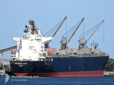
PRINCESS HARU
Cargo
Current Trip
| Time Travelled | 25 days |
|---|---|
| Remaining Time | --- |
| Distance Travelled | 6312.69 nm |
| Remaining Distance | --- |
| AVG Speed | 12.4 Knop |
| MAX Speed | 17.8 Knop |
| AVG Wind | 17.9 knots |
| MAX Wind | 33.5 knots |
| MIN Temp | 4°C / 39.2°F |
| MAX Temp | 18.8°C / 65.84°F |
| Djupgående | 10.9 m |
| Position mottagen | 5 d sen |
Current Position
| Longitud | -126.64234° |
|---|---|
| Latitude | 44.22726° |
| Status | Under way using engine |
| Fart | 12.4 Knop |
| Kurs | 295.8° |
| Område | North Pacific Ocean |
| Station | T-AIS |
| Position mottagen | 5 d sen |
Info
Information
The current position of PRINCESS HARU is in North Pacific Ocean with coordinates 44.22726° / -126.64234° as reported on 2024-04-19 01:43 by AIS to our vessel tracker app. The vessel's current speed is 12.4 Knop and is heading at the port of SHIKOKUCHUO. The estimated time of arrival as calculated by MyShipTracking vessel tracking app is 2024-05-05 01:00 LT
The vessel PRINCESS HARU (IMO: 9801237, MMSI: 538007472) is a Cargo It's sailing under the flag of [MH] Marshall Is.
In this page you can find informations about the vessels current position, last detected port calls, and current voyage information. If the vessels is not in coverage by AIS you will find the latest position.
The current position of PRINCESS HARU is detected by our AIS receivers and we are not responsible for the reliability of the data. The last position was recorded while the vessel was in Coverage by the Ais receivers of our vessel tracking app.
The current draught of PRINCESS HARU as reported by AIS is 10.9 meters
Weather
| Temperature | 4°C / 39.2°F |
|---|---|
| Wind Speed | 8 knots |
| Direction | 297° WNW |
| Pressure | 1007 hPa |
| Humidity | 74 % |
| Cloud Coverage | 56 % |
Featured Company
Last Port Calls
| Port | Arrival | Departure | Time In Port |
|---|---|---|---|
| 2024-03-25 21:09 | 2024-03-29 07:43 | 3 d | |
| 2024-03-25 19:12 | 2024-03-25 20:36 | 1 h | |
| 2024-03-02 04:01 |
Most Visited Ports (Last year)
| Port | Arrivals | |
|---|---|---|
| 9 | ||
| 3 | ||
| 2 | ||
| 1 | ||
| 1 |
Last Trips
| Origin | Departure | Destination | Arrival | Distance | |
|---|---|---|---|---|---|
| 2024-03-26 05:36 | 2024-03-26 06:09 | 2.48 nm | |||
| 2024-03-26 05:36 | 2024-03-26 04:12 | 2.48 nm | |||
| 2024-01-20 07:59 | 2024-03-02 13:01 | 6464.25 nm |
Events
| Tid | Event | Detaljer | Position / Dest | Information |
|---|---|---|---|---|
| 2024-04-19 01:57 | Status ändrad | Default Under way using engine |
44.24804 / -126.70229
JP MKX
|
Fart: 12.4 kn Kurs: 295.8° |
| 2024-04-19 01:43 | UTANFÖR täckningsområde |
44.22726 / -126.64234
North Pacific Ocean
JP MKX
|
Fart: 12.4 kn Kurs: 295.8° |
|
| 2024-04-19 01:11 | Djupgående ändrat | 10.9 6.8 |
44.18054 / -126.50772
JP MKX
|
Fart: 12.1 kn Kurs: 295.2° |
| 2024-04-19 01:11 | Destination ändrad | JP MKX >US COB |
44.18054 / -126.50772
JP MKX
|
Fart: 12.1 kn Kurs: 295.2° |
| 2024-04-19 01:11 | ETA ändrat | 2024/05/05 01:00 2024/04/13 07:00 |
44.18054 / -126.50772
JP MKX
|
Fart: 12.1 kn Kurs: 295.2° |
| 2024-04-19 00:28 | Upptäckt i hav | United States part of the North Pacific Ocean |
44.11656 / -126.32887
North Pacific Ocean
|
Fart: 11.9 kn Kurs: 299.4° |
| 2024-04-19 00:28 | I täckningsområde |
44.11656 / -126.32887
North Pacific Ocean
|
Fart: 11.9 kn Kurs: 299.4° |