
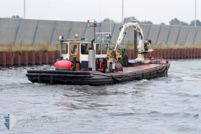
PIETER
Dredging or underwater ops
Current Trip
| Trip Time | --- |
|---|---|
| Trip Distance | --- |
| AVG Speed | --- |
| MAX Speed | --- |
| Djupgående | --- |
| AVG Wind | --- |
| MAX Wind | --- |
| MIN Temp | --- |
| MAX Temp | --- |
| Position mottagen | 1 d sen |
Current Position
| Longitud | 4.88851° |
|---|---|
| Latitude | 52.40010° |
| Status | Under way using engine |
| Fart | |
| Kurs | --- |
| Område | North Sea |
| Station | T-AIS |
| Position mottagen | 1 d sen |
Info
Information
The current position of PIETER is in North Sea with coordinates 52.40010° / 4.88851° as reported on 2024-04-18 21:43 by AIS to our vessel tracker app. The vessel's current speed is 0 Knop and is currently inside the port of AMSTERDAM.
The vessel PIETER (MMSI: 244780616) is a Dredging or underwater ops It's sailing under the flag of [NL] Netherlands.
In this page you can find informations about the vessels current position, last detected port calls, and current voyage information. If the vessels is not in coverage by AIS you will find the latest position.
The current position of PIETER is detected by our AIS receivers and we are not responsible for the reliability of the data. The last position was recorded while the vessel was in Coverage by the Ais receivers of our vessel tracking app.
The current draught of PIETER as reported by AIS is 0.1 meters
Weather
| Temperature | 7.8°C / 46.04°F |
|---|---|
| Wind Speed | 14 knots |
| Direction | 239° WSW |
| Pressure | 1016 hPa |
| Humidity | 79.2 % |
| Cloud Coverage | 100 % |
Featured Company
Last Port Calls
| Port | Arrival | Departure | Time In Port |
|---|---|---|---|
| 2024-04-17 07:05 | |||
| 2024-04-11 08:45 | 2024-04-11 08:58 | 13 m | |
| 2024-04-11 07:04 | 2024-04-11 07:55 | 51 m | |
| 2024-04-09 07:38 | 2024-04-09 08:44 | 1 h | |
| 2024-04-04 05:26 | 2024-04-04 07:31 | 2 h | |
| 2024-04-03 07:52 | 2024-04-03 14:08 | 6 h | |
| 2024-04-02 06:52 | 2024-04-02 07:29 | 37 m | |
| 2024-04-02 06:20 | |||
| 2024-03-12 09:25 | 2024-03-12 10:59 | 1 h | |
| 2024-03-12 08:57 |
Most Visited Ports (Last year)
| Port | Arrivals | |
|---|---|---|
| 17 | ||
| 16 | ||
| 7 | ||
| 1 | ||
| 1 | ||
| 1 |
Last Trips
| Origin | Departure | Destination | Arrival | Distance | |
|---|---|---|---|---|---|
| 2024-04-11 09:55 | 2024-04-11 10:45 | 3.25 nm | |||
| 2024-04-09 10:44 | 2024-04-11 09:04 | 4.49 nm | |||
| 2024-04-04 09:31 | 2024-04-09 09:38 | 4.27 nm | |||
| 2024-04-03 16:08 | 2024-04-04 07:26 | 4.43 nm | |||
| 2024-04-02 09:29 | 2024-04-03 09:52 | 4.25 nm | |||
| 2024-04-02 08:20 | 2024-04-02 08:52 | 2.44 nm | |||
| 2024-03-12 09:57 | 2024-03-12 10:25 | 2.37 nm | |||
| 2024-03-03 23:26 | 2024-03-04 09:42 | 1.96 nm | |||
| 2024-02-21 11:32 | 2024-02-25 05:16 | 42.97 nm | |||
| 2024-02-20 11:38 | 2024-02-21 09:42 | 4.34 nm |
Events
| Tid | Event | Detaljer | Position / Dest | Information |
|---|---|---|---|---|
| 2024-04-18 21:43 | UTANFÖR täckningsområde |
52.40010 / 4.88852
North Sea
[NL] AMSTERDAM
|
Fart: Kurs: 65.6° |
|
| 2024-04-18 21:43 | I täckningsområde |
52.40010 / 4.88852
North Sea
[NL] AMSTERDAM
|
Fart: Kurs: 65.6° |
|
| 2024-04-17 09:24 | UTANFÖR täckningsområde |
51.79676 / 5.35492
North Sea
|
Fart: Kurs: 0° |
|
| 2024-04-17 09:23 | STOPPAR förflyttning | 0.51 nm, East of ROSSUM |
51.79677 / 5.35491
|
Fart: 0.2 kn Kurs: 511° |
| 2024-04-17 08:42 | STARTAR förflyttning | 0.51 nm, North West of KERKDRIEL |
51.77585 / 5.34314
|
Fart: 5.5 kn Kurs: 127.4° |
| 2024-04-17 08:16 | STOPPAR förflyttning | 0.73 nm, South of ALEM |
51.77933 / 5.33434
|
Fart: Kurs: 511° |
| 2024-04-17 07:10 | STARTAR förflyttning | 0.61 nm, East of ROSSUM |
51.79598 / 5.35802
|
Fart: 3.9 kn Kurs: 111.6° |
| 2024-04-17 07:06 | I täckningsområde |
51.79678 / 5.35495
North Sea
|
Fart: Kurs: 0° |
|
| 2024-04-17 07:05 | AVGÅTT HAMN |
|
51.79678 / 5.35493
|
Fart: Kurs: 511° |
| 2024-04-16 05:26 | UTANFÖR täckningsområde |
52.37673 / 4.88493
North Sea
[NL] AMSTERDAM
|
Fart: Kurs: 511° |