
PATRIOT
Vehicles Carrier
Current Trip
| Time Travelled | 1 day |
|---|---|
| Remaining Time | 1 day |
| Distance Travelled | 536.31 nm |
| Remaining Distance | 673.53 nm |
| AVG Speed | 14.3 Knop |
| MAX Speed | 18.7 Knop |
| AVG Wind | 12.2 knots |
| MAX Wind | 18.3 knots |
| MIN Temp | 1.9°C / 35.42°F |
| MAX Temp | 7.2°C / 44.96°F |
| Djupgående | 10.1 m |
| Position mottagen | Nu |
Current Position
| Longitud | 11.10930° |
|---|---|
| Latitude | 57.70425° |
| Status | Under way using engine |
| Fart | 14.7 Knop |
| Kurs | 321.8° |
| Område | Kattegat |
| Station | T-AIS |
| Position mottagen | Nu |
Info
Information
The current position of PATRIOT is in Kattegat with coordinates 57.70425° / 11.10930° as reported on 2024-04-24 19:15 by AIS to our vessel tracker app. The vessel's current speed is 14.7 Knop and is heading at the port of SOUTHAMPTON. The estimated time of arrival as calculated by MyShipTracking vessel tracking app is 2024-04-26 15:51 LT
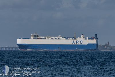
The vessel PATRIOT (IMO: 9316139, MMSI: 303210000) is a Vehicles Carrier that was built in 2006 ( 18 År gammal ). It's sailing under the flag of [US] USA.
In this page you can find informations about the vessels current position, last detected port calls, and current voyage information. If the vessels is not in coverage by AIS you will find the latest position.
The current position of PATRIOT is detected by our AIS receivers and we are not responsible for the reliability of the data. The last position was recorded while the vessel was in Coverage by the Ais receivers of our vessel tracking app.
The current draught of PATRIOT as reported by AIS is 10.1 meters
Weather
| Temperature | 5.1°C / 41.18°F |
|---|---|
| Wind Speed | 2 knots |
| Direction | 127° SE |
| Pressure | 1007.1 hPa |
| Humidity | 74.5 % |
| Cloud Coverage | 100 % |
Featured Company
Last Port Calls
| Port | Arrival | Departure | Time In Port |
|---|---|---|---|
| 2024-04-20 15:50 | 2024-04-23 01:38 | 2 d | |
| 2024-04-10 20:14 | 2024-04-13 14:13 | 2 d | |
| 2024-03-24 10:14 | 2024-03-24 18:53 | 8 h | |
| 2024-03-17 13:59 | 2024-03-19 20:42 | 2 d | |
| 2024-03-12 10:15 | 2024-03-12 21:44 | 11 h | |
| 2024-03-09 12:16 | 2024-03-09 17:25 | 5 h | |
| 2024-03-06 23:26 | 2024-03-07 22:38 | 23 h | |
| 2024-03-05 22:44 | 2024-03-06 23:21 | 1 d | |
| 2024-02-22 06:11 | 2024-02-24 12:25 | 2 d | |
| 2024-02-18 16:53 | 2024-02-21 00:00 | 2 d |
Most Visited Ports (Last year)
| Port | Arrivals | |
|---|---|---|
| 11 | ||
| 9 | ||
| 8 | ||
| 6 | ||
| 6 | ||
| 6 |
Last Trips
| Origin | Departure | Destination | Arrival | Distance | |
|---|---|---|---|---|---|
| 2024-04-13 16:13 | 2024-04-20 17:50 | 907.71 nm | |||
| 2024-03-24 14:53 | 2024-04-10 22:14 | 4381.79 nm | |||
| 2024-03-19 15:42 | 2024-03-24 06:14 | 1275.97 nm | |||
| 2024-03-12 17:44 | 2024-03-17 08:59 | 1264.27 nm | |||
| 2024-03-09 12:25 | 2024-03-12 06:15 | 852.17 nm | |||
| 2024-03-07 17:38 | 2024-03-09 07:16 | 528.26 nm | |||
| 2024-03-06 18:21 | 2024-03-06 18:26 | 0.55 nm | |||
| 2024-02-24 12:25 | 2024-03-05 17:44 | 3739.85 nm | |||
| 2024-02-21 01:00 | 2024-02-22 06:11 | 469.77 nm | |||
| 2024-02-17 17:31 | 2024-02-18 17:53 | 340.21 nm |
Events
| Tid | Event | Detaljer | Position / Dest | Information |
|---|---|---|---|---|
| 2024-04-24 18:50 | Byter havsområde | Danish part of the Kattegat Swedish part of the Kattegat |
57.62449 / 11.22907
Kattegat
GB SOU
|
Fart: 14.9 kn Kurs: 320.9° |
| 2024-04-24 15:53 | Byter havsområde | Swedish part of the Kattegat Danish part of the Kattegat |
56.97119 / 11.78077
Kattegat
GB SOU
|
Fart: 14.6 kn Kurs: 341.3° |
| 2024-04-24 15:17 | Byter havsområde | Danish part of the Kattegat Swedish part of the Kattegat |
56.83904 / 11.88448
Kattegat
GB SOU
|
Fart: 14.3 kn Kurs: 330.5° |
| 2024-04-24 14:56 | Byter havsområde | Swedish part of the Kattegat Danish part of the Kattegat |
56.76623 / 11.95063
Kattegat
GB SOU
|
Fart: 14.3 kn Kurs: 0.8° |
| 2024-04-24 10:54 | STARTAR förflyttning | 12.98 nm, West of SJAELLANDS ODDE |
55.90248 / 10.93568
GB SOU
|
Fart: 16.7 kn Kurs: 40.1° |
| 2024-04-24 10:53 | STOPPAR förflyttning | 13.1 nm, West of SJAELLANDS ODDE |
55.90065 / 10.93295
GB SOU
|
Fart: Kurs: 0° |
| 2024-04-24 10:24 | STARTAR förflyttning | 9.66 nm, East of KOLBY |
55.78689 / 10.81293
GB SOU
|
Fart: 16.6 kn Kurs: 3.5° |
| 2024-04-24 10:23 | STOPPAR förflyttning | 9.66 nm, East of KOLBY |
55.78458 / 10.81268
GB SOU
|
Fart: Kurs: 0° |
| 2024-04-24 10:18 | STARTAR förflyttning | 9.82 nm, East of KOLBY |
55.75964 / 10.81056
GB SOU
|
Fart: 16.7 kn Kurs: 2.7° |
| 2024-04-24 10:17 | STOPPAR förflyttning | 9.84 nm, East of KOLBY |
55.75733 / 10.81029
GB SOU
|
Fart: Kurs: 0° |