
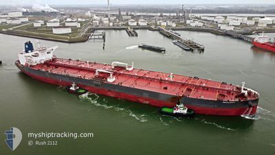
PAPALEMOS
Tanker
Current Trip
OM MFH
| Time Travelled | --- |
|---|---|
| Remaining Time | --- |
| Distance Travelled | 6726.62 nm |
| Remaining Distance | --- |
| AVG Speed | 10.5 Knop |
| MAX Speed | 14.3 Knop |
| AVG Wind | 11.8 knots |
| MAX Wind | 29.3 knots |
| MIN Temp | 24.8°C / 76.64°F |
| MAX Temp | 32.4°C / 90.32°F |
| Djupgående | 11 m |
| Position mottagen | 2 d sen |
Current Position
| Longitud | 76.52274° |
|---|---|
| Latitude | 7.10111° |
| Status | Under way using engine |
| Fart | 13.5 Knop |
| Kurs | 117.4° |
| Område | Laccadive Sea |
| Station | T-AIS |
| Position mottagen | 2 d sen |
Info
Information
The current position of PAPALEMOS is in Laccadive Sea with coordinates 7.10111° / 76.52274° as reported on 2024-04-13 16:50 by AIS to our vessel tracker app. The vessel's current speed is 13.5 Knop
The vessel PAPALEMOS (IMO: 9826110, MMSI: 248642000) is a Tanker It's sailing under the flag of [MT] Malta.
In this page you can find informations about the vessels current position, last detected port calls, and current voyage information. If the vessels is not in coverage by AIS you will find the latest position.
The current position of PAPALEMOS is detected by our AIS receivers and we are not responsible for the reliability of the data. The last position was recorded while the vessel was in Coverage by the Ais receivers of our vessel tracking app.
The current draught of PAPALEMOS as reported by AIS is 11 meters
Weather
| Temperature | 30.1°C / 86.18°F |
|---|---|
| Wind Speed | 8 knots |
| Direction | 45° NE |
| Pressure | 1008.7 hPa |
| Humidity | 71.4 % |
| Cloud Coverage | 22 % |
Featured Company
Last Port Calls
Most Visited Ports (Last year)
| Port | Arrivals | |
|---|---|---|
| 1 |
Last Trips
| Origin | Departure | Destination | Arrival | Distance |
|---|
Events
| Tid | Event | Detaljer | Position / Dest | Information |
|---|---|---|---|---|
| 2024-04-13 16:51 | Status ändrad | Default Under way using engine |
7.09833 / 76.52666
OM MFH
|
Fart: 13.5 kn Kurs: 117.4° |
| 2024-04-13 16:50 | UTANFÖR täckningsområde |
7.10111 / 76.52274
Laccadive Sea
|
Fart: 13.5 kn Kurs: 117.4° |
|
| 2024-04-13 16:41 | Byter havsområde | Indian part of the Laccadive Sea Omani part of the Gulf of Oman |
7.11644 / 76.49276
Laccadive Sea
|
Fart: 13.4 kn Kurs: 117° |
| 2024-04-13 16:40 | Status ändrad | Under way using engine Default |
7.11866 / 76.48832
OM MFH
|
Fart: 13 kn Kurs: 117° |
| 2024-04-13 16:33 | I täckningsområde |
7.11644 / 76.49276
Laccadive Sea
|
Fart: 13.4 kn Kurs: 117° |
|
| 2024-04-08 19:53 | STARTAR förflyttning | 3.23 nm, North East of MINA AL FAHL |
23.67931 / 58.54635
OM MFH
|
Fart: 3.4 kn Kurs: 65° |