
ORITA
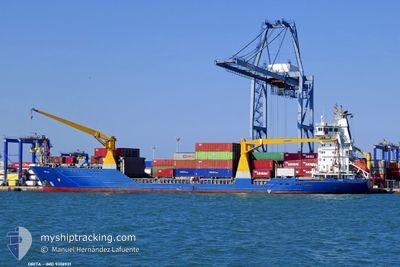
Container Ship
Current Trip
| Time Travelled | 5 days |
|---|---|
| Remaining Time | --- |
| Distance Travelled | 780.35 nm |
| Remaining Distance | --- |
| AVG Speed | 11.3 Knop |
| MAX Speed | 12.1 Knop |
| AVG Wind | 13.5 knots |
| MAX Wind | 26.8 knots |
| MIN Temp | 12.1°C / 53.78°F |
| MAX Temp | 20.3°C / 68.54°F |
| Djupgående | 7.3 m |
| Position mottagen | 2 d sen |
Current Position
| Longitud | 12.18564° |
|---|---|
| Latitude | 36.18132° |
| Status | Under way using engine |
| Fart | 10.9 Knop |
| Kurs | 267° |
| Område | Mediterranean Sea - Eastern Basin |
| Station | T-AIS |
| Position mottagen | 2 d sen |
Info
Information
The current position of ORITA is in Mediterranean Sea - Eastern Basin with coordinates 36.18132° / 12.18564° as reported on 2024-04-14 23:45 by AIS to our vessel tracker app. The vessel's current speed is 10.9 Knop and is heading at the port of SOUSSE. The estimated time of arrival as calculated by MyShipTracking vessel tracking app is 2024-04-15 09:00 LT
The vessel ORITA (IMO: 9318931, MMSI: 373184000) is a Container Ship that was built in 2005 ( 19 År gammal ). It's sailing under the flag of [PA] Panama.
In this page you can find informations about the vessels current position, last detected port calls, and current voyage information. If the vessels is not in coverage by AIS you will find the latest position.
The current position of ORITA is detected by our AIS receivers and we are not responsible for the reliability of the data. The last position was recorded while the vessel was in Coverage by the Ais receivers of our vessel tracking app.
The current draught of ORITA as reported by AIS is 7.3 meters
Weather
| Temperature | 17.9°C / 64.22°F |
|---|---|
| Wind Speed | 23 knots |
| Direction | 79° E |
| Pressure | 1013.9 hPa |
| Humidity | 78.4 % |
| Cloud Coverage | 38 % |
Featured Company
Last Port Calls
| Port | Arrival | Departure | Time In Port |
|---|---|---|---|
| 2024-04-11 19:39 | 2024-04-12 02:30 | 6 h | |
| 2024-04-10 03:56 | 2024-04-10 20:24 | 16 h | |
| 2024-04-07 08:16 | 2024-04-08 14:46 | 1 d | |
| 2024-04-04 08:23 | 2024-04-04 21:27 | 13 h | |
| 2024-03-30 09:54 | 2024-03-31 10:40 | 1 d | |
| 2024-03-28 08:32 | 2024-03-29 15:50 | 1 d | |
| 2024-03-27 05:29 | |||
| 2024-03-19 15:51 | 2024-03-20 02:14 | 10 h | |
| 2024-03-17 22:48 | 2024-03-18 17:46 | 18 h | |
| 2024-03-17 02:57 | 2024-03-17 15:27 | 12 h |
Most Visited Ports (Last year)
| Port | Arrivals | |
|---|---|---|
| 27 | ||
| 21 | ||
| 6 | ||
| 6 | ||
| 6 | ||
| 6 |
Last Trips
| Origin | Departure | Destination | Arrival | Distance | |
|---|---|---|---|---|---|
| 2024-04-10 23:24 | 2024-04-11 22:39 | 261.01 nm | |||
| 2024-04-08 17:46 | 2024-04-10 06:56 | 62.46 nm | |||
| 2024-04-05 00:27 | 2024-04-07 11:16 | 49.19 nm | |||
| 2024-03-31 12:40 | 2024-04-04 11:23 | 901.84 nm | |||
| 2024-03-29 17:50 | 2024-03-30 11:54 | 71.72 nm | |||
| 2024-03-27 06:29 | 2024-03-28 10:32 | 240.28 nm | |||
| 2024-03-18 20:46 | 2024-03-19 18:51 | 256.82 nm | |||
| 2024-03-17 18:27 | 2024-03-18 01:48 | 57.73 nm | |||
| 2024-03-17 01:27 | 2024-03-17 05:57 | 45.18 nm | |||
| 2024-03-12 17:28 | 2024-03-16 08:40 | 895.66 nm |
Events
| Tid | Event | Detaljer | Position / Dest | Information |
|---|---|---|---|---|
| 2024-04-14 23:49 | Status ändrad | Default Under way using engine |
36.18048 / 12.17072
TNSUS
|
Fart: 10.9 kn Kurs: 267° |
| 2024-04-14 23:45 | UTANFÖR täckningsområde |
36.18132 / 12.18564
Mediterranean Sea - Eastern Basin
TNSUS
|
Fart: 10.9 kn Kurs: 267° |
|
| 2024-04-14 23:42 | Upptäckt i hav | Tunisian part of the Mediterranean Sea - Eastern Basin |
36.18194 / 12.19685
Mediterranean Sea - Eastern Basin
TNSUS
|
Fart: 10.9 kn Kurs: 264.9° |
| 2024-04-14 23:42 | Status ändrad | Under way using engine Default |
36.18194 / 12.19685
TNSUS
|
Fart: 11 kn Kurs: 268° |
| 2024-04-14 23:23 | I täckningsområde |
36.18194 / 12.19685
Mediterranean Sea - Eastern Basin
TNSUS
|
Fart: 10.9 kn Kurs: 264.9° |
|
| 2024-04-14 22:01 | Status ändrad | Default Under way using engine |
36.19490 / 12.57707
TNSUS
|
Fart: 10.7 kn Kurs: 269.5° |
| 2024-04-14 21:49 | UTANFÖR täckningsområde |
36.19530 / 12.62193
Mediterranean Sea - Eastern Basin
TNSUS
|
Fart: 10.7 kn Kurs: 269.5° |
|
| 2024-04-14 21:48 | Status ändrad | Under way using engine Default |
36.19531 / 12.62564
TNSUS
|
Fart: 10.9 kn Kurs: 268° |
| 2024-04-14 21:40 | Status ändrad | Default Under way using engine |
36.19543 / 12.65564
TNSUS
|
Fart: 11 kn Kurs: 268.8° |
| 2024-04-14 21:34 | Status ändrad | Under way using engine Default |
36.19557 / 12.67834
TNSUS
|
Fart: 10.9 kn Kurs: 262° |