
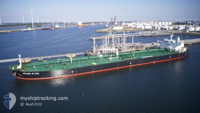
ORANGE STARS
Crude Oil Tanker
Current Trip
GR GYT (OPL)
| Time Travelled | 6 days |
|---|---|
| Remaining Time | --- |
| Distance Travelled | 1864.11 nm |
| Remaining Distance | --- |
| AVG Speed | 12.2 Knop |
| MAX Speed | 15.8 Knop |
| AVG Wind | 10.7 knots |
| MAX Wind | 23.9 knots |
| MIN Temp | 10°C / 50°F |
| MAX Temp | 19.5°C / 67.1°F |
| Djupgående | 8.8 m |
| Position mottagen | 1 h, 38 m sen |
Current Position
| Longitud | 1.78410° |
|---|---|
| Latitude | 37.14788° |
| Status | Under way using engine |
| Fart | 13.9 Knop |
| Kurs | 74° |
| Område | Mediterranean Sea - Western Basin |
| Station | T-AIS |
| Position mottagen | 1 h, 38 m sen |
Info
Information
The current position of ORANGE STARS is in Mediterranean Sea - Western Basin with coordinates 37.14788° / 1.78410° as reported on 2024-04-16 11:44 by AIS to our vessel tracker app. The vessel's current speed is 13.9 Knop
The vessel ORANGE STARS (IMO: 9433597, MMSI: 538004145) is a Crude Oil Tanker that was built in 2011 ( 13 År gammal ). It's sailing under the flag of [MH] Marshall Is.
In this page you can find informations about the vessels current position, last detected port calls, and current voyage information. If the vessels is not in coverage by AIS you will find the latest position.
The current position of ORANGE STARS is detected by our AIS receivers and we are not responsible for the reliability of the data. The last position was recorded while the vessel was in Coverage by the Ais receivers of our vessel tracking app.
The current draught of ORANGE STARS as reported by AIS is 8.8 meters
Weather
| Temperature | 17.9°C / 64.22°F |
|---|---|
| Wind Speed | 5 knots |
| Direction | 271° W |
| Pressure | 1015.3 hPa |
| Humidity | 74.2 % |
| Cloud Coverage | --- |
Featured Company
Most Visited Ports (Last year)
| Port | Arrivals | |
|---|---|---|
| 5 | ||
| 3 | ||
| 2 | ||
| 1 | ||
| 1 | ||
| 1 |
Last Trips
| Origin | Departure | Destination | Arrival | Distance | |
|---|---|---|---|---|---|
| 2024-02-19 10:35 | 2024-04-03 21:46 | 9077.77 nm | |||
| 2024-01-09 16:59 | 2024-02-17 21:14 | 9435.03 nm |
Events
| Tid | Event | Detaljer | Position / Dest | Information |
|---|---|---|---|---|
| 2024-04-16 11:47 | Status ändrad | Default Under way using engine |
37.15049 / 1.79720
GR GYT (OPL)
|
Fart: 13.9 kn Kurs: 74° |
| 2024-04-16 11:44 | UTANFÖR täckningsområde |
37.14788 / 1.78410
Mediterranean Sea - Western Basin
GR GYT (OPL)
|
Fart: 13.9 kn Kurs: 74° |
|
| 2024-04-16 11:04 | Djupgående ändrat | 8.8 8 |
37.10692 / 1.59455
GR GYT (OPL)
|
Fart: 13.7 kn Kurs: 72.6° |
| 2024-04-16 11:04 | ETA ändrat | 2024/04/19 22:00 |
37.10692 / 1.59455
GR GYT (OPL)
|
Fart: 13.7 kn Kurs: 72.6° |
| 2024-04-16 10:57 | Status ändrad | Under way using engine Default |
37.09979 / 1.56567
GR GYT (OPL)
|
Fart: 13.6 kn Kurs: 72° |
| 2024-04-16 10:57 | I täckningsområde |
37.10182 / 1.57403
Mediterranean Sea - Western Basin
|
Fart: 13.6 kn Kurs: 72.9° |
|
| 2024-04-16 08:19 | Status ändrad | Default Under way using engine |
36.94820 / .82931
GR GYT (OPL)
|
Fart: 13.9 kn Kurs: 75° |
| 2024-04-16 08:14 | UTANFÖR täckningsområde |
36.94275 / .80382
Mediterranean Sea - Western Basin
|
Fart: 13.9 kn Kurs: 75° |
|
| 2024-04-16 08:14 | Status ändrad | Under way using engine Default |
36.94245 / .80242
GR GYT (OPL)
|
Fart: 13.9 kn Kurs: 77° |
| 2024-04-16 08:07 | Status ändrad | Default Under way using engine |
36.93672 / .77233
GR GYT (OPL)
|
Fart: 12.9 kn Kurs: 77° |