
OPTION B
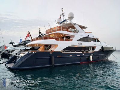
Pleasure Craft
Current Trip
| Trip Time | 45 mins |
|---|---|
| Trip Distance | 6.40 nm |
| AVG Speed | 11.3 Knop |
| MAX Speed | 16.4 Knop |
| Djupgående | 2.6 m |
| AVG Wind | 10 knots |
| MAX Wind | 10.9 knots |
| MIN Temp | 20.9°C / 69.62°F |
| MAX Temp | 21.3°C / 70.34°F |
| Position mottagen | 4 h, 10 m sen |
Current Position
| Longitud | 23.68493° |
|---|---|
| Latitude | 37.93008° |
| Status | Under way using engine |
| Fart | |
| Kurs | 282° |
| Område | Aegean Sea |
| Station | T-AIS |
| Position mottagen | 4 h, 10 m sen |
Info
Information
The current position of OPTION B is in Aegean Sea with coordinates 37.93008° / 23.68493° as reported on 2024-04-19 10:56 by AIS to our vessel tracker app. The vessel's current speed is 0 Knop and is currently inside the port of FLISVOS.
The vessel OPTION B (IMO: 8794164, MMSI: 248365000) is a Pleasure Craft It's sailing under the flag of [MT] Malta.
In this page you can find informations about the vessels current position, last detected port calls, and current voyage information. If the vessels is not in coverage by AIS you will find the latest position.
The current position of OPTION B is detected by our AIS receivers and we are not responsible for the reliability of the data. The last position was recorded while the vessel was in Coverage by the Ais receivers of our vessel tracking app.
The current draught of OPTION B as reported by AIS is 2.6 meters
Weather
| Temperature | 19.5°C / 67.1°F |
|---|---|
| Wind Speed | 9 knots |
| Direction | 188° S |
| Pressure | 1009.1 hPa |
| Humidity | 40.4 % |
| Cloud Coverage | 4 % |
Featured Company
Events
| Tid | Event | Detaljer | Position / Dest | Information |
|---|---|---|---|---|
| 2024-04-19 10:56 | UTANFÖR täckningsområde |
37.93008 / 23.68493
Aegean Sea
[GR] FLISVOS
|
Fart: Kurs: 206° |
|
| 2024-04-19 10:52 | I täckningsområde |
37.93009 / 23.68492
Aegean Sea
[GR] FLISVOS
|
Fart: Kurs: 212° |
|
| 2024-04-18 13:34 | UTANFÖR täckningsområde |
37.93012 / 23.68493
Aegean Sea
[GR] FLISVOS
|
Fart: Kurs: 35.5° |
|
| 2024-04-18 13:04 | STOPPAR förflyttning |
37.92950 / 23.68443
[GR] FLISVOS
|
Fart: 0.2 kn Kurs: 204° |
|
| 2024-04-18 12:57 | ANLÄNDER HAMN |
|
37.93523 / 23.67901
[GR] FLISVOS
|
Fart: 4.6 kn Kurs: 117° |
| 2024-04-18 12:55 | STARTAR förflyttning | 0.34 nm, West of FLISVOS |
37.93635 / 23.67632
PERAMA
|
Fart: 4.7 kn Kurs: 101° |
| 2024-04-18 12:51 | STOPPAR förflyttning | 0.39 nm, East of FALIRO |
37.93725 / 23.67423
PERAMA
|
Fart: 0.3 kn Kurs: 116° |
| 2024-04-18 12:12 | AVGÅTT HAMN |
|
37.95455 / 23.57432
PERAMA
|
Fart: 8.2 kn Kurs: 184° |
| 2024-04-18 12:10 | STARTAR förflyttning |
37.95871 / 23.57322
[GR] PERAMA
|
Fart: 3.8 kn Kurs: 223° |
|
| 2024-04-18 11:52 | I täckningsområde |
37.96049 / 23.57359
Aegean Sea
[GR] PERAMA
|
Fart: Kurs: 296.4° |