
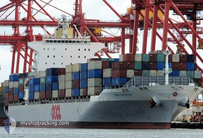
OOCL HOUSTON
Container Ship
Current Trip
| Time Travelled | 5 days |
|---|---|
| Remaining Time | 5 days |
| Distance Travelled | 2132.07 nm |
| Remaining Distance | 1814.18 nm |
| AVG Speed | 16.3 Knop |
| MAX Speed | 20.5 Knop |
| AVG Wind | 12.4 knots |
| MAX Wind | 18.5 knots |
| MIN Temp | 23.6°C / 74.48°F |
| MAX Temp | 30°C / 86°F |
| Djupgående | 11 m |
| Position mottagen | 1 m sen |
Current Position
| Longitud | 113.00248° |
|---|---|
| Latitude | -29.90507° |
| Status | Under way using engine |
| Fart | 13.6 Knop |
| Kurs | 160° |
| Område | Indian Ocean |
| Station | T-AIS |
| Position mottagen | 1 m sen |
Info
Information
The current position of OOCL HOUSTON is in Indian Ocean with coordinates -29.90507° / 113.00248° as reported on 2024-04-20 10:47 by AIS to our vessel tracker app. The vessel's current speed is 13.6 Knop and is heading at the port of MELBOURNE. The estimated time of arrival as calculated by MyShipTracking vessel tracking app is 2024-04-25 17:38 LT
The vessel OOCL HOUSTON (IMO: 9355757, MMSI: 477958300) is a Container Ship that was built in 2007 ( 17 År gammal ). It's sailing under the flag of [HK] Hong Kong.
In this page you can find informations about the vessels current position, last detected port calls, and current voyage information. If the vessels is not in coverage by AIS you will find the latest position.
The current position of OOCL HOUSTON is detected by our AIS receivers and we are not responsible for the reliability of the data. The last position was recorded while the vessel was in Coverage by the Ais receivers of our vessel tracking app.
The current draught of OOCL HOUSTON as reported by AIS is 11 meters
Weather
| Temperature | 23.6°C / 74.48°F |
|---|---|
| Wind Speed | 8 knots |
| Direction | 99° E |
| Pressure | 1020.5 hPa |
| Humidity | 62.9 % |
| Cloud Coverage | 6 % |
Featured Company
Last Port Calls
| Port | Arrival | Departure | Time In Port |
|---|---|---|---|
| 2024-04-14 07:34 | 2024-04-15 05:44 | 22 h | |
| 2024-04-09 15:05 | 2024-04-11 22:17 | 2 d | |
| 2024-04-06 07:03 | 2024-04-07 05:46 | 22 h | |
| 2024-03-26 12:43 | 2024-03-28 00:44 | 1 d | |
| 2024-03-22 15:57 | 2024-03-24 11:56 | 1 d | |
| 2024-03-19 19:11 | 2024-03-20 21:35 | 1 d | |
| 2024-03-09 06:34 | 2024-03-10 00:08 | 17 h | |
| 2024-03-05 00:59 | 2024-03-06 10:40 | 1 d | |
| 2024-03-02 11:01 | 2024-03-03 06:07 | 19 h | |
| 2024-02-19 12:05 | 2024-02-20 10:52 | 22 h |
Most Visited Ports (Last year)
| Port | Arrivals | |
|---|---|---|
| 20 | ||
| 10 | ||
| 9 | ||
| 9 | ||
| 9 |
Last Trips
| Origin | Departure | Destination | Arrival | Distance | |
|---|---|---|---|---|---|
| 2024-04-12 05:17 | 2024-04-14 15:34 | 799.48 nm | |||
| 2024-04-07 13:46 | 2024-04-09 22:05 | 803.00 nm | |||
| 2024-03-28 10:44 | 2024-04-06 15:03 | 3793.95 nm | |||
| 2024-03-24 22:56 | 2024-03-26 22:43 | 535.07 nm | |||
| 2024-03-21 08:35 | 2024-03-23 02:57 | 585.54 nm | |||
| 2024-03-10 08:08 | 2024-03-20 06:11 | 3956.43 nm | |||
| 2024-03-06 17:40 | 2024-03-09 14:34 | 798.87 nm | |||
| 2024-03-03 14:07 | 2024-03-05 07:59 | 782.35 nm | |||
| 2024-02-20 20:52 | 2024-03-02 19:01 | 3955.18 nm | |||
| 2024-02-18 14:10 | 2024-02-19 22:05 | 535.54 nm |
Events
| Tid | Event | Detaljer | Position / Dest | Information |
|---|---|---|---|---|
| 2024-04-20 10:47 | Status ändrad | Under way using engine Default |
-29.90205 / 113.00120
AU MEL
|
Fart: 13.7 kn Kurs: 161° |
| 2024-04-20 10:43 | I täckningsområde |
-29.90383 / 113.00193
Indian Ocean
AU MEL
|
Fart: 13.6 kn Kurs: 160° |
|
| 2024-04-20 07:55 | Status ändrad | Default Under way using engine |
-29.25678 / 112.78040
AU MEL
|
Fart: 14.6 kn Kurs: 161° |
| 2024-04-20 07:50 | UTANFÖR täckningsområde |
-29.23777 / 112.77328
Indian Ocean
AU MEL
|
Fart: 14.6 kn Kurs: 161° |
|
| 2024-04-20 07:45 | Status ändrad | Under way using engine Default |
-29.21800 / 112.76555
AU MEL
|
Fart: 14.6 kn Kurs: 161° |
| 2024-04-20 07:43 | I täckningsområde |
-29.21800 / 112.76555
Indian Ocean
AU MEL
|
Fart: 14.6 kn Kurs: 161° |
|
| 2024-04-19 15:35 | Status ändrad | Default Under way using engine |
-25.12460 / 111.27250
AU MEL
|
Fart: 16.1 kn Kurs: 158° |
| 2024-04-19 15:06 | UTANFÖR täckningsområde |
-24.99997 / 111.22067
Indian Ocean
AU MEL
|
Fart: 16.1 kn Kurs: 158° |
|
| 2024-04-19 14:25 | ETA ändrat | 2024/04/25 15:00 2024/04/24 20:30 |
-24.82568 / 111.13842
AU MEL
|
Fart: 16.6 kn Kurs: 158° |
| 2024-04-19 14:07 | Byter havsområde | Australian part of the Indian Ocean Malaysian part of the South China Sea |
-24.75202 / 111.10733
Indian Ocean
AU MEL
|
Fart: 16.1 kn Kurs: 159° |