
ALEXANDROS PETRAKIS
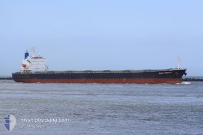
Bulk Carrier
Current Trip
SUEZ-EG
| Time Travelled | 11 days |
|---|---|
| Remaining Time | --- |
| Distance Travelled | 2955.28 nm |
| Remaining Distance | --- |
| AVG Speed | 13.6 Knop |
| MAX Speed | 17.2 Knop |
| AVG Wind | 8.8 knots |
| MAX Wind | 19 knots |
| MIN Temp | 25.9°C / 78.62°F |
| MAX Temp | 30.4°C / 86.72°F |
| Djupgående | 7.1 m |
| Position mottagen | 13 h, 32 m sen |
Current Position
| Longitud | 37.53007° |
|---|---|
| Latitude | 22.70978° |
| Status | Under way using engine |
| Fart | 13.5 Knop |
| Kurs | 329.8° |
| Område | Red Sea |
| Station | T-AIS |
| Position mottagen | 13 h, 32 m sen |
Info
Information
The current position of ALEXANDROS PETRAKIS is in Red Sea with coordinates 22.70978° / 37.53007° as reported on 2024-04-23 20:57 by AIS to our vessel tracker app. The vessel's current speed is 13.5 Knop
The vessel ALEXANDROS PETRAKIS (IMO: 9442938, MMSI: 538009094) is a Bulk Carrier that was built in 2008 ( 16 År gammal ). It's sailing under the flag of [MH] Marshall Is.
In this page you can find informations about the vessels current position, last detected port calls, and current voyage information. If the vessels is not in coverage by AIS you will find the latest position.
The current position of ALEXANDROS PETRAKIS is detected by our AIS receivers and we are not responsible for the reliability of the data. The last position was recorded while the vessel was in Coverage by the Ais receivers of our vessel tracking app.
The current draught of ALEXANDROS PETRAKIS as reported by AIS is 7.1 meters
Weather
| Temperature | 25.9°C / 78.62°F |
|---|---|
| Wind Speed | 11 knots |
| Direction | 307° NW |
| Pressure | 1007.4 hPa |
| Humidity | 73.6 % |
| Cloud Coverage | --- |
Featured Company
Events
| Tid | Event | Detaljer | Position / Dest | Information |
|---|---|---|---|---|
| 2024-04-23 21:04 | Status ändrad | Default Under way using engine |
22.73143 / 37.51641
SUEZ-EG
|
Fart: 13.5 kn Kurs: 329.8° |
| 2024-04-23 20:57 | UTANFÖR täckningsområde |
22.70978 / 37.53007
Red Sea
SUEZ-EG
|
Fart: 13.5 kn Kurs: 329.8° |
|
| 2024-04-23 20:52 | Status ändrad | Under way using engine Default |
22.69295 / 37.54078
SUEZ-EG
|
Fart: 13.4 kn Kurs: 329° |
| 2024-04-23 20:41 | Status ändrad | Default Under way using engine |
22.65754 / 37.56370
SUEZ-EG
|
Fart: 13.3 kn Kurs: 328.2° |
| 2024-04-23 20:25 | Status ändrad | Under way using engine Default |
22.60801 / 37.59560
SUEZ-EG
|
Fart: 13.1 kn Kurs: 329° |
| 2024-04-23 20:20 | Status ändrad | Default Under way using engine |
22.59219 / 37.60579
SUEZ-EG
|
Fart: 13.1 kn Kurs: 328.6° |
| 2024-04-23 20:11 | Status ändrad | Under way using engine Default |
22.56124 / 37.62596
SUEZ-EG
|
Fart: 13.4 kn Kurs: 326° |
| 2024-04-23 19:57 | Status ändrad | Default Under way using engine |
22.51914 / 37.65468
SUEZ-EG
|
Fart: 13.7 kn Kurs: 328.4° |
| 2024-04-23 19:54 | Status ändrad | Under way using engine Default |
22.50773 / 37.66226
SUEZ-EG
|
Fart: 13.8 kn Kurs: 328° |
| 2024-04-23 19:10 | Status ändrad | Default Under way using engine |
22.35870 / 37.75450
SUEZ-EG
|
Fart: 13.9 kn Kurs: 329° |