
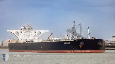
OCEANIS
Crude Oil Tanker
Current Trip
| Time Travelled | 40 days |
|---|---|
| Remaining Time | --- |
| Distance Travelled | 9162.62 nm |
| Remaining Distance | --- |
| AVG Speed | 11.5 Knop |
| MAX Speed | 15.7 Knop |
| AVG Wind | 8.9 knots |
| MAX Wind | 35 knots |
| MIN Temp | 20.5°C / 68.9°F |
| MAX Temp | 30.3°C / 86.54°F |
| Djupgående | 20.2 m |
| Position mottagen | 5 d sen |
Current Position
| Longitud | --- |
|---|---|
| Latitude | --- |
| Status | Under way using engine |
| Fart | 11.4 Knop |
| Kurs | 45.9° |
| Område | Singapore Strait |
| Station | T-AIS |
| Position mottagen | 5 d sen |
Info
Information
The current position of OCEANIS is in Singapore Strait with coordinates 1.30382° / 104.35271° as reported on 2025-12-02 00:56 by AIS to our vessel tracker app. The vessel's current speed is 11.4 Knop
The vessel OCEANIS (IMO: 9532757, MMSI: 241089000) is a Crude Oil Tanker that was built in 2011 ( 14 År gammal ). It's sailing under the flag of [GR] Greece.
In this page you can find informations about the vessels current position, last detected port calls, and current voyage information. If the vessels is not in coverage by AIS you will find the latest position.
The current position of OCEANIS is detected by our AIS receivers and we are not responsible for the reliability of the data. The last position was recorded while the vessel was in Coverage by the Ais receivers of our vessel tracking app.
The current draught of OCEANIS as reported by AIS is 20.2 meters
Weather
| Temperature | 20.6°C / 69.08°F |
|---|---|
| Wind Speed | 12 knots |
| Direction | 76° ENE |
| Pressure | 1019.9 hPa |
| Humidity | 84.6 % |
| Cloud Coverage | 100 % |
Featured Company
Last Trips
| Origin | Departure | Destination | Arrival | Distance |
|---|
Events
| Tid | Event | Detaljer | Position / Dest | Information |
|---|---|---|---|---|
| 2025-12-06 19:52 | STOPPAR förflyttning |
20.99379 / 108.59440
SARTA=>CNQZH
|
Fart: 0.3 kn Kurs: 203° |
|
| 2025-12-02 01:02 | Status ändrad | Default Under way using engine |
1.31702 / 104.36641
SARTA=>CNQZH
|
Fart: 11.4 kn Kurs: 45.9° |
| 2025-12-02 00:56 | UTANFÖR täckningsområde |
1.30382 / 104.35271
Singapore Strait
SARTA=>CNQZH
|
Fart: 11.4 kn Kurs: 45.9° |
|
| 2025-12-02 00:50 | Status ändrad | Under way using engine Default |
1.29061 / 104.33768
SARTA=>CNQZH
|
Fart: 11.8 kn Kurs: 72° |
| 2025-12-02 00:21 | Status ändrad | Default Under way using engine |
1.27340 / 104.24239
SARTA=>CNQZH
|
Fart: 11.6 kn Kurs: 87.5° |
| 2025-12-02 00:02 | Status ändrad | Under way using engine Default |
1.26708 / 104.18314
SARTA=>CNQZH
|
Fart: 10.8 kn Kurs: 83° |
| 2025-12-02 00:01 | Status ändrad | Default Under way using engine |
1.26676 / 104.17963
SARTA=>CNQZH
|
Fart: 9.5 kn Kurs: 80.3° |
| 2025-12-01 23:48 | Byter havsområde | Malaysian part of the Singapore Strait Indonesian part of the Singapore Strait |
1.26038 / 104.14539
Singapore Strait
SARTA=>CNQZH
|
Fart: 9.5 kn Kurs: 72.5° |
| 2025-12-01 22:02 | Byter havsområde | Indonesian part of the Singapore Strait Singaporean part of the Singapore Strait |
1.19797 / 103.86544
Singapore Strait
SARTA=>CNQZH
|
Fart: 9.4 kn Kurs: 68.9° |
| 2025-12-01 21:53 | Byter havsområde | Singaporean part of the Singapore Strait Indonesian part of the Singapore Strait |
1.18905 / 103.84352
Singapore Strait
SARTA=>CNQZH
|
Fart: 9.8 kn Kurs: 64.8° |