
NORTH SEA
Tanker
Current Trip
US NYC (FOR ORDERS)
| Time Travelled | 10 days |
|---|---|
| Remaining Time | --- |
| Distance Travelled | 3110.50 nm |
| Remaining Distance | --- |
| AVG Speed | 11.7 Knop |
| MAX Speed | 14.6 Knop |
| AVG Wind | 15.4 knots |
| MAX Wind | 28 knots |
| MIN Temp | 7.5°C / 45.5°F |
| MAX Temp | 17.7°C / 63.86°F |
| Djupgående | 10.9 m |
| Position mottagen | Nu |
Current Position
| Longitud | -71.94581° |
|---|---|
| Latitude | 40.01988° |
| Status | Under way using engine |
| Fart | 8.6 Knop |
| Kurs | 263.4° |
| Område | North Atlantic Ocean |
| Station | T-AIS |
| Position mottagen | Nu |
Info
Information
The current position of NORTH SEA is in North Atlantic Ocean with coordinates 40.01988° / -71.94581° as reported on 2024-04-19 20:17 by AIS to our vessel tracker app. The vessel's current speed is 8.6 Knop
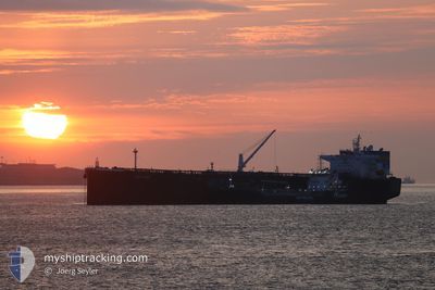
The vessel NORTH SEA (IMO: 9760495, MMSI: 636017501) is a Tanker It's sailing under the flag of [LR] Liberia.
In this page you can find informations about the vessels current position, last detected port calls, and current voyage information. If the vessels is not in coverage by AIS you will find the latest position.
The current position of NORTH SEA is detected by our AIS receivers and we are not responsible for the reliability of the data. The last position was recorded while the vessel was in Coverage by the Ais receivers of our vessel tracking app.
The current draught of NORTH SEA as reported by AIS is 10.9 meters
Weather
| Temperature | 7.7°C / 45.86°F |
|---|---|
| Wind Speed | 14 knots |
| Direction | 104° ESE |
| Pressure | 1018.6 hPa |
| Humidity | 90.5 % |
| Cloud Coverage | 100 % |
Featured Company
Events
| Tid | Event | Detaljer | Position / Dest | Information |
|---|---|---|---|---|
| 2024-04-19 19:52 | Byter havsområde | United States part of the North Atlantic Ocean High seas of the North Atlantic Ocean |
40.01485 / -71.83539
North Atlantic Ocean
|
Fart: 13.3 kn Kurs: 280.2° |
| 2024-04-19 19:52 | Status ändrad | Under way using engine Default |
40.01485 / -71.83539
US NYC (FOR ORDERS)
|
Fart: 13.6 kn Kurs: 272° |
| 2024-04-19 19:52 | I täckningsområde |
40.01485 / -71.83539
North Atlantic Ocean
|
Fart: 13.3 kn Kurs: 280.2° |
|
| 2024-04-11 02:00 | Status ändrad | Default Under way using engine |
45.72035 / -13.63835
US NYC (FOR ORDERS)
|
Fart: 12.4 kn Kurs: 260.4° |
| 2024-04-11 01:54 | Status ändrad | Under way using engine Default |
45.72400 / -13.60692
US NYC (FOR ORDERS)
|
Fart: 12.3 kn Kurs: 260° |
| 2024-04-11 01:54 | UTANFÖR täckningsområde |
45.72400 / -13.60692
North Atlantic Ocean
US NYC (FOR ORDERS)
|
Fart: 12.4 kn Kurs: 260.4° |
|
| 2024-04-11 01:25 | Status ändrad | Default Under way using engine |
45.73831 / -13.47025
US NYC (FOR ORDERS)
|
Fart: 12.1 kn Kurs: 261.1° |
| 2024-04-11 01:10 | Status ändrad | Under way using engine Default |
45.74597 / -13.39499
US NYC (FOR ORDERS)
|
Fart: 12.5 kn Kurs: 261° |
| 2024-04-11 00:30 | Status ändrad | Default Under way using engine |
45.76823 / -13.20068
US NYC (FOR ORDERS)
|
Fart: 12.2 kn Kurs: 260° |
| 2024-04-11 00:25 | Status ändrad | Under way using engine Default |
45.77105 / -13.17766
US NYC (FOR ORDERS)
|
Fart: 12.1 kn Kurs: 261° |