
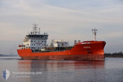
NORMA
Tanker
Current Trip
| Time Travelled | 21 h, 21 mins |
|---|---|
| Remaining Time | --- |
| Distance Travelled | 165.20 nm |
| Remaining Distance | --- |
| AVG Speed | 8.9 Knop |
| MAX Speed | 13.2 Knop |
| AVG Wind | 5.7 knots |
| MAX Wind | 12.9 knots |
| MIN Temp | -0.1°C / 31.82°F |
| MAX Temp | 6.9°C / 44.42°F |
| Djupgående | 7.2 m |
| Position mottagen | Nu |
Current Position
| Longitud | 12.35287° |
|---|---|
| Latitude | 54.59923° |
| Status | Under way using engine |
| Fart | 12.2 Knop |
| Kurs | 55.3° |
| Område | Baltic Sea |
| Station | T-AIS |
| Position mottagen | Nu |
Info
Information
The current position of NORMA is in Baltic Sea with coordinates 54.59923° / 12.35287° as reported on 2024-04-23 06:34 by AIS to our vessel tracker app. The vessel's current speed is 12.2 Knop and is heading at the port of HUSUM. The estimated time of arrival as calculated by MyShipTracking vessel tracking app is 2024-04-25 10:00 LT
The vessel NORMA (IMO: 9870666, MMSI: 210048000) is a Tanker It's sailing under the flag of [CY] Cyprus.
In this page you can find informations about the vessels current position, last detected port calls, and current voyage information. If the vessels is not in coverage by AIS you will find the latest position.
The current position of NORMA is detected by our AIS receivers and we are not responsible for the reliability of the data. The last position was recorded while the vessel was in Coverage by the Ais receivers of our vessel tracking app.
The current draught of NORMA as reported by AIS is 7.2 meters
Weather
| Temperature | 3.8°C / 38.84°F |
|---|---|
| Wind Speed | 10 knots |
| Direction | 304° NW |
| Pressure | 1019.5 hPa |
| Humidity | 66.1 % |
| Cloud Coverage | 90 % |
Featured Company
Last Port Calls
| Port | Arrival | Departure | Time In Port |
|---|---|---|---|
| 2024-04-21 12:06 | 2024-04-22 09:13 | 21 h | |
| 2024-04-18 15:24 | 2024-04-19 18:29 | 1 d | |
| 2024-04-17 12:27 | 2024-04-18 14:34 | 1 d | |
| 2024-04-08 17:49 | 2024-04-09 11:26 | 17 h | |
| 2024-04-06 20:13 | 2024-04-07 15:13 | 18 h | |
| 2024-04-05 09:10 | 2024-04-05 17:26 | 8 h | |
| 2024-04-01 15:05 | 2024-04-01 19:04 | 3 h | |
| 2024-03-28 20:50 | 2024-03-30 02:33 | 1 d | |
| 2024-03-25 11:43 | 2024-03-26 19:01 | 1 d | |
| 2024-03-13 16:44 | 2024-03-14 06:42 | 13 h |
Last Trips
| Origin | Departure | Destination | Arrival | Distance | |
|---|---|---|---|---|---|
| 2024-04-19 20:29 | 2024-04-21 14:06 | 365.25 nm | |||
| 2024-04-18 16:34 | 2024-04-18 17:24 | 4.95 nm | |||
| 2024-04-09 13:26 | 2024-04-17 14:27 | 1460.06 nm | |||
| 2024-04-07 17:13 | 2024-04-08 19:49 | 312.83 nm | |||
| 2024-04-05 19:26 | 2024-04-06 22:13 | 166.76 nm | |||
| 2024-04-01 21:04 | 2024-04-05 11:10 | 526.55 nm | |||
| 2024-03-30 03:33 | 2024-04-01 17:05 | 669.57 nm | |||
| 2024-03-26 20:01 | 2024-03-28 21:50 | 389.46 nm | |||
| 2024-03-14 07:42 | 2024-03-25 12:43 | 1541.11 nm | |||
| 2024-03-11 01:40 | 2024-03-13 17:44 | 629.40 nm |
Events
| Tid | Event | Detaljer | Position / Dest | Information |
|---|---|---|---|---|
| 2024-04-23 06:28 | Byter havsområde | German part of the Baltic Sea Danish part of the Baltic Sea |
54.58767 / 12.32376
Baltic Sea
HUSUM
|
Fart: 12 kn Kurs: 55.5° |
| 2024-04-23 06:23 | Byter havsområde | Danish part of the Baltic Sea German part of the Baltic Sea |
54.57512 / 12.30634
Baltic Sea
HUSUM
|
Fart: 12.2 kn Kurs: 21.7° |
| 2024-04-23 05:13 | Byter havsområde | German part of the Baltic Sea Danish part of the Baltic Sea |
54.40413 / 12.08701
Baltic Sea
HUSUM
|
Fart: 12.8 kn Kurs: 91.9° |
| 2024-04-23 03:29 | Byter havsområde | Danish part of the Baltic Sea German part of the Baltic Sea |
54.48142 / 11.48426
Baltic Sea
HUSUM
|
Fart: 13.2 kn Kurs: 114.7° |
| 2024-04-23 01:20 | Byter havsområde | German part of the Baltic Sea Danish part of the Baltic Sea |
54.56030 / 10.76616
Baltic Sea
HUSUM
|
Fart: 12.9 kn Kurs: 85.7° |
| 2024-04-23 00:56 | Byter havsområde | Danish part of the Baltic Sea German part of the Baltic Sea |
54.55184 / 10.62097
Baltic Sea
HUSUM
|
Fart: 12.5 kn Kurs: 82.8° |
| 2024-04-23 00:35 | ETA ändrat | 2024/04/25 10:00 2024/04/25 20:00 |
54.52793 / 10.49930
HUSUM
|
Fart: 12.7 kn Kurs: 67.5° |
| 2024-04-22 23:47 | Byter havsområde | German part of the Baltic Sea German part of the North Sea |
54.46541 / 10.26977
Baltic Sea
HUSUM
|
Fart: 12.4 kn Kurs: 32° |
| 2024-04-22 23:01 | STARTAR förflyttning | 1.32 nm, South West of STICKENHΟRN SPORT |
54.36597 / 10.14394
HUSUM
|
Fart: 3.1 kn Kurs: 105° |
| 2024-04-22 22:34 | STOPPAR förflyttning | 1.37 nm, South West of STICKENHΟRN SPORT |
54.36649 / 10.14060
HUSUM
|
Fart: 0.3 kn Kurs: 104° |