
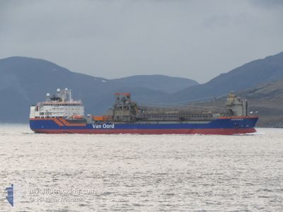
NORDNES
Pipe Burying Vessel
Current Trip
| Time Travelled | 17 days |
|---|---|
| Remaining Time | --- |
| Distance Travelled | 1656.02 nm |
| Remaining Distance | --- |
| AVG Speed | 12.4 Knop |
| MAX Speed | 15.4 Knop |
| AVG Wind | 16 knots |
| MAX Wind | 36 knots |
| MIN Temp | -0.8°C / 30.56°F |
| MAX Temp | 7.7°C / 45.86°F |
| Djupgående | 10.7 m |
| Position mottagen | 2 m sen |
Current Position
| Longitud | 4.98071° |
|---|---|
| Latitude | 63.35115° |
| Status | Under way using engine |
| Fart | 12.9 Knop |
| Kurs | 204° |
| Område | Norwegian Sea |
| Station | T-AIS |
| Position mottagen | 2 m sen |
Info
Information
The current position of NORDNES is in Norwegian Sea with coordinates 63.35115° / 4.98071° as reported on 2024-04-25 11:45 by AIS to our vessel tracker app. The vessel's current speed is 12.9 Knop and is heading at the port of SKIPAVIK-GULEN. The estimated time of arrival as calculated by MyShipTracking vessel tracking app is 2024-04-26 03:00 LT
The vessel NORDNES (IMO: 9229910, MMSI: 244962000) is a Pipe Burying Vessel that was built in 2001 ( 23 År gammal ). It's sailing under the flag of [NL] Netherlands.
In this page you can find informations about the vessels current position, last detected port calls, and current voyage information. If the vessels is not in coverage by AIS you will find the latest position.
The current position of NORDNES is detected by our AIS receivers and we are not responsible for the reliability of the data. The last position was recorded while the vessel was in Coverage by the Ais receivers of our vessel tracking app.
The current draught of NORDNES as reported by AIS is 10.7 meters
Weather
| Temperature | 4.4°C / 39.92°F |
|---|---|
| Wind Speed | 1 knots |
| Direction | 203° SSW |
| Pressure | 1005.1 hPa |
| Humidity | 62.9 % |
| Cloud Coverage | 100 % |
Featured Company
Last Port Calls
| Port | Arrival | Departure | Time In Port |
|---|---|---|---|
| 2024-04-06 21:18 | 2024-04-07 13:19 | 16 h | |
| 2024-04-03 16:27 | 2024-04-03 23:29 | 7 h | |
| 2024-04-02 22:27 | 2024-04-03 10:28 | 12 h | |
| 2024-03-22 08:12 | 2024-03-27 12:59 | 5 d | |
| 2024-03-16 00:44 | 2024-03-16 17:40 | 16 h | |
| 2024-03-08 08:48 | 2024-03-09 19:22 | 1 d | |
| 2024-02-26 13:18 | 2024-02-28 01:21 | 1 d | |
| 2024-02-18 06:56 | 2024-02-18 23:29 | 16 h | |
| 2024-02-15 11:39 | 2024-02-15 18:17 | 6 h | |
| 2024-02-05 09:29 | 2024-02-06 15:33 | 1 d |
Most Visited Ports (Last year)
| Port | Arrivals | |
|---|---|---|
| 24 | ||
| 5 | ||
| 3 | ||
| 2 | ||
| 1 | ||
| 1 |
Last Trips
| Origin | Departure | Destination | Arrival | Distance | |
|---|---|---|---|---|---|
| 2024-04-04 01:29 | 2024-04-06 23:18 | 294.85 nm | |||
| 2024-04-03 12:28 | 2024-04-03 18:27 | 3.12 nm | |||
| 2024-03-27 13:59 | 2024-04-03 00:27 | 602.90 nm | |||
| 2024-03-16 18:40 | 2024-03-22 09:12 | 600.26 nm | |||
| 2024-03-09 20:22 | 2024-03-16 01:44 | 425.89 nm | |||
| 2024-02-28 02:21 | 2024-03-08 09:48 | 619.73 nm | |||
| 2024-02-19 00:29 | 2024-02-26 14:18 | 603.41 nm | |||
| 2024-02-15 19:17 | 2024-02-18 07:56 | 271.64 nm | |||
| 2024-02-06 16:33 | 2024-02-15 12:39 | 645.98 nm | |||
| 2024-01-24 21:11 | 2024-02-05 10:29 | 678.14 nm |
Events
| Tid | Event | Detaljer | Position / Dest | Information |
|---|---|---|---|---|
| 2024-04-25 09:21 | Destination ändrad | NO SIP BERLING |
63.80588 / 5.42941
NO SIP
|
Fart: 11.9 kn Kurs: 202.8° |
| 2024-04-25 09:21 | ETA ändrat | 2024/04/26 03:00 2024/04/25 00:00 |
63.80588 / 5.42941
NO SIP
|
Fart: 11.9 kn Kurs: 202.8° |
| 2024-04-25 07:53 | I täckningsområde |
64.06740 / 5.68178
Norwegian Sea
|
Fart: 12.1 kn Kurs: 203.4° |
|
| 2024-04-24 18:41 | UTANFÖR täckningsområde |
65.71458 / 9.13154
Norwegian Sea
BERLING
|
Fart: 12.7 kn Kurs: 240.1° |
|
| 2024-04-24 09:25 | Djupgående ändrat | 10.7 7.5 |
66.02953 / 12.77895
BERLING
|
Fart: 10.4 kn Kurs: 67.1° |
| 2024-04-24 09:25 | Destination ändrad | BERLING NO JSS |
66.02953 / 12.77895
BERLING
|
Fart: 10.4 kn Kurs: 67.1° |
| 2024-04-24 09:25 | ETA ändrat | 2024/04/25 00:00 2024/04/23 16:30 |
66.02953 / 12.77895
BERLING
|
Fart: 10.4 kn Kurs: 67.1° |
| 2024-04-24 09:19 | Status ändrad | Under way using engine Moored |
66.02177 / 12.73375
NO JSS
|
Fart: 12.7 kn Kurs: 66.4° |
| 2024-04-24 09:07 | STARTAR förflyttning | 1.29 nm, South of SANDNESSJOEN |
66.00497 / 12.65504
NO JSS
|
Fart: 4.8 kn Kurs: 61° |
| 2024-04-23 17:26 | Status ändrad | Moored Under way using engine |
66.00406 / 12.64943
NO JSS
|
Fart: Kurs: 45° |