
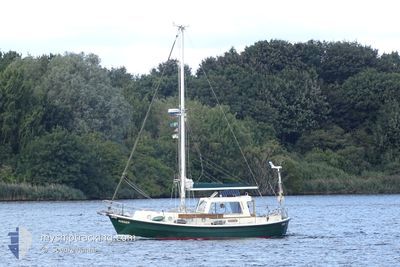
NISSER
Pleasure Craft
Current Trip
NISSER is out of coverage. Learn how you can join the community and extend the coverage to your area by clicking here!
Unknown
Destination Port
ETA*
---
| Time Travelled | 2 days |
|---|---|
| Remaining Time | --- |
| Distance Travelled | 62.32 nm |
| Remaining Distance | --- |
| AVG Speed | 6.3 Knop |
| MAX Speed | 8 Knop |
| AVG Wind | 5.7 knots |
| MAX Wind | 12.8 knots |
| MIN Temp | 0.9°C / 33.62°F |
| MAX Temp | 8.5°C / 47.3°F |
| Djupgående | --- |
| Position mottagen | 7 h, 54 m sen |
Current Position
| Longitud | 9.44375° |
|---|---|
| Latitude | 54.19141° |
| Status | Default |
| Fart | 4.6 Knop |
| Kurs | 182.2° |
| Område | North Sea |
| Station | T-AIS |
| Position mottagen | 7 h, 54 m sen |
Info
info
Information
The current position of NISSER is in North Sea with coordinates 54.19141° / 9.44375° as reported on 2024-04-25 11:32 by AIS to our vessel tracker app. The vessel's current speed is 4.6 Knop
The vessel NISSER (MMSI: 211679070) is a Pleasure Craft It's sailing under the flag of [DE] Germany.
In this page you can find informations about the vessels current position, last detected port calls, and current voyage information. If the vessels is not in coverage by AIS you will find the latest position.
The current position of NISSER is detected by our AIS receivers and we are not responsible for the reliability of the data. The last position was recorded while the vessel was in Coverage by the Ais receivers of our vessel tracking app.
Weather
| Temperature | 8.5°C / 47.3°F |
|---|---|
| Wind Speed | 7 knots |
| Direction | 230° SW |
| Pressure | 1002.4 hPa |
| Humidity | 69.7 % |
| Cloud Coverage | 100 % |
Featured Company
Limited time offer - Install a base station receiver to your area and list your company on MyShipTracking Free forever!
Last Trips
| Origin | Departure | Destination | Arrival | Distance |
|---|
Events
| Tid | Event | Detaljer | Position / Dest | Information |
|---|---|---|---|---|
| 2024-04-25 11:32 | UTANFÖR täckningsområde |
54.19141 / 9.44375
North Sea
|
Fart: 4.6 kn Kurs: 182.2° |
|
| 2024-04-25 11:06 | STARTAR förflyttning | 4.61 nm, North East of FISCHERHUTTE |
54.22007 / 9.43711
|
Fart: 5.2 kn Kurs: 171° |
| 2024-04-25 10:54 | STOPPAR förflyttning | 4.73 nm, North East of FISCHERHUTTE |
54.22278 / 9.43600
|
Fart: Kurs: 511° |
| 2024-04-25 07:46 | I täckningsområde |
54.34023 / 9.24478
North Sea
|
Fart: 6.6 kn Kurs: 93.1° |
|
| 2024-04-24 14:07 | UTANFÖR täckningsområde |
54.33611 / 9.22927
North Sea
|
Fart: 6.3 kn Kurs: 16.3° |
|
| 2024-04-24 12:50 | STARTAR förflyttning | 3.05 nm, South East of FRIEDRICHSTADT |
54.33856 / 9.13984
|
Fart: 3.7 kn Kurs: 134° |
| 2024-04-24 12:32 | STOPPAR förflyttning | 2.83 nm, South East of FRIEDRICHSTADT |
54.34106 / 9.13513
|
Fart: 0.2 kn Kurs: 511° |
| 2024-04-24 10:23 | I täckningsområde |
54.31472 / 8.95376
North Sea
|
Fart: 2 kn Kurs: 69.3° |
|
| 2024-04-23 10:29 | UTANFÖR täckningsområde |
54.27424 / 8.90814
North Sea
|
Fart: 8 kn Kurs: 65.3° |
|
| 2024-04-23 10:19 | I täckningsområde |
54.26064 / 8.88266
North Sea
|
Fart: 8 kn Kurs: 80° |