
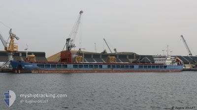
NEVA-LEADER 1
General Cargo
Current Trip
| Trip Time | 5 days |
|---|---|
| Trip Distance | 704.00 nm |
| AVG Speed | 7.8 Knop |
| MAX Speed | 12.8 Knop |
| Djupgående | 3.6 m |
| AVG Wind | 10.5 knots |
| MAX Wind | 23.9 knots |
| MIN Temp | 10.5°C / 50.9°F |
| MAX Temp | 19.5°C / 67.1°F |
| Position mottagen | 3 d sen |
Current Position
| Longitud | 29.64685° |
|---|---|
| Latitude | 41.42955° |
| Status | Under way using engine |
| Fart | 9 Knop |
| Kurs | 63.3° |
| Område | Black Sea |
| Station | T-AIS |
| Position mottagen | 3 d sen |
Info
Information
The current position of NEVA-LEADER 1 is in Black Sea with coordinates 41.42955° / 29.64685° as reported on 2024-04-21 14:13 by AIS to our vessel tracker app. The vessel's current speed is 9 Knop and is currently inside the port of YEYSK.
The vessel NEVA-LEADER 1 (IMO: 9598816, MMSI: 273351280) is a General Cargo that was built in 2012 ( 12 År gammal ). It's sailing under the flag of [RU] Russia.
In this page you can find informations about the vessels current position, last detected port calls, and current voyage information. If the vessels is not in coverage by AIS you will find the latest position.
The current position of NEVA-LEADER 1 is detected by our AIS receivers and we are not responsible for the reliability of the data. The last position was recorded while the vessel was in Coverage by the Ais receivers of our vessel tracking app.
The current draught of NEVA-LEADER 1 as reported by AIS is 3.6 meters
Weather
| Temperature | 23.2°C / 73.76°F |
|---|---|
| Wind Speed | 6 knots |
| Direction | 200° SSW |
| Pressure | 1007.4 hPa |
| Humidity | 47.9 % |
| Cloud Coverage | 92 % |
Featured Company
Last Trips
| Origin | Departure | Destination | Arrival | Distance | |
|---|---|---|---|---|---|
| 2024-04-19 14:25 | 2024-04-25 09:08 | 704.00 nm | |||
| 2024-03-28 08:30 | 2024-04-18 00:44 | 1675.77 nm | |||
| 2024-03-04 15:56 | 2024-03-26 02:20 | 1657.88 nm | |||
| 2024-02-07 20:24 | 2024-03-01 14:43 | 1601.60 nm | |||
| 2024-01-29 00:39 | 2024-02-06 03:37 | 897.86 nm |
Events
| Tid | Event | Detaljer | Position / Dest | Information |
|---|---|---|---|---|
| 2024-04-25 09:56 | STOPPAR förflyttning |
46.72787 / 38.26928
[RU] YEYSK
|
Fart: 0.1 kn Kurs: 321° |
|
| 2024-04-25 06:08 | ANLÄNDER HAMN |
|
46.73007 / 38.26970
[RU] YEYSK
|
Fart: 6.2 kn Kurs: 134° |
| 2024-04-25 05:32 | STARTAR förflyttning | 2.11 nm, North West of YEYSK |
46.74652 / 38.22818
RU YEY
|
Fart: 3.1 kn Kurs: 58° |
| 2024-04-25 02:21 | STOPPAR förflyttning | 2.22 nm, North West of YEYSK |
46.74602 / 38.22472
RU YEY
|
Fart: 0.3 kn Kurs: 172° |
| 2024-04-23 07:10 | STOPPAR förflyttning | 8.67 nm, South of TAMAN |
44.98231 / 36.61715
RU YEY
|
Fart: Kurs: 239° |
| 2024-04-21 14:24 | Status ändrad | Default Under way using engine |
41.44220 / 29.68177
RU YEY
|
Fart: 9 kn Kurs: 63.3° |
| 2024-04-21 14:13 | UTANFÖR täckningsområde |
41.42955 / 29.64685
Black Sea
RU YEY
|
Fart: 9 kn Kurs: 63.3° |
|
| 2024-04-21 14:10 | Status ändrad | Under way using engine Default |
41.42615 / 29.63745
RU YEY
|
Fart: 9.6 kn Kurs: 63° |
| 2024-04-21 13:47 | Status ändrad | Default Under way using engine |
41.40003 / 29.56600
RU YEY
|
Fart: 8.9 kn Kurs: 70.5° |
| 2024-04-21 11:31 | Byter havsområde | Turkish part of the Black Sea Turkish part of the Sea of Marmara |
41.23208 / 29.15627
Black Sea
RU YEY
|
Fart: 8.6 kn Kurs: 51.3° |