
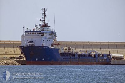
NAUTILUS
Offshore Supply Ship
Current Trip
| Trip Time | 7 days |
|---|---|
| Trip Distance | 1533.65 nm |
| AVG Speed | 9.6 Knop |
| MAX Speed | 14.4 Knop |
| Djupgående | 4.5 m |
| AVG Wind | 17.7 knots |
| MAX Wind | 27.9 knots |
| MIN Temp | 13.4°C / 56.12°F |
| MAX Temp | 22.9°C / 73.22°F |
| Position mottagen | 3 h, 48 m sen |
Current Position
| Longitud | 14.52149° |
|---|---|
| Latitude | 35.89968° |
| Status | Under way using engine |
| Fart | 8.5 Knop |
| Kurs | 213° |
| Område | Mediterranean Sea - Eastern Basin |
| Station | T-AIS |
| Position mottagen | 3 h, 48 m sen |
Info
Information
The current position of NAUTILUS is in Mediterranean Sea - Eastern Basin with coordinates 35.89968° / 14.52149° as reported on 2024-04-23 20:42 by AIS to our vessel tracker app. The vessel's current speed is 8.5 Knop and is currently inside the port of VALLETTA.
The vessel NAUTILUS (IMO: 9237694, MMSI: 224738000) is a Offshore Supply Ship that was built in 2001 ( 23 År gammal ). It's sailing under the flag of [ES] Spain.
In this page you can find informations about the vessels current position, last detected port calls, and current voyage information. If the vessels is not in coverage by AIS you will find the latest position.
The current position of NAUTILUS is detected by our AIS receivers and we are not responsible for the reliability of the data. The last position was recorded while the vessel was in Coverage by the Ais receivers of our vessel tracking app.
The current draught of NAUTILUS as reported by AIS is 4.5 meters
Weather
| Temperature | 15.2°C / 59.36°F |
|---|---|
| Wind Speed | 19 knots |
| Direction | 308° NW |
| Pressure | 1013.5 hPa |
| Humidity | 59.3 % |
| Cloud Coverage | --- |
Featured Company
Last Port Calls
| Port | Arrival | Departure | Time In Port |
|---|---|---|---|
| 2024-04-23 20:41 | |||
| 2024-04-16 07:31 |
Most Visited Ports (Last year)
| Port | Arrivals | |
|---|---|---|
| 4 | ||
| 2 | ||
| 1 | ||
| 1 | ||
| 1 |
Last Trips
| Origin | Departure | Destination | Arrival | Distance | |
|---|---|---|---|---|---|
| 2024-04-16 08:31 | 2024-04-23 22:41 | 1533.65 nm |
Events
| Tid | Event | Detaljer | Position / Dest | Information |
|---|---|---|---|---|
| 2024-04-23 20:42 | UTANFÖR täckningsområde |
35.89968 / 14.52149
Mediterranean Sea - Eastern Basin
[MT] VALLETTA
|
Fart: 8.5 kn Kurs: 213.5° |
|
| 2024-04-23 20:41 | ANLÄNDER HAMN |
|
35.90131 / 14.52354
[MT] VALLETTA
|
Fart: 8.1 kn Kurs: 242.2° |
| 2024-04-23 17:44 | ETA ändrat | 2024/04/23 20:30 2024/04/24 06:00 |
36.26701 / 14.10717
MT MLA
|
Fart: 12 kn Kurs: 123.5° |
| 2024-04-23 17:24 | Upptäckt i hav | Maltese part of the Mediterranean Sea - Eastern Basin |
36.30283 / 14.03498
Mediterranean Sea - Eastern Basin
MT MLA
|
Fart: 12.3 kn Kurs: 120.7° |
| 2024-04-23 17:24 | I täckningsområde |
36.30283 / 14.03498
Mediterranean Sea - Eastern Basin
MT MLA
|
Fart: 12.3 kn Kurs: 120.7° |
|
| 2024-04-21 08:35 | UTANFÖR täckningsområde |
37.11216 / .34978
Mediterranean Sea - Western Basin
MT MLA
|
Fart: 9.7 kn Kurs: 44.6° |
|
| 2024-04-21 07:33 | Upptäckt i hav | Algerian part of the Mediterranean Sea - Western Basin |
37.01032 / .16175
Mediterranean Sea - Western Basin
MT MLA
|
Fart: 11.3 kn Kurs: 87.9° |
| 2024-04-21 07:33 | I täckningsområde |
37.01032 / .16175
Mediterranean Sea - Western Basin
MT MLA
|
Fart: 11.3 kn Kurs: 87.9° |
|
| 2024-04-21 05:29 | UTANFÖR täckningsområde |
36.95242 / -.28186
Mediterranean Sea - Western Basin
MT MLA
|
Fart: 12 kn Kurs: 64.8° |
|
| 2024-04-21 04:27 | UTANFÖR täckningsområde |
36.87024 / -.49935
Mediterranean Sea - Western Basin
MT MLA
|
Fart: 11.6 kn Kurs: 64.5° |