
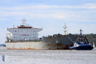
MYKONOS WAVE
Bulk Carrier
Current Trip
| Time Travelled | 53 days |
|---|---|
| Remaining Time | --- |
| Distance Travelled | 7413.40 nm |
| Remaining Distance | --- |
| AVG Speed | 10.5 Knop |
| MAX Speed | 15 Knop |
| AVG Wind | 9.6 knots |
| MAX Wind | 25.3 knots |
| MIN Temp | 20.7°C / 69.26°F |
| MAX Temp | 30.9°C / 87.62°F |
| Djupgående | 14 m |
| Position mottagen | 8 d sen |
Current Position
| Longitud | 114.45667° |
|---|---|
| Latitude | 22.05800° |
| Status | At anchor |
| Fart | 12.1 Knop |
| Kurs | 137° |
| Område | South China Sea |
| Station | T-AIS |
| Position mottagen | 8 d sen |
Info
Information
The current position of MYKONOS WAVE is in South China Sea with coordinates 22.05800° / 114.45667° as reported on 2024-04-10 19:38 by AIS to our vessel tracker app. The vessel's current speed is 12.1 Knop and is heading at the port of HONG KONG.
The vessel MYKONOS WAVE (IMO: 9453406, MMSI: 209430000) is a Bulk Carrier that was built in 2012 ( 12 År gammal ). It's sailing under the flag of [CY] Cyprus.
In this page you can find informations about the vessels current position, last detected port calls, and current voyage information. If the vessels is not in coverage by AIS you will find the latest position.
The current position of MYKONOS WAVE is detected by our AIS receivers and we are not responsible for the reliability of the data. The last position was recorded while the vessel was in Coverage by the Ais receivers of our vessel tracking app.
The current draught of MYKONOS WAVE as reported by AIS is 14 meters
Weather
| Temperature | 29.2°C / 84.56°F |
|---|---|
| Wind Speed | 8 knots |
| Direction | 127° SE |
| Pressure | 1006.1 hPa |
| Humidity | 67.7 % |
| Cloud Coverage | 97 % |
Featured Company
Most Visited Ports (Last year)
| Port | Arrivals | |
|---|---|---|
| 2 | ||
| 2 | ||
| 2 | ||
| 2 | ||
| 1 | ||
| 1 |
Last Trips
| Origin | Departure | Destination | Arrival | Distance | |
|---|---|---|---|---|---|
| 2024-01-30 06:56 | 2024-02-23 19:51 | 4231.10 nm |
Events
| Tid | Event | Detaljer | Position / Dest | Information |
|---|---|---|---|---|
| 2024-04-15 16:54 | STOPPAR förflyttning | 3.19 nm, East of TANJUNG BARA |
.53667 / 117.70834
HK HKG
|
Fart: Kurs: -1° |
| 2024-04-10 19:42 | Status ändrad | Default At anchor |
22.04917 / 114.46516
HK HKG
|
Fart: 12.1 kn Kurs: 137° |
| 2024-04-10 19:38 | UTANFÖR täckningsområde |
22.05800 / 114.45667
South China Sea
|
Fart: 12.1 kn Kurs: 137° |
|
| 2024-04-10 19:23 | Status ändrad | At anchor Default |
22.09700 / 114.41983
HK HKG
|
Fart: 12 kn Kurs: 97° |
| 2024-04-10 19:06 | Status ändrad | Default At anchor |
22.10317 / 114.35867
HK HKG
|
Fart: 12 kn Kurs: 94° |
| 2024-04-10 18:32 | Status ändrad | At anchor Default |
22.11050 / 114.23950
HK HKG
|
Fart: 9.7 kn Kurs: 93° |
| 2024-04-10 18:30 | Status ändrad | Default At anchor |
22.11067 / 114.23333
HK HKG
|
Fart: 8.4 kn Kurs: 119° |
| 2024-04-10 18:26 | Status ändrad | At anchor Default |
22.11183 / 114.22333
HK HKG
|
Fart: 10.1 kn Kurs: 150° |
| 2024-04-10 18:10 | Status ändrad | Default At anchor |
22.15116 / 114.19417
HK HKG
|
Fart: 9.3 kn Kurs: 138° |
| 2024-04-10 18:04 | Status ändrad | At anchor Default |
22.16467 / 114.18250
HK HKG
|
Fart: 8.7 kn Kurs: 120° |