
MSC TERESA
Container Ship
Current Trip
| Time Travelled | 16 days |
|---|---|
| Remaining Time | --- |
| Distance Travelled | 6543.29 nm |
| Remaining Distance | --- |
| AVG Speed | 16.2 Knop |
| MAX Speed | 19.1 Knop |
| AVG Wind | 12.9 knots |
| MAX Wind | 33.1 knots |
| MIN Temp | 14.9°C / 58.82°F |
| MAX Temp | 36.7°C / 98.06°F |
| Djupgående | 15.9 m |
| Position mottagen | 9 d sen |
Current Position
| Longitud | 19.45022° |
|---|---|
| Latitude | -34.90330° |
| Status | Under way using engine |
| Fart | 16.5 Knop |
| Kurs | 98.4° |
| Område | South Atlantic Ocean |
| Station | T-AIS |
| Position mottagen | 9 d sen |
Info
Information
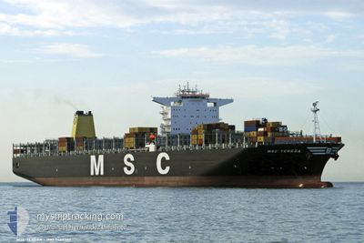
The current position of MSC TERESA is in South Atlantic Ocean with coordinates -34.90330° / 19.45022° as reported on 2024-04-14 05:22 by AIS to our vessel tracker app. The vessel's current speed is 16.5 Knop and is heading at the port of COLOMBO. The estimated time of arrival as calculated by MyShipTracking vessel tracking app is 2024-04-24 11:30 LT
The vessel MSC TERESA (IMO: 9469560, MMSI: 357891000) is a Container Ship that was built in 2011 ( 13 År gammal ). It's sailing under the flag of [PA] Panama.
In this page you can find informations about the vessels current position, last detected port calls, and current voyage information. If the vessels is not in coverage by AIS you will find the latest position.
The current position of MSC TERESA is detected by our AIS receivers and we are not responsible for the reliability of the data. The last position was recorded while the vessel was in Coverage by the Ais receivers of our vessel tracking app.
The current draught of MSC TERESA as reported by AIS is 15.9 meters
Weather
| Temperature | 28.6°C / 83.48°F |
|---|---|
| Wind Speed | 7 knots |
| Direction | 319° NW |
| Pressure | 1006.1 hPa |
| Humidity | 76.5 % |
| Cloud Coverage | 100 % |
Featured Company
Last Port Calls
| Port | Arrival | Departure | Time In Port |
|---|---|---|---|
| 2024-04-05 10:41 | 2024-04-07 12:49 | 2 d | |
| 2024-04-01 16:23 | 2024-04-03 13:51 | 1 d | |
| 2024-03-27 20:53 | 2024-03-28 23:24 | 1 d | |
| 2024-02-29 20:21 | 2024-03-02 04:54 | 1 d | |
| 2024-02-23 23:52 | 2024-02-24 06:56 | 7 h | |
| 2024-02-17 09:26 | 2024-02-17 23:55 | 14 h | |
| 2024-02-14 11:02 | 2024-02-16 07:41 | 1 d | |
| 2024-02-07 03:30 | 2024-02-09 09:06 | 2 d |
Most Visited Ports (Last year)
| Port | Arrivals | |
|---|---|---|
| 6 | ||
| 3 | ||
| 3 | ||
| 2 | ||
| 2 | ||
| 2 |
Last Trips
| Origin | Departure | Destination | Arrival | Distance | |
|---|---|---|---|---|---|
| 2024-04-03 13:51 | 2024-04-05 10:41 | 406.93 nm | |||
| 2024-03-28 23:24 | 2024-04-01 16:23 | 449.76 nm | |||
| 2024-03-02 12:54 | 2024-03-27 20:53 | 8323.95 nm | |||
| 2024-02-24 14:56 | 2024-03-01 04:21 | 1622.63 nm | |||
| 2024-02-18 08:55 | 2024-02-24 07:52 | 1510.77 nm | |||
| 2024-02-16 16:41 | 2024-02-17 18:26 | 143.48 nm | |||
| 2024-02-09 17:06 | 2024-02-14 20:02 | 742.20 nm | |||
| 2024-01-15 08:05 | 2024-02-07 11:30 | 8162.59 nm |
Events
| Tid | Event | Detaljer | Position / Dest | Information |
|---|---|---|---|---|
| 2024-04-14 05:26 | Status ändrad | Default Under way using engine |
-34.90600 / 19.47175
LKCMB
|
Fart: 16.5 kn Kurs: 98.4° |
| 2024-04-14 05:22 | Status ändrad | Under way using engine Default |
-34.90330 / 19.45022
LKCMB
|
Fart: 16.5 kn Kurs: 98° |
| 2024-04-14 05:22 | UTANFÖR täckningsområde |
-34.90330 / 19.45022
South Atlantic Ocean
LKCMB
|
Fart: 16.5 kn Kurs: 98.4° |
|
| 2024-04-14 05:19 | I täckningsområde |
-34.90330 / 19.45022
South Atlantic Ocean
LKCMB
|
Fart: 16.5 kn Kurs: 98.4° |
|
| 2024-04-14 04:08 | Status ändrad | Default Under way using engine |
-34.84333 / 19.04167
LKCMB
|
Fart: 16.2 kn Kurs: 99.9° |
| 2024-04-14 04:04 | Status ändrad | Under way using engine Default |
-34.84051 / 19.02227
LKCMB
|
Fart: 16.1 kn Kurs: 101° |
| 2024-04-14 04:04 | UTANFÖR täckningsområde |
-34.84051 / 19.02227
South Atlantic Ocean
LKCMB
|
Fart: 16.2 kn Kurs: 99.9° |
|
| 2024-04-14 04:00 | Status ändrad | Default Under way using engine |
-34.83669 / 18.99638
LKCMB
|
Fart: 16 kn Kurs: 101° |
| 2024-04-14 03:54 | Status ändrad | Under way using engine Default |
-34.83252 / 18.96842
LKCMB
|
Fart: 15.9 kn Kurs: 101° |
| 2024-04-14 03:48 | I täckningsområde |
-34.83252 / 18.96842
South Atlantic Ocean
LKCMB
|
Fart: 16 kn Kurs: 101° |