
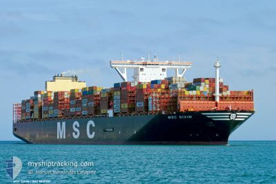
MSC SIXIN
Cargo A
Current Trip
| Time Travelled | 21 days |
|---|---|
| Remaining Time | 13 days |
| Distance Travelled | 8141.75 nm |
| Remaining Distance | 5600.75 nm |
| AVG Speed | 16.9 Knop |
| MAX Speed | 19.8 Knop |
| AVG Wind | 12 knots |
| MAX Wind | 35 knots |
| MIN Temp | 9.3°C / 48.74°F |
| MAX Temp | 29.6°C / 85.28°F |
| Djupgående | 13.8 m |
| Position mottagen | 3 h, 8 m sen |
Current Position
| Longitud | 18.58975° |
|---|---|
| Latitude | -34.70040° |
| Status | Under way using engine |
| Fart | 17.2 Knop |
| Kurs | 116.7° |
| Område | South Atlantic Ocean |
| Station | T-AIS |
| Position mottagen | 3 h, 8 m sen |
Info
Information
The current position of MSC SIXIN is in South Atlantic Ocean with coordinates -34.70040° / 18.58975° as reported on 2024-04-25 07:26 by AIS to our vessel tracker app. The vessel's current speed is 17.2 Knop and is heading at the port of SINGAPORE. The estimated time of arrival as calculated by MyShipTracking vessel tracking app is 2024-05-09 04:30 LT
The vessel MSC SIXIN (IMO: 9839301, MMSI: 370711000) is a Cargo A It's sailing under the flag of [PA] Panama.
In this page you can find informations about the vessels current position, last detected port calls, and current voyage information. If the vessels is not in coverage by AIS you will find the latest position.
The current position of MSC SIXIN is detected by our AIS receivers and we are not responsible for the reliability of the data. The last position was recorded while the vessel was in Coverage by the Ais receivers of our vessel tracking app.
The current draught of MSC SIXIN as reported by AIS is 13.8 meters
Weather
| Temperature | 18.2°C / 64.76°F |
|---|---|
| Wind Speed | 7 knots |
| Direction | 179° S |
| Pressure | 1021.9 hPa |
| Humidity | 83.8 % |
| Cloud Coverage | 85 % |
Featured Company
Last Port Calls
| Port | Arrival | Departure | Time In Port |
|---|---|---|---|
| 2024-04-06 18:37 | 2024-04-08 08:45 | 1 d | |
| 2024-04-02 02:38 | 2024-04-04 04:56 | 2 d | |
| 2024-03-25 10:33 | 2024-03-30 12:42 | 5 d | |
| 2024-03-18 16:35 | 2024-03-22 10:58 | 3 d | |
| 2024-02-09 22:52 | 2024-02-11 09:32 | 1 d | |
| 2024-02-05 07:58 | 2024-02-06 07:13 | 23 h | |
| 2024-02-04 00:10 | 2024-02-04 21:45 | 21 h |
Most Visited Ports (Last year)
| Port | Arrivals | |
|---|---|---|
| 7 | ||
| 7 | ||
| 6 | ||
| 6 | ||
| 4 | ||
| 4 |
Last Trips
| Origin | Departure | Destination | Arrival | Distance | |
|---|---|---|---|---|---|
| 2024-04-04 06:56 | 2024-04-06 20:37 | 981.31 nm | |||
| 2024-03-30 13:42 | 2024-04-02 04:38 | 702.91 nm | |||
| 2024-03-22 11:58 | 2024-03-25 11:33 | 271.85 nm | |||
| 2024-02-11 17:32 | 2024-03-18 17:35 | 11325.21 nm | |||
| 2024-02-06 15:13 | 2024-02-10 06:52 | 1493.61 nm | |||
| 2024-02-05 05:45 | 2024-02-05 15:58 | 136.58 nm | |||
| 2024-01-30 19:44 | 2024-02-04 08:10 | 971.37 nm |
Events
| Tid | Event | Detaljer | Position / Dest | Information |
|---|---|---|---|---|
| 2024-04-25 07:31 | Status ändrad | Default Under way using engine |
-34.70916 / 18.61327
EGPSE>SGSIN
|
Fart: 17.2 kn Kurs: 116.7° |
| 2024-04-25 07:26 | UTANFÖR täckningsområde |
-34.70040 / 18.58975
South Atlantic Ocean
EGPSE>SGSIN
|
Fart: 17.2 kn Kurs: 116.7° |
|
| 2024-04-25 04:51 | Status ändrad | Under way using engine Default |
-34.41704 / 17.77473
EGPSE>SGSIN
|
Fart: 17 kn Kurs: 115° |
| 2024-04-25 04:47 | Status ändrad | Default Under way using engine |
-34.40891 / 17.75341
EGPSE>SGSIN
|
Fart: 16.8 kn Kurs: 114° |
| 2024-04-25 04:41 | Status ändrad | Under way using engine Default |
-34.39737 / 17.72299
EGPSE>SGSIN
|
Fart: 16.7 kn Kurs: 114° |
| 2024-04-25 04:37 | Status ändrad | Default Under way using engine |
-34.39011 / 17.70397
EGPSE>SGSIN
|
Fart: 16.6 kn Kurs: 113.8° |
| 2024-04-25 03:43 | Byter havsområde | South African part of the South Atlantic Ocean High seas of the South Atlantic Ocean |
-34.21069 / 17.49552
South Atlantic Ocean
EGPSE>SGSIN
|
Fart: 17.2 kn Kurs: 144.7° |
| 2024-04-25 03:42 | Status ändrad | Under way using engine Default |
-34.20480 / 17.49053
EGPSE>SGSIN
|
Fart: 17.2 kn Kurs: 146° |
| 2024-04-25 03:34 | I täckningsområde |
-34.21069 / 17.49552
South Atlantic Ocean
EGPSE>SGSIN
|
Fart: 17.2 kn Kurs: 144.7° |
|
| 2024-04-21 13:54 | UTANFÖR täckningsområde |
-14.28695 / 1.32589
South Atlantic Ocean
EGPSE>SGSIN
|
Fart: 17 kn Kurs: 144.3° |