
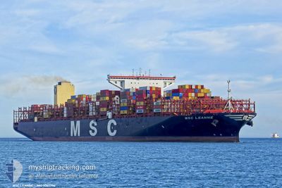
MSC LEANNE
Cargo A
Current Trip
| Time Travelled | 12 days |
|---|---|
| Remaining Time | 3 days |
| Distance Travelled | 4200.46 nm |
| Remaining Distance | 1635.54 nm |
| AVG Speed | 14.9 Knop |
| MAX Speed | 14.9 Knop |
| AVG Wind | 13.1 knots |
| MAX Wind | 29.7 knots |
| MIN Temp | 13.4°C / 56.12°F |
| MAX Temp | 21.9°C / 71.42°F |
| Djupgående | 15.1 m |
| Position mottagen | 1 d sen |
Current Position
| Longitud | -13.48884° |
|---|---|
| Latitude | 28.09639° |
| Status | Under way using engine |
| Fart | 19.3 Knop |
| Kurs | 226.6° |
| Område | North Atlantic Ocean |
| Station | T-AIS |
| Position mottagen | 1 d sen |
Info
Information
The current position of MSC LEANNE is in North Atlantic Ocean with coordinates 28.09639° / -13.48884° as reported on 2024-04-22 00:24 by AIS to our vessel tracker app. The vessel's current speed is 19.3 Knop and is heading at the port of LOME. The estimated time of arrival as calculated by MyShipTracking vessel tracking app is 2024-04-27 09:47 LT
The vessel MSC LEANNE (IMO: 9767390, MMSI: 636017686) is a Cargo A It's sailing under the flag of [LR] Liberia.
In this page you can find informations about the vessels current position, last detected port calls, and current voyage information. If the vessels is not in coverage by AIS you will find the latest position.
The current position of MSC LEANNE is detected by our AIS receivers and we are not responsible for the reliability of the data. The last position was recorded while the vessel was in Coverage by the Ais receivers of our vessel tracking app.
The current draught of MSC LEANNE as reported by AIS is 15.1 meters
Weather
| Temperature | 21.7°C / 71.06°F |
|---|---|
| Wind Speed | 9 knots |
| Direction | 341° NNW |
| Pressure | 1011.8 hPa |
| Humidity | 83 % |
| Cloud Coverage | 1 % |
Featured Company
Last Port Calls
| Port | Arrival | Departure | Time In Port |
|---|---|---|---|
| 2024-04-14 19:22 | 2024-04-15 17:34 | 22 h | |
| 2024-04-09 05:17 | 2024-04-11 09:34 | 2 d | |
| 2024-04-07 02:55 | 2024-04-08 22:48 | 1 d | |
| 2024-04-04 04:39 | 2024-04-06 19:29 | 2 d | |
| 2024-03-28 19:43 | 2024-04-01 03:22 | 3 d | |
| 2024-03-27 05:20 | 2024-03-28 10:08 | 1 d | |
| 2024-02-23 02:32 | 2024-02-24 20:55 | 1 d | |
| 2024-02-07 06:56 | 2024-02-08 14:03 | 1 d | |
| 2024-02-04 06:00 | 2024-02-06 03:47 | 1 d |
Most Visited Ports (Last year)
| Port | Arrivals | |
|---|---|---|
| 8 | ||
| 6 | ||
| 6 | ||
| 6 | ||
| 5 | ||
| 4 |
Last Trips
| Origin | Departure | Destination | Arrival | Distance | |
|---|---|---|---|---|---|
| 2024-04-11 12:34 | 2024-04-14 21:22 | 766.19 nm | |||
| 2024-04-09 01:48 | 2024-04-09 08:17 | 58.49 nm | |||
| 2024-04-06 22:29 | 2024-04-07 05:55 | 62.37 nm | |||
| 2024-04-01 06:22 | 2024-04-04 07:39 | 928.18 nm | |||
| 2024-02-25 04:55 | 2024-03-28 21:43 | 12780.58 nm | |||
| 2024-02-25 04:55 | 2024-03-27 07:20 | 12634.08 nm | |||
| 2024-02-08 23:03 | 2024-02-23 10:32 | 2959.64 nm | |||
| 2024-02-06 12:47 | 2024-02-07 15:56 | 26.24 nm | |||
| 2024-01-17 05:57 | 2024-02-04 15:00 | 5522.01 nm |
Events
| Tid | Event | Detaljer | Position / Dest | Information |
|---|---|---|---|---|
| 2024-04-22 00:26 | Status ändrad | Default Under way using engine |
28.08833 / -13.49667
TGLFW
|
Fart: 19.3 kn Kurs: 226.6° |
| 2024-04-22 00:24 | UTANFÖR täckningsområde |
28.09639 / -13.48884
North Atlantic Ocean
TGLFW
|
Fart: 19.3 kn Kurs: 226.6° |
|
| 2024-04-22 00:18 | Byter havsområde | Spanish (Canary Islands) part of the North Atlantic Ocean Moroccan part of the North Atlantic Ocean |
28.11800 / -13.46313
North Atlantic Ocean
TGLFW
|
Fart: 19.2 kn Kurs: 226.5° |
| 2024-04-22 00:18 | Status ändrad | Under way using engine Default |
28.11800 / -13.46313
TGLFW
|
Fart: 19.2 kn Kurs: 226° |
| 2024-04-22 00:05 | I täckningsområde |
28.11800 / -13.46313
North Atlantic Ocean
TGLFW
|
Fart: 19.2 kn Kurs: 226.5° |
|
| 2024-04-20 17:49 | Status ändrad | Default Under way using engine |
35.78164 / -6.44642
TGLFW
|
Fart: 18.8 kn Kurs: 231° |
| 2024-04-20 17:41 | Status ändrad | Under way using engine Default |
35.80915 / -6.40644
TGLFW
|
Fart: 18 kn Kurs: 234° |
| 2024-04-20 17:41 | UTANFÖR täckningsområde |
35.80915 / -6.40644
North Atlantic Ocean
TGLFW
|
Fart: 18.8 kn Kurs: 231° |
|
| 2024-04-20 17:17 | Status ändrad | Default Under way using engine |
35.87500 / -6.27500
TGLFW
|
Fart: 18.3 kn Kurs: 244.7° |
| 2024-04-20 17:06 | Status ändrad | Under way using engine Default |
35.90763 / -6.19557
TGLFW
|
Fart: 18.2 kn Kurs: 245° |