
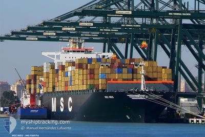
MSC INES
Container Ship
Current Trip
| Trip Time | 2 days |
|---|---|
| Trip Distance | 303.69 nm |
| AVG Speed | 6.2 Knop |
| MAX Speed | 13.1 Knop |
| Djupgående | 9.9 m |
| AVG Wind | 12.5 knots |
| MAX Wind | 19.8 knots |
| MIN Temp | 12.7°C / 54.86°F |
| MAX Temp | 24.3°C / 75.74°F |
| Position mottagen | 1 m sen |
Current Position
| Longitud | 8.91515° |
|---|---|
| Latitude | 44.40480° |
| Status | Under way using engine |
| Fart | |
| Kurs | 105° |
| Område | Ligurian Sea |
| Station | T-AIS |
| Position mottagen | 1 m sen |
Info
Information
The current position of MSC INES is in Ligurian Sea with coordinates 44.40480° / 8.91515° as reported on 2024-04-16 07:28 by AIS to our vessel tracker app. The vessel's current speed is 0 Knop and is currently inside the port of GENOVA.
The vessel MSC INES (IMO: 9305714, MMSI: 356112000) is a Container Ship that was built in 2006 ( 18 År gammal ). It's sailing under the flag of [PA] Panama.
In this page you can find informations about the vessels current position, last detected port calls, and current voyage information. If the vessels is not in coverage by AIS you will find the latest position.
The current position of MSC INES is detected by our AIS receivers and we are not responsible for the reliability of the data. The last position was recorded while the vessel was in Coverage by the Ais receivers of our vessel tracking app.
The current draught of MSC INES as reported by AIS is 9.9 meters
Weather
| Temperature | 13.3°C / 55.94°F |
|---|---|
| Wind Speed | 1 knots |
| Direction | 144° SE |
| Pressure | 999.8 hPa |
| Humidity | 81.5 % |
| Cloud Coverage | 100 % |
Featured Company
Last Port Calls
| Port | Arrival | Departure | Time In Port |
|---|---|---|---|
| 2024-04-16 06:45 | |||
| 2024-04-12 17:22 | 2024-04-13 11:14 | 17 h | |
| 2024-04-08 20:52 | 2024-04-08 21:00 | 8 m | |
| 2024-04-07 20:39 | 2024-04-08 20:51 | 1 d | |
| 2024-04-07 06:43 | 2024-04-07 20:37 | 13 h | |
| 2024-04-05 04:38 | 2024-04-06 06:28 | 1 d | |
| 2024-04-04 03:18 | 2024-04-04 12:38 | 9 h | |
| 2024-04-01 07:33 | 2024-04-02 02:39 | 19 h | |
| 2024-03-30 19:23 | 2024-03-31 23:45 | 1 d | |
| 2024-03-28 12:06 | 2024-03-28 23:44 | 11 h |
Most Visited Ports (Last year)
| Port | Arrivals | |
|---|---|---|
| 9 | ||
| 7 | ||
| 6 | ||
| 6 | ||
| 5 | ||
| 4 |
Last Trips
| Origin | Departure | Destination | Arrival | Distance | |
|---|---|---|---|---|---|
| 2024-04-13 13:14 | 2024-04-16 08:45 | 303.69 nm | |||
| 2024-04-09 00:00 | 2024-04-12 19:22 | 1751.45 nm | |||
| 2024-04-08 23:51 | 2024-04-08 23:52 | 1.08 nm | |||
| 2024-04-07 23:37 | 2024-04-07 23:39 | 1.85 nm | |||
| 2024-04-06 08:28 | 2024-04-07 09:43 | 152.87 nm | |||
| 2024-04-02 05:39 | 2024-04-05 06:38 | 1275.83 nm | |||
| 2024-04-02 05:39 | 2024-04-04 05:18 | 605.28 nm | |||
| 2024-04-01 02:45 | 2024-04-01 10:33 | 82.51 nm | |||
| 2024-03-29 02:44 | 2024-03-30 22:23 | 554.82 nm | |||
| 2024-03-26 13:44 | 2024-03-28 15:06 | 545.64 nm |
Events
| Tid | Event | Detaljer | Position / Dest | Information |
|---|---|---|---|---|
| 2024-04-16 07:15 | STOPPAR förflyttning |
44.40482 / 8.91538
[IT] GENOVA
|
Fart: 0.3 kn Kurs: 102° |
|
| 2024-04-16 06:45 | ANLÄNDER HAMN |
|
44.38561 / 8.94557
[IT] GENOVA
|
Fart: 8.7 kn Kurs: 332.2° |
| 2024-04-15 14:34 | STARTAR förflyttning | 4.37 nm, South West of GENOVA |
44.34030 / 8.81123
ITGOA
|
Fart: 3.3 kn Kurs: 235° |
| 2024-04-15 09:34 | STOPPAR förflyttning | 10.72 nm, South of GENOVA |
44.23031 / 8.92430
ITGOA
|
Fart: 0.3 kn Kurs: 147° |
| 2024-04-15 08:10 | STARTAR förflyttning | 4.06 nm, South of ARENZANO |
44.33331 / 8.66791
ITGOA
|
Fart: 3.1 kn Kurs: 69° |
| 2024-04-14 22:48 | STOPPAR förflyttning | 9.37 nm, South of GENOVA |
44.24809 / 8.88666
ITGOA
|
Fart: 0.3 kn Kurs: 120° |
| 2024-04-14 13:13 | Upptäckt i hav | Italian part of the Ligurian Sea |
43.64009 / 7.88941
Ligurian Sea
ITGOA
|
Fart: 6.1 kn Kurs: 53.9° |
| 2024-04-14 11:04 | Byter havsområde | Italian part of the Mediterranean Sea - Western Basin French part of the Mediterranean Sea - Western Basin |
43.50779 / 7.65077
Mediterranean Sea - Western Basin
ITGOA
|
Fart: 6.2 kn Kurs: 51.7° |
| 2024-04-14 10:19 | Upptäckt i hav | French part of the Mediterranean Sea - Western Basin |
43.45738 / 7.56609
Mediterranean Sea - Western Basin
ITGOA
|
Fart: 6.3 kn Kurs: 50.3° |
| 2024-04-14 10:02 | Upptäckt i hav | Mon�gasque part of the Mediterranean Sea - Western Basin |
43.43836 / 7.53473
Mediterranean Sea - Western Basin
ITGOA
|
Fart: 6.2 kn Kurs: 50° |