
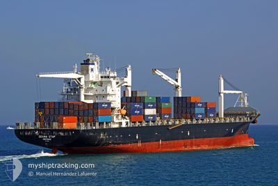
MSC CAPUCINE R
Container Ship
Current Trip
| Time Travelled | 4 days |
|---|---|
| Remaining Time | 3 days |
| Distance Travelled | 1211.56 nm |
| Remaining Distance | 792.66 nm |
| AVG Speed | 10.6 Knop |
| MAX Speed | 16.9 Knop |
| AVG Wind | 14.4 knots |
| MAX Wind | 27.3 knots |
| MIN Temp | 10.4°C / 50.72°F |
| MAX Temp | 26.6°C / 79.88°F |
| Djupgående | 8.9 m |
| Position mottagen | 5 h, 29 m sen |
Current Position
| Longitud | -74.20335° |
|---|---|
| Latitude | 20.81155° |
| Status | Under way using engine |
| Fart | 10.6 Knop |
| Kurs | 159.8° |
| Område | North Atlantic Ocean |
| Station | T-AIS |
| Position mottagen | 5 h, 29 m sen |
Info
Information
The current position of MSC CAPUCINE R is in North Atlantic Ocean with coordinates 20.81155° / -74.20335° as reported on 2024-04-24 18:37 by AIS to our vessel tracker app. The vessel's current speed is 10.6 Knop and is heading at the port of MOIN. The estimated time of arrival as calculated by MyShipTracking vessel tracking app is 2024-04-28 02:54 LT
The vessel MSC CAPUCINE R (IMO: 9210086, MMSI: 636016415) is a Container Ship that was built in 2001 ( 23 År gammal ). It's sailing under the flag of [LR] Liberia.
In this page you can find informations about the vessels current position, last detected port calls, and current voyage information. If the vessels is not in coverage by AIS you will find the latest position.
The current position of MSC CAPUCINE R is detected by our AIS receivers and we are not responsible for the reliability of the data. The last position was recorded while the vessel was in Coverage by the Ais receivers of our vessel tracking app.
The current draught of MSC CAPUCINE R as reported by AIS is 8.9 meters
Weather
| Temperature | 26.5°C / 79.7°F |
|---|---|
| Wind Speed | 17 knots |
| Direction | 39° NE |
| Pressure | 1014.9 hPa |
| Humidity | 68.3 % |
| Cloud Coverage | 2 % |
Featured Company
Last Port Calls
| Port | Arrival | Departure | Time In Port |
|---|---|---|---|
| 2024-04-18 21:07 | 2024-04-20 09:26 | 1 d | |
| 2024-04-17 22:50 | 2024-04-18 12:18 | 13 h | |
| 2024-04-09 10:15 | 2024-04-11 12:52 | 2 d | |
| 2024-04-02 01:15 | 2024-04-02 07:11 | 5 h | |
| 2024-03-28 19:50 | 2024-03-29 21:19 | 1 d | |
| 2024-03-28 03:33 | 2024-03-28 16:22 | 12 h | |
| 2024-03-20 03:10 | 2024-03-21 12:02 | 1 d | |
| 2024-03-12 03:51 | 2024-03-12 23:13 | 19 h | |
| 2024-03-07 08:35 | 2024-03-08 03:49 | 19 h | |
| 2024-03-06 12:08 | 2024-03-07 05:45 | 17 h |
Most Visited Ports (Last year)
| Port | Arrivals | |
|---|---|---|
| 12 | ||
| 11 | ||
| 11 | ||
| 4 | ||
| 3 | ||
| 3 |
Last Trips
| Origin | Departure | Destination | Arrival | Distance | |
|---|---|---|---|---|---|
| 2024-04-18 08:18 | 2024-04-18 17:07 | 21.95 nm | |||
| 2024-04-11 07:52 | 2024-04-17 18:50 | 1959.20 nm | |||
| 2024-04-02 03:11 | 2024-04-09 05:15 | 1586.94 nm | |||
| 2024-03-29 17:19 | 2024-04-01 21:15 | 880.47 nm | |||
| 2024-03-28 12:22 | 2024-03-28 15:50 | 21.61 nm | |||
| 2024-03-21 07:02 | 2024-03-27 23:33 | 2179.24 nm | |||
| 2024-03-12 19:13 | 2024-03-19 22:10 | 1442.83 nm | |||
| 2024-03-07 22:49 | 2024-03-11 23:51 | 937.50 nm | |||
| 2024-03-07 00:45 | 2024-03-07 03:35 | 21.26 nm | |||
| 2024-02-29 20:37 | 2024-03-06 07:08 | 1947.72 nm |
Events
| Tid | Event | Detaljer | Position / Dest | Information |
|---|---|---|---|---|
| 2024-04-24 18:45 | Status ändrad | Default Under way using engine |
20.78667 / -74.19334
CRMOB
|
Fart: 10.6 kn Kurs: 159.8° |
| 2024-04-24 18:37 | UTANFÖR täckningsområde |
20.81155 / -74.20335
North Atlantic Ocean
CRMOB
|
Fart: 10.6 kn Kurs: 159.8° |
|
| 2024-04-24 18:29 | Byter havsområde | Cuban part of the North Atlantic Ocean Bahamas part of the North Atlantic Ocean |
20.83271 / -74.21123
North Atlantic Ocean
CRMOB
|
Fart: 10 kn Kurs: 161° |
| 2024-04-24 15:23 | Byter havsområde | Bahamas part of the North Atlantic Ocean United States part of the North Atlantic Ocean |
21.34857 / -74.42980
North Atlantic Ocean
CRMOB
|
Fart: 10.8 kn Kurs: 158.4° |
| 2024-04-24 15:23 | Status ändrad | Under way using engine Default |
21.34857 / -74.42980
CRMOB
|
Fart: 12 kn Kurs: 157° |
| 2024-04-24 15:19 | I täckningsområde |
21.34857 / -74.42980
North Atlantic Ocean
CRMOB
|
Fart: 10.8 kn Kurs: 158.4° |
|
| 2024-04-20 17:02 | Status ändrad | Default Under way using engine |
38.44094 / -74.72478
CRMOB
|
Fart: 10.9 kn Kurs: 147.2° |
| 2024-04-20 16:56 | UTANFÖR täckningsområde |
38.45638 / -74.73623
North Atlantic Ocean
CRMOB
|
Fart: 10.9 kn Kurs: 147.2° |
|
| 2024-04-20 16:52 | Status ändrad | Under way using engine Default |
38.46659 / -74.74488
CRMOB
|
Fart: 11 kn Kurs: 143° |
| 2024-04-20 16:34 | I täckningsområde |
38.46486 / -74.74341
North Atlantic Ocean
CRMOB
|
Fart: 11 kn Kurs: 146.5° |