
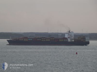
MSC CANCUN
Container Ship
Current Trip
| Time Travelled | 6 days |
|---|---|
| Remaining Time | 1 day |
| Distance Travelled | 2811.25 nm |
| Remaining Distance | 350.01 nm |
| AVG Speed | 17.1 Knop |
| MAX Speed | 22.2 Knop |
| AVG Wind | 11.3 knots |
| MAX Wind | 27.6 knots |
| MIN Temp | 5.7°C / 42.26°F |
| MAX Temp | 19.9°C / 67.82°F |
| Djupgående | 10.8 m |
| Position mottagen | Nu |
Current Position
| Longitud | 22.77408° |
|---|---|
| Latitude | 36.03553° |
| Status | Under way using engine |
| Fart | 11.8 Knop |
| Kurs | 99.5° |
| Område | Mediterranean Sea - Eastern Basin |
| Station | T-AIS |
| Position mottagen | Nu |
Info
Information
The current position of MSC CANCUN is in Mediterranean Sea - Eastern Basin with coordinates 36.03553° / 22.77408° as reported on 2024-04-16 19:20 by AIS to our vessel tracker app. The vessel's current speed is 11.8 Knop and is heading at the port of THESSALONIKI. The estimated time of arrival as calculated by MyShipTracking vessel tracking app is 2024-04-18 00:26 LT
The vessel MSC CANCUN (IMO: 9403396, MMSI: 636020198) is a Container Ship that was built in 2009 ( 15 År gammal ). It's sailing under the flag of [LR] Liberia.
In this page you can find informations about the vessels current position, last detected port calls, and current voyage information. If the vessels is not in coverage by AIS you will find the latest position.
The current position of MSC CANCUN is detected by our AIS receivers and we are not responsible for the reliability of the data. The last position was recorded while the vessel was in Coverage by the Ais receivers of our vessel tracking app.
The current draught of MSC CANCUN as reported by AIS is 10.8 meters
Weather
| Temperature | 18.8°C / 65.84°F |
|---|---|
| Wind Speed | 10 knots |
| Direction | 157° SSE |
| Pressure | 1009.6 hPa |
| Humidity | 73.4 % |
| Cloud Coverage | 100 % |
Featured Company
Last Port Calls
| Port | Arrival | Departure | Time In Port |
|---|---|---|---|
| 2024-04-09 04:35 | 2024-04-10 02:56 | 22 h | |
| 2024-04-07 20:37 | 2024-04-08 17:48 | 21 h | |
| 2024-04-06 12:04 | 2024-04-07 07:22 | 19 h | |
| 2024-04-02 10:32 | 2024-04-03 03:44 | 17 h | |
| 2024-03-29 03:37 | 2024-03-30 00:30 | 20 h | |
| 2024-03-26 18:57 | 2024-03-27 14:46 | 19 h | |
| 2024-03-24 19:41 | 2024-03-26 01:59 | 1 d | |
| 2024-03-23 17:38 | 2024-03-24 05:17 | 11 h | |
| 2024-03-21 15:47 | 2024-03-22 14:34 | 22 h | |
| 2024-03-12 13:25 | 2024-03-13 15:09 | 1 d |
Most Visited Ports (Last year)
| Port | Arrivals | |
|---|---|---|
| 11 | ||
| 7 | ||
| 6 | ||
| 4 | ||
| 3 | ||
| 2 |
Last Trips
| Origin | Departure | Destination | Arrival | Distance | |
|---|---|---|---|---|---|
| 2024-04-08 19:48 | 2024-04-09 06:35 | 125.85 nm | |||
| 2024-04-07 08:22 | 2024-04-07 22:37 | 157.57 nm | |||
| 2024-04-03 04:44 | 2024-04-06 13:04 | 1185.68 nm | |||
| 2024-03-30 01:30 | 2024-04-02 11:32 | 1315.79 nm | |||
| 2024-03-27 16:46 | 2024-03-29 04:37 | 546.69 nm | |||
| 2024-03-26 04:59 | 2024-03-26 20:57 | 214.44 nm | |||
| 2024-03-24 07:17 | 2024-03-24 22:41 | 219.02 nm | |||
| 2024-03-22 16:34 | 2024-03-23 19:38 | 288.67 nm | |||
| 2024-03-13 16:09 | 2024-03-21 17:47 | 3157.97 nm | |||
| 2024-03-11 14:21 | 2024-03-12 14:25 | 167.45 nm |
Events
| Tid | Event | Detaljer | Position / Dest | Information |
|---|---|---|---|---|
| 2024-04-16 19:20 | Status ändrad | Under way using engine Default |
36.03553 / 22.77408
GRSKG
|
Fart: 11.9 kn Kurs: 98° |
| 2024-04-16 19:10 | Status ändrad | Default Under way using engine |
36.04038 / 22.73543
GRSKG
|
Fart: 11.7 kn Kurs: 96.8° |
| 2024-04-16 18:38 | Status ändrad | Under way using engine Default |
36.05398 / 22.60523
GRSKG
|
Fart: 11.9 kn Kurs: 88° |
| 2024-04-16 18:27 | I täckningsområde |
36.05398 / 22.60523
Mediterranean Sea - Eastern Basin
GRSKG
|
Fart: 11.8 kn Kurs: 95.6° |
|
| 2024-04-16 10:55 | Status ändrad | Default Under way using engine |
36.11145 / 20.70660
GRSKG
|
Fart: 12 kn Kurs: 92.9° |
| 2024-04-16 10:48 | UTANFÖR täckningsområde |
36.11262 / 20.67868
Mediterranean Sea - Eastern Basin
GRSKG
|
Fart: 12 kn Kurs: 92.9° |
|
| 2024-04-16 09:12 | Status ändrad | Under way using engine Default |
36.12863 / 20.28832
GRSKG
|
Fart: 11.8 kn Kurs: 92° |
| 2024-04-16 08:46 | Status ändrad | Default Under way using engine |
36.13285 / 20.18449
GRSKG
|
Fart: 11.7 kn Kurs: 93.3° |
| 2024-04-16 08:06 | Status ändrad | Under way using engine Default |
36.13957 / 20.01987
GRSKG
|
Fart: 11.7 kn Kurs: 93° |
| 2024-04-16 07:40 | Status ändrad | Default Under way using engine |
36.14376 / 19.91681
GRSKG
|
Fart: 11.7 kn Kurs: 92.6° |