
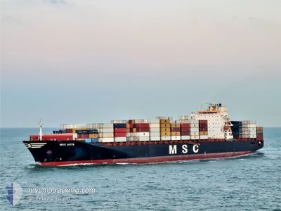
MSC ANYA
Container Ship
Current Trip
| Time Travelled | 2 days |
|---|---|
| Remaining Time | 8 days |
| Distance Travelled | 751.73 nm |
| Remaining Distance | 2284.11 nm |
| AVG Speed | 12.1 Knop |
| MAX Speed | 16 Knop |
| AVG Wind | 10.8 knots |
| MAX Wind | 29.1 knots |
| MIN Temp | 8.6°C / 47.48°F |
| MAX Temp | 13.7°C / 56.66°F |
| Djupgående | 11.8 m |
| Position mottagen | 1 d sen |
Current Position
| Longitud | -11.61082° |
|---|---|
| Latitude | 51.24364° |
| Status | Under way using engine |
| Fart | 12.1 Knop |
| Kurs | 265.4° |
| Område | North Atlantic Ocean |
| Station | T-AIS |
| Position mottagen | 1 d sen |
Info
Information
The current position of MSC ANYA is in North Atlantic Ocean with coordinates 51.24364° / -11.61082° as reported on 2024-04-24 05:12 by AIS to our vessel tracker app. The vessel's current speed is 12.1 Knop and is heading at the port of MONTREAL. The estimated time of arrival as calculated by MyShipTracking vessel tracking app is 2024-05-03 18:30 LT
The vessel MSC ANYA (IMO: 9297864, MMSI: 636016424) is a Container Ship that was built in 2005 ( 19 År gammal ). It's sailing under the flag of [LR] Liberia.
In this page you can find informations about the vessels current position, last detected port calls, and current voyage information. If the vessels is not in coverage by AIS you will find the latest position.
The current position of MSC ANYA is detected by our AIS receivers and we are not responsible for the reliability of the data. The last position was recorded while the vessel was in Coverage by the Ais receivers of our vessel tracking app.
The current draught of MSC ANYA as reported by AIS is 11.8 meters
Weather
| Temperature | 9.3°C / 48.74°F |
|---|---|
| Wind Speed | 24 knots |
| Direction | 279° W |
| Pressure | 1016.6 hPa |
| Humidity | 72.6 % |
| Cloud Coverage | 100 % |
Featured Company
Last Port Calls
| Port | Arrival | Departure | Time In Port |
|---|---|---|---|
| 2024-04-21 22:55 | 2024-04-22 21:59 | 23 h | |
| 2024-04-18 10:56 | 2024-04-19 02:06 | 15 h | |
| 2024-04-16 11:15 | 2024-04-16 19:55 | 8 h | |
| 2024-04-14 01:27 | 2024-04-15 09:56 | 1 d | |
| 2024-03-31 02:06 | 2024-04-02 15:02 | 2 d | |
| 2024-03-18 05:15 | 2024-03-19 04:45 | 23 h | |
| 2024-03-15 04:04 | 2024-03-15 20:41 | 16 h | |
| 2024-03-12 12:48 | 2024-03-13 08:49 | 20 h | |
| 2024-03-09 11:48 | 2024-03-10 19:14 | 1 d | |
| 2024-02-25 10:47 | 2024-02-27 16:13 | 2 d |
Most Visited Ports (Last year)
| Port | Arrivals | |
|---|---|---|
| 12 | ||
| 12 | ||
| 11 | ||
| 11 | ||
| 10 |
Last Trips
| Origin | Departure | Destination | Arrival | Distance | |
|---|---|---|---|---|---|
| 2024-04-19 04:06 | 2024-04-21 23:55 | 546.29 nm | |||
| 2024-04-16 21:55 | 2024-04-18 12:56 | 520.48 nm | |||
| 2024-04-15 11:56 | 2024-04-16 13:15 | 374.66 nm | |||
| 2024-04-02 11:02 | 2024-04-14 03:27 | 3429.77 nm | |||
| 2024-03-19 04:45 | 2024-03-30 22:06 | 3092.55 nm | |||
| 2024-03-15 21:41 | 2024-03-18 05:15 | 549.21 nm | |||
| 2024-03-13 09:49 | 2024-03-15 05:04 | 519.13 nm | |||
| 2024-03-10 20:14 | 2024-03-12 13:48 | 378.25 nm | |||
| 2024-02-27 11:13 | 2024-03-09 12:48 | 3623.10 nm | |||
| 2024-02-13 01:45 | 2024-02-25 05:47 | 3697.85 nm |
Events
| Tid | Event | Detaljer | Position / Dest | Information |
|---|---|---|---|---|
| 2024-04-24 05:17 | Status ändrad | Default Under way using engine |
51.24166 / -11.63833
CAMTR
|
Fart: 12.1 kn Kurs: 265.4° |
| 2024-04-24 05:12 | Status ändrad | Under way using engine Default |
51.24364 / -11.61082
CAMTR
|
Fart: 12 kn Kurs: 266° |
| 2024-04-24 05:12 | UTANFÖR täckningsområde |
51.24364 / -11.61082
North Atlantic Ocean
CAMTR
|
Fart: 12.1 kn Kurs: 265.4° |
|
| 2024-04-24 05:02 | Status ändrad | Default Under way using engine |
51.24500 / -11.55833
CAMTR
|
Fart: 12 kn Kurs: 266° |
| 2024-04-24 04:53 | Status ändrad | Under way using engine Default |
51.24816 / -11.50961
CAMTR
|
Fart: 11 kn Kurs: 265° |
| 2024-04-24 04:47 | Status ändrad | Default Under way using engine |
51.24833 / -11.47833
CAMTR
|
Fart: 12.1 kn Kurs: 268.5° |
| 2024-04-24 04:37 | Status ändrad | Under way using engine Default |
51.25115 / -11.42325
CAMTR
|
Fart: 12 kn Kurs: 262° |
| 2024-04-24 04:20 | Status ändrad | Default Under way using engine |
51.25834 / -11.33333
CAMTR
|
Fart: 12.1 kn Kurs: 270.7° |
| 2024-04-24 04:05 | Status ändrad | Under way using engine Default |
51.26058 / -11.25515
CAMTR
|
Fart: 12 kn Kurs: 268° |
| 2024-04-24 04:05 | I täckningsområde |
51.26061 / -11.25781
North Atlantic Ocean
CAMTR
|
Fart: 12.1 kn Kurs: 270.7° |