
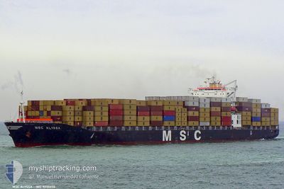
MSC ALYSSA
Container Ship
Current Trip
| Trip Time | 2 days |
|---|---|
| Trip Distance | 973.11 nm |
| AVG Speed | 13 Knop |
| MAX Speed | 19.9 Knop |
| Djupgående | 10.3 m |
| AVG Wind | 10.7 knots |
| MAX Wind | 25.8 knots |
| MIN Temp | -0.5°C / 31.1°F |
| MAX Temp | 5.3°C / 41.54°F |
| Position mottagen | 1 m sen |
Current Position
| Longitud | -63.56001° |
|---|---|
| Latitude | 44.62679° |
| Status | Moored |
| Fart | |
| Kurs | 147° |
| Område | North Atlantic Ocean |
| Station | T-AIS |
| Position mottagen | 1 m sen |
Info
Information
The current position of MSC ALYSSA is in North Atlantic Ocean with coordinates 44.62679° / -63.56001° as reported on 2024-04-16 18:31 by AIS to our vessel tracker app. The vessel's current speed is 0 Knop and is currently inside the port of HALIFAX.
The vessel MSC ALYSSA (IMO: 9235050, MMSI: 351473000) is a Container Ship that was built in 2001 ( 23 År gammal ). It's sailing under the flag of [PA] Panama.
In this page you can find informations about the vessels current position, last detected port calls, and current voyage information. If the vessels is not in coverage by AIS you will find the latest position.
The current position of MSC ALYSSA is detected by our AIS receivers and we are not responsible for the reliability of the data. The last position was recorded while the vessel was in Coverage by the Ais receivers of our vessel tracking app.
The current draught of MSC ALYSSA as reported by AIS is 10.3 meters
Weather
| Temperature | 13.9°C / 57.02°F |
|---|---|
| Wind Speed | 3 knots |
| Direction | 293° WNW |
| Pressure | 1012.1 hPa |
| Humidity | 55.1 % |
| Cloud Coverage | 79 % |
Featured Company
Last Port Calls
| Port | Arrival | Departure | Time In Port |
|---|---|---|---|
| 2024-04-16 12:09 | |||
| 2024-04-11 11:08 | 2024-04-13 19:12 | 2 d | |
| 2024-04-07 19:31 | 2024-04-08 03:53 | 8 h | |
| 2024-03-29 17:33 | 2024-03-30 20:34 | 1 d | |
| 2024-03-26 11:21 | 2024-03-27 05:24 | 18 h | |
| 2024-03-23 05:34 | 2024-03-23 16:40 | 11 h | |
| 2024-03-20 14:40 | 2024-03-21 20:07 | 1 d | |
| 2024-03-19 17:32 | 2024-03-20 08:11 | 14 h | |
| 2024-03-16 17:42 | 2024-03-17 15:28 | 21 h | |
| 2024-03-07 10:27 | 2024-03-07 23:06 | 12 h |
Last Trips
| Origin | Departure | Destination | Arrival | Distance | |
|---|---|---|---|---|---|
| 2024-04-13 15:12 | 2024-04-16 09:09 | 973.11 nm | |||
| 2024-04-08 00:53 | 2024-04-11 07:08 | 986.14 nm | |||
| 2024-03-30 20:34 | 2024-04-07 16:31 | 2755.56 nm | |||
| 2024-03-27 06:24 | 2024-03-29 17:33 | 674.78 nm | |||
| 2024-03-23 17:40 | 2024-03-26 12:21 | 739.26 nm | |||
| 2024-03-21 21:07 | 2024-03-23 06:34 | 363.05 nm | |||
| 2024-03-20 09:11 | 2024-03-20 15:40 | 84.13 nm | |||
| 2024-03-17 16:28 | 2024-03-19 18:32 | 839.73 nm | |||
| 2024-03-07 19:06 | 2024-03-16 18:42 | 2842.19 nm | |||
| 2024-03-04 06:49 | 2024-03-07 06:27 | 544.83 nm |
Events
| Tid | Event | Detaljer | Position / Dest | Information |
|---|---|---|---|---|
| 2024-04-16 12:53 | Status ändrad | Moored Under way using engine |
44.62673 / -63.55985
[CA] HALIFAX
|
Fart: 0.1 kn Kurs: 146° |
| 2024-04-16 12:36 | STOPPAR förflyttning |
44.62489 / -63.55554
[CA] HALIFAX
|
Fart: 0.3 kn Kurs: 94° |
|
| 2024-04-16 12:09 | ANLÄNDER HAMN |
|
44.60562 / -63.54181
[CA] HALIFAX
|
Fart: 5.7 kn Kurs: 340.7° |
| 2024-04-16 07:51 | Upptäckt i hav | Canadian part of the North Atlantic Ocean |
44.51707 / -62.87349
North Atlantic Ocean
CAHAL
|
Fart: 9.9 kn Kurs: 250.7° |
| 2024-04-16 07:51 | Status ändrad | Under way using engine Default |
44.51707 / -62.87349
CAHAL
|
Fart: 10.2 kn Kurs: 250° |
| 2024-04-16 07:36 | I täckningsområde |
44.51707 / -62.87349
North Atlantic Ocean
CAHAL
|
Fart: 9.9 kn Kurs: 250.7° |
|
| 2024-04-14 14:07 | Status ändrad | Default Under way using engine |
48.68082 / -68.45148
CAHAL
|
Fart: 18.7 kn Kurs: 56.6° |
| 2024-04-14 13:59 | UTANFÖR täckningsområde |
48.65854 / -68.50413
Gulf of St-Lawrence
CAHAL
|
Fart: 18.7 kn Kurs: 56.6° |
|
| 2024-04-14 13:53 | Status ändrad | Under way using engine Default |
48.63968 / -68.54502
CAHAL
|
Fart: 18.7 kn Kurs: 55° |
| 2024-04-14 13:29 | Status ändrad | Default Under way using engine |
48.56889 / -68.70063
CAHAL
|
Fart: 18.6 kn Kurs: 57.9° |