
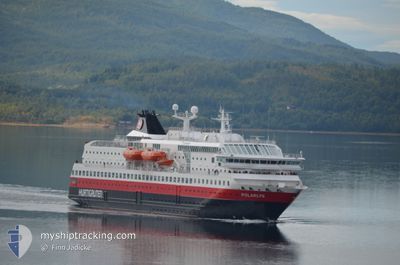
POLARLYS
Ro-Ro/Passenger Ship
Current Trip
| Time Travelled | 1 h, 19 mins |
|---|---|
| Remaining Time | --- |
| Distance Travelled | 16.82 nm |
| Remaining Distance | --- |
| AVG Speed | 13.9 Knop |
| MAX Speed | 14 Knop |
| AVG Wind | 20 knots |
| MAX Wind | 21.6 knots |
| MIN Temp | -2.3°C / 27.86°F |
| MAX Temp | -1.8°C / 28.76°F |
| Djupgående | 5.1 m |
| Position mottagen | 1 m sen |
Current Position
| Longitud | 26.83758° |
|---|---|
| Latitude | 70.98811° |
| Status | Under way using engine |
| Fart | 13.9 Knop |
| Kurs | 89.4° |
| Område | Barentsz Sea |
| Station | T-AIS |
| Position mottagen | 1 m sen |
Info
Information
The current position of POLARLYS is in Barentsz Sea with coordinates 70.98811° / 26.83758° as reported on 2024-04-19 14:05 by AIS to our vessel tracker app. The vessel's current speed is 13.9 Knop and is heading at the port of KIRKENES. The estimated time of arrival as calculated by MyShipTracking vessel tracking app is 2024-04-20 07:07 LT
The vessel POLARLYS (IMO: 9107796, MMSI: 259322000) is a Ro-Ro/Passenger Ship that was built in 1996 ( 28 År gammal ). It's sailing under the flag of [NO] Norway.
In this page you can find informations about the vessels current position, last detected port calls, and current voyage information. If the vessels is not in coverage by AIS you will find the latest position.
The current position of POLARLYS is detected by our AIS receivers and we are not responsible for the reliability of the data. The last position was recorded while the vessel was in Coverage by the Ais receivers of our vessel tracking app.
The current draught of POLARLYS as reported by AIS is 5.1 meters
Weather
| Temperature | -2.2°C / 28.04°F |
|---|---|
| Wind Speed | 21 knots |
| Direction | 151° SSE |
| Pressure | 1021 hPa |
| Humidity | 74.1 % |
| Cloud Coverage | 79 % |
Featured Company
Last Port Calls
| Port | Arrival | Departure | Time In Port |
|---|---|---|---|
| 2024-04-19 08:52 | 2024-04-19 12:48 | 3 h | |
| 2024-04-19 06:36 | 2024-04-19 06:55 | 19 m | |
| 2024-04-19 03:01 | 2024-04-19 03:47 | 46 m | |
| 2024-04-18 12:17 | 2024-04-18 16:21 | 4 h | |
| 2024-04-18 09:00 | 2024-04-18 09:38 | 38 m | |
| 2024-04-18 05:03 | 2024-04-18 05:49 | 45 m | |
| 2024-04-18 00:56 | 2024-04-18 01:18 | 22 m | |
| 2024-04-17 23:31 | 2024-04-17 23:36 | 4 m | |
| 2024-04-17 19:39 | 2024-04-17 20:32 | 52 m | |
| 2024-04-17 17:27 | 2024-04-17 18:06 | 39 m |
Last Trips
| Origin | Departure | Destination | Arrival | Distance | |
|---|---|---|---|---|---|
| 2024-04-19 08:55 | 2024-04-19 10:52 | 26.69 nm | |||
| 2024-04-19 05:47 | 2024-04-19 08:36 | 36.15 nm | |||
| 2024-04-18 18:21 | 2024-04-19 05:01 | 140.79 nm | |||
| 2024-04-18 11:38 | 2024-04-18 14:17 | 36.18 nm | |||
| 2024-04-18 07:49 | 2024-04-18 11:00 | 41.70 nm | |||
| 2024-04-18 03:18 | 2024-04-18 07:03 | 43.49 nm | |||
| 2024-04-18 01:36 | 2024-04-18 02:56 | 15.52 nm | |||
| 2024-04-17 22:32 | 2024-04-18 01:31 | 35.79 nm | |||
| 2024-04-17 20:06 | 2024-04-17 21:39 | 19.32 nm | |||
| 2024-04-17 15:39 | 2024-04-17 19:27 | 52.97 nm |
Events
| Tid | Event | Detaljer | Position / Dest | Information |
|---|---|---|---|---|
| 2024-04-19 12:48 | AVGÅTT HAMN |
|
70.97531 / 25.95109
NO KKN
|
Fart: 7.1 kn Kurs: 220° |
| 2024-04-19 12:46 | STARTAR förflyttning |
70.98010 / 25.95291
[NO] HONNINGSVAAG
|
Fart: 7.1 kn Kurs: 220° |
|
| 2024-04-19 12:19 | Status ändrad | Under way using engine Moored |
70.98082 / 25.96916
[NO] HONNINGSVAAG
|
Fart: Kurs: 111° |
| 2024-04-19 09:00 | Status ändrad | Moored Under way using engine |
70.98082 / 25.96909
[NO] HONNINGSVAAG
|
Fart: 1 kn Kurs: 108° |
| 2024-04-19 09:00 | STOPPAR förflyttning |
70.98082 / 25.96909
[NO] HONNINGSVAAG
|
Fart: Kurs: 111° |
|
| 2024-04-19 08:52 | ANLÄNDER HAMN |
|
70.97734 / 25.94670
[NO] HONNINGSVAAG
|
Fart: 13.8 kn Kurs: 25.9° |
| 2024-04-19 08:21 | Byter havsområde | Norwegian part of the Barentsz Sea Norwegian part of the Norwegian Sea |
70.92980 / 25.63634
Barentsz Sea
NO KKN
|
Fart: 13.8 kn Kurs: 77.4° |
| 2024-04-19 06:55 | STARTAR förflyttning | 0.77 nm, East of HAVOYSUND |
70.99512 / 24.70394
NO KKN
|
Fart: 10.9 kn Kurs: 91° |
| 2024-04-19 06:55 | AVGÅTT HAMN |
|
70.99512 / 24.70394
NO KKN
|
Fart: 3.2 kn Kurs: 84° |
| 2024-04-19 06:36 | STOPPAR förflyttning |
70.99488 / 24.68833
[NO] HAVOYSUND
|
Fart: 0.1 kn Kurs: 84° |