
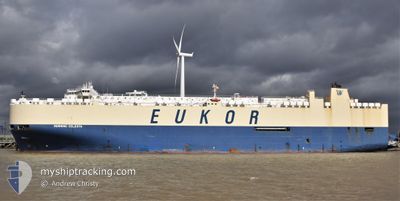
MORNING CELESTA
Vehicles Carrier
Current Trip
| Time Travelled | 5 days |
|---|---|
| Remaining Time | --- |
| Distance Travelled | 2152.74 nm |
| Remaining Distance | --- |
| AVG Speed | 15.6 Knop |
| MAX Speed | 17.7 Knop |
| AVG Wind | 16.7 knots |
| MAX Wind | 28.1 knots |
| MIN Temp | 6.8°C / 44.24°F |
| MAX Temp | 14.2°C / 57.56°F |
| Djupgående | 9.9 m |
| Position mottagen | 4 d sen |
Current Position
| Longitud | -7.08185° |
|---|---|
| Latitude | 49.53769° |
| Status | Under way using engine |
| Fart | 16.5 Knop |
| Kurs | 275.1° |
| Område | Celtic Sea |
| Station | T-AIS |
| Position mottagen | 4 d sen |
Info
Information
The current position of MORNING CELESTA is in Celtic Sea with coordinates 49.53769° / -7.08185° as reported on 2024-04-20 17:10 by AIS to our vessel tracker app. The vessel's current speed is 16.5 Knop and is heading at the port of BRUNSWICK. The estimated time of arrival as calculated by MyShipTracking vessel tracking app is 2024-04-29 13:30 LT
The vessel MORNING CELESTA (IMO: 9336062, MMSI: 311000705) is a Vehicles Carrier that was built in 2008 ( 16 År gammal ). It's sailing under the flag of [BS] Bahamas.
In this page you can find informations about the vessels current position, last detected port calls, and current voyage information. If the vessels is not in coverage by AIS you will find the latest position.
The current position of MORNING CELESTA is detected by our AIS receivers and we are not responsible for the reliability of the data. The last position was recorded while the vessel was in Coverage by the Ais receivers of our vessel tracking app.
The current draught of MORNING CELESTA as reported by AIS is 9.9 meters
Weather
| Temperature | 8°C / 46.4°F |
|---|---|
| Wind Speed | 15 knots |
| Direction | 267° W |
| Pressure | 1020.8 hPa |
| Humidity | 94.3 % |
| Cloud Coverage | 94 % |
Featured Company
Last Port Calls
| Port | Arrival | Departure | Time In Port |
|---|---|---|---|
| 2024-04-18 23:21 | 2024-04-19 23:25 | 1 d | |
| 2024-04-14 11:22 | 2024-04-17 12:21 | 3 d | |
| 2024-04-12 01:50 | 2024-04-12 18:56 | 17 h | |
| 2024-04-08 23:17 | 2024-04-10 23:11 | 1 d | |
| 2024-03-26 14:51 | 2024-03-28 00:43 | 1 d | |
| 2024-03-24 14:22 | 2024-03-26 01:37 | 1 d | |
| 2024-03-20 14:10 | 2024-03-21 18:01 | 1 d | |
| 2024-03-18 13:58 | 2024-03-18 21:23 | 7 h | |
| 2024-03-06 10:56 | 2024-03-08 07:04 | 1 d | |
| 2024-03-03 05:51 | 2024-03-04 19:39 | 1 d |
Most Visited Ports (Last year)
| Port | Arrivals | |
|---|---|---|
| 4 | ||
| 3 | ||
| 3 | ||
| 3 | ||
| 3 | ||
| 2 |
Last Trips
| Origin | Departure | Destination | Arrival | Distance | |
|---|---|---|---|---|---|
| 2024-04-17 14:21 | 2024-04-19 00:21 | 238.47 nm | |||
| 2024-04-12 20:56 | 2024-04-14 13:22 | 590.44 nm | |||
| 2024-04-11 01:11 | 2024-04-12 03:50 | 425.48 nm | |||
| 2024-03-27 20:43 | 2024-04-09 01:17 | 4701.46 nm | |||
| 2024-03-25 21:37 | 2024-03-26 10:51 | 174.00 nm | |||
| 2024-03-21 14:01 | 2024-03-24 10:22 | 781.15 nm | |||
| 2024-03-18 18:23 | 2024-03-20 10:10 | 616.57 nm | |||
| 2024-03-08 08:04 | 2024-03-18 10:58 | 3055.60 nm | |||
| 2024-03-04 20:39 | 2024-03-06 11:56 | 407.05 nm | |||
| 2024-03-01 16:56 | 2024-03-03 06:51 | 581.73 nm |
Events
| Tid | Event | Detaljer | Position / Dest | Information |
|---|---|---|---|---|
| 2024-04-20 17:19 | Status ändrad | Default Under way using engine |
49.54167 / -7.14667
US SSI
|
Fart: 16.5 kn Kurs: 275.1° |
| 2024-04-20 17:10 | UTANFÖR täckningsområde |
49.53769 / -7.08185
Celtic Sea
US SSI
|
Fart: 16.5 kn Kurs: 275.1° |
|
| 2024-04-20 17:10 | Status ändrad | Under way using engine Default |
49.53764 / -7.08112
US SSI
|
Fart: 16.5 kn Kurs: 275° |
| 2024-04-20 16:52 | Status ändrad | Default Under way using engine |
49.52833 / -6.95333
US SSI
|
Fart: 16.5 kn Kurs: 275° |
| 2024-04-20 16:49 | Status ändrad | Under way using engine Default |
49.52827 / -6.93074
US SSI
|
Fart: 16.6 kn Kurs: 275° |
| 2024-04-20 16:46 | Status ändrad | Default Under way using engine |
49.52732 / -6.91303
US SSI
|
Fart: 16.4 kn Kurs: 273.6° |
| 2024-04-20 16:25 | Byter havsområde | United Kingdom part of the Celtic Sea United Kingdom part of the English Channel |
49.52068 / -6.76129
Celtic Sea
US SSI
|
Fart: 16.4 kn Kurs: 273.7° |
| 2024-04-20 16:24 | Status ändrad | Under way using engine Default |
49.52054 / -6.75848
US SSI
|
Fart: 16.4 kn Kurs: 274° |
| 2024-04-20 16:11 | I täckningsområde |
49.52068 / -6.76129
Celtic Sea
US SSI
|
Fart: 16.4 kn Kurs: 273.7° |
|
| 2024-04-20 11:58 | UTANFÖR täckningsområde |
49.64189 / -4.98253
English Channel
US SSI
|
Fart: 15.7 kn Kurs: 259.9° |