
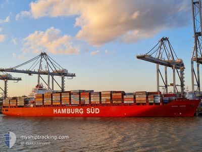
MONTE VERDE
Container Ship
Current Trip
| Time Travelled | 1 day |
|---|---|
| Remaining Time | --- |
| Distance Travelled | 635.39 nm |
| Remaining Distance | --- |
| AVG Speed | 16.4 Knop |
| MAX Speed | 17.9 Knop |
| AVG Wind | 12.5 knots |
| MAX Wind | 15.9 knots |
| MIN Temp | 26.8°C / 80.24°F |
| MAX Temp | 28.5°C / 83.3°F |
| Djupgående | 12.8 m |
| Position mottagen | 1 d sen |
Current Position
| Longitud | -38.80412° |
|---|---|
| Latitude | -3.52421° |
| Status | Under way using engine |
| Fart | 1 Knop |
| Kurs | 315° |
| Område | South Atlantic Ocean |
| Station | T-AIS |
| Position mottagen | 1 d sen |
Info
Information
The current position of MONTE VERDE is in South Atlantic Ocean with coordinates -3.52421° / -38.80412° as reported on 2024-04-21 18:04 by AIS to our vessel tracker app. The vessel's current speed is 1 Knop and is heading at the port of SALVADOR. The estimated time of arrival as calculated by MyShipTracking vessel tracking app is 2024-04-18 20:00 LT
The vessel MONTE VERDE (IMO: 9283239, MMSI: 563051800) is a Container Ship that was built in 2005 ( 19 År gammal ). It's sailing under the flag of [SG] Singapore.
In this page you can find informations about the vessels current position, last detected port calls, and current voyage information. If the vessels is not in coverage by AIS you will find the latest position.
The current position of MONTE VERDE is detected by our AIS receivers and we are not responsible for the reliability of the data. The last position was recorded while the vessel was in Coverage by the Ais receivers of our vessel tracking app.
The current draught of MONTE VERDE as reported by AIS is 12.8 meters
Weather
| Temperature | 26.6°C / 79.88°F |
|---|---|
| Wind Speed | 15 knots |
| Direction | 55° NE |
| Pressure | 1011.6 hPa |
| Humidity | 73.2 % |
| Cloud Coverage | 96 % |
Featured Company
Last Port Calls
| Port | Arrival | Departure | Time In Port |
|---|---|---|---|
| 2024-04-21 09:29 | 2024-04-21 18:11 | 8 h | |
| 2024-04-18 20:48 | 2024-04-19 06:49 | 10 h | |
| 2024-04-16 00:11 | 2024-04-16 00:18 | 6 m | |
| 2024-04-14 09:20 | 2024-04-15 10:30 | 1 d | |
| 2024-04-12 23:11 | 2024-04-13 19:15 | 20 h | |
| 2024-04-07 01:02 | 2024-04-07 23:49 | 22 h | |
| 2024-03-25 07:12 | 2024-03-26 04:57 | 21 h | |
| 2024-03-21 06:25 | 2024-03-22 05:38 | 23 h | |
| 2024-03-17 13:16 | 2024-03-18 05:38 | 16 h | |
| 2024-03-14 08:43 | 2024-03-14 23:59 | 15 h |
Most Visited Ports (Last year)
| Port | Arrivals | |
|---|---|---|
| 15 | ||
| 8 | ||
| 8 | ||
| 8 | ||
| 8 | ||
| 8 |
Last Trips
| Origin | Departure | Destination | Arrival | Distance | |
|---|---|---|---|---|---|
| 2024-04-19 03:49 | 2024-04-21 06:29 | 842.00 nm | |||
| 2024-04-15 21:18 | 2024-04-18 17:48 | 776.72 nm | |||
| 2024-04-15 07:30 | 2024-04-15 21:11 | 221.34 nm | |||
| 2024-04-13 16:15 | 2024-04-14 06:20 | 192.37 nm | |||
| 2024-04-07 20:49 | 2024-04-12 20:11 | 1106.12 nm | |||
| 2024-03-26 00:57 | 2024-04-06 22:02 | 4784.08 nm | |||
| 2024-03-22 01:38 | 2024-03-25 03:12 | 562.31 nm | |||
| 2024-03-18 01:38 | 2024-03-21 02:25 | 452.77 nm | |||
| 2024-03-14 19:59 | 2024-03-17 09:16 | 287.40 nm | |||
| 2024-03-12 20:36 | 2024-03-14 04:43 | 253.66 nm |
Events
| Tid | Event | Detaljer | Position / Dest | Information |
|---|---|---|---|---|
| 2024-04-21 18:11 | STARTAR förflyttning | 0.68 nm, North of PECEM |
-3.52117 / -38.80640
BRRIO>>BRSSA
|
Fart: 4.2 kn Kurs: 332° |
| 2024-04-21 18:11 | AVGÅTT HAMN |
|
-3.52117 / -38.80640
BRRIO>>BRSSA
|
Fart: 2.4 kn Kurs: 332° |
| 2024-04-21 18:09 | Status ändrad | Default Under way using engine |
-3.52340 / -38.80509
[BR] PECEM
|
Fart: 1 kn Kurs: 315° |
| 2024-04-21 18:04 | UTANFÖR täckningsområde |
-3.52421 / -38.80412
South Atlantic Ocean
|
Fart: 1 kn Kurs: 242.8° |
|
| 2024-04-21 16:56 | Status ändrad | Under way using engine Moored |
-3.52132 / -38.80226
[BR] PECEM
|
Fart: Kurs: 140° |
| 2024-04-21 16:31 | Status ändrad | Moored Default |
-3.52132 / -38.80226
[BR] PECEM
|
Fart: Kurs: 139° |
| 2024-04-21 16:22 | I täckningsområde |
-3.52132 / -38.80226
South Atlantic Ocean
[BR] PECEM
|
Fart: Kurs: 143.3° |
|
| 2024-04-21 15:10 | Status ändrad | Default Moored |
-3.52135 / -38.80226
[BR] PECEM
|
Fart: 0.1 kn Kurs: 139° |
| 2024-04-21 15:07 | Status ändrad | Moored Default |
-3.52135 / -38.80226
[BR] PECEM
|
Fart: Kurs: 140° |
| 2024-04-21 15:07 | UTANFÖR täckningsområde |
-3.52135 / -38.80226
South Atlantic Ocean
[BR] PECEM
|
Fart: 0.1 kn Kurs: 349.9° |