
MONTE ULIA
Tanker
Current Trip
| Time Travelled | 6 days |
|---|---|
| Remaining Time | 2 days |
| Distance Travelled | 1514.14 nm |
| Remaining Distance | 663.68 nm |
| AVG Speed | 11 Knop |
| MAX Speed | 15.1 Knop |
| AVG Wind | 11.5 knots |
| MAX Wind | 24.3 knots |
| MIN Temp | 2.5°C / 36.5°F |
| MAX Temp | 11.7°C / 53.06°F |
| Djupgående | 9.3 m |
| Position mottagen | 2 h, 26 m sen |
Current Position
| Longitud | -5.86347° |
|---|---|
| Latitude | 48.08031° |
| Status | Under way using engine |
| Fart | 0.3 Knop |
| Kurs | 201° |
| Område | Celtic Sea |
| Station | T-AIS |
| Position mottagen | 2 h, 26 m sen |
Info
Information
The current position of MONTE ULIA is in Celtic Sea with coordinates 48.08031° / -5.86347° as reported on 2024-04-25 13:23 by AIS to our vessel tracker app. The vessel's current speed is 0.3 Knop and is heading at the port of SETUBAL. The estimated time of arrival as calculated by MyShipTracking vessel tracking app is 2024-04-28 02:49 LT
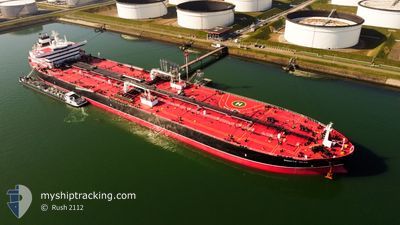
The vessel MONTE ULIA (IMO: 9803285, MMSI: 255806025) is a Tanker It's sailing under the flag of [PT] Portugal.
In this page you can find informations about the vessels current position, last detected port calls, and current voyage information. If the vessels is not in coverage by AIS you will find the latest position.
The current position of MONTE ULIA is detected by our AIS receivers and we are not responsible for the reliability of the data. The last position was recorded while the vessel was in Coverage by the Ais receivers of our vessel tracking app.
The current draught of MONTE ULIA as reported by AIS is 9.3 meters
Weather
| Temperature | 11.6°C / 52.88°F |
|---|---|
| Wind Speed | 9 knots |
| Direction | 260° W |
| Pressure | 1006.3 hPa |
| Humidity | 66.9 % |
| Cloud Coverage | 75 % |
Featured Company
Last Port Calls
| Port | Arrival | Departure | Time In Port |
|---|---|---|---|
| 2024-04-17 10:50 | 2024-04-19 14:37 | 2 d | |
| 2024-03-28 07:56 | 2024-03-30 17:28 | 2 d | |
| 2024-03-09 14:43 | 2024-03-10 21:32 | 1 d | |
| 2024-03-02 15:45 | 2024-03-04 23:49 | 2 d | |
| 2024-02-24 10:07 | 2024-02-27 12:22 | 3 d | |
| 2024-02-07 01:41 | 2024-02-10 17:21 | 3 d |
Last Trips
| Origin | Departure | Destination | Arrival | Distance | |
|---|---|---|---|---|---|
| 2024-03-30 19:28 | 2024-04-17 12:50 | 4354.90 nm | |||
| 2024-03-10 22:32 | 2024-03-28 09:56 | 3512.75 nm | |||
| 2024-03-05 00:49 | 2024-03-09 15:43 | 959.95 nm | |||
| 2024-02-27 13:22 | 2024-03-02 16:45 | 1208.82 nm | |||
| 2024-02-10 18:21 | 2024-02-24 11:07 | 926.41 nm | |||
| 2023-12-18 20:45 | 2024-02-07 02:41 | 7493.65 nm |
Events
| Tid | Event | Detaljer | Position / Dest | Information |
|---|---|---|---|---|
| 2024-04-25 13:38 | Status ändrad | Default Under way using engine |
48.07982 / -5.85995
SETUBAL
|
Fart: 0.3 kn Kurs: 201° |
| 2024-04-25 13:23 | UTANFÖR täckningsområde |
48.08031 / -5.86347
Celtic Sea
SETUBAL
|
Fart: 0.3 kn Kurs: 125.1° |
|
| 2024-04-25 13:12 | STOPPAR förflyttning |
48.08126 / -5.86435
SETUBAL
|
Fart: 0.3 kn Kurs: 214° |
|
| 2024-04-25 10:56 | Byter havsområde | French part of the Celtic Sea French part of the English Channel |
48.40022 / -5.96683
Celtic Sea
SETUBAL
|
Fart: 11.6 kn Kurs: 176.8° |
| 2024-04-25 10:55 | Status ändrad | Under way using engine Default |
48.40455 / -5.96715
SETUBAL
|
Fart: 11 kn Kurs: 174° |
| 2024-04-25 10:40 | I täckningsområde |
48.40022 / -5.96683
Celtic Sea
SETUBAL
|
Fart: 11.6 kn Kurs: 176.8° |
|
| 2024-04-25 02:10 | Status ändrad | Default Under way using engine |
49.41149 / -4.39819
SETUBAL
|
Fart: 11.1 kn Kurs: 239.1° |
| 2024-04-25 02:06 | UTANFÖR täckningsområde |
49.41884 / -4.37922
English Channel
SETUBAL
|
Fart: 11.1 kn Kurs: 239.1° |
|
| 2024-04-25 01:41 | Status ändrad | Under way using engine Default |
49.45859 / -4.27609
SETUBAL
|
Fart: 11.6 kn Kurs: 240° |
| 2024-04-25 01:14 | Status ändrad | Default Under way using engine |
49.50220 / -4.16036
SETUBAL
|
Fart: 12.1 kn Kurs: 240.6° |