
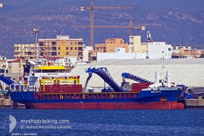
SEHER S
General Cargo
Current Trip
| Time Travelled | 12 days |
|---|---|
| Remaining Time | 1 h, 28 mins |
| Distance Travelled | 2783.62 nm |
| Remaining Distance | 165.36 nm |
| AVG Speed | 9.5 Knop |
| MAX Speed | 11.6 Knop |
| AVG Wind | 15.5 knots |
| MAX Wind | 29 knots |
| MIN Temp | 12.8°C / 55.04°F |
| MAX Temp | 25.1°C / 77.18°F |
| Djupgående | 5.3 m |
| Position mottagen | 1 d sen |
Current Position
| Longitud | 28.98903° |
|---|---|
| Latitude | 34.23144° |
| Status | Under way using engine |
| Fart | 10.4 Knop |
| Kurs | 107.3° |
| Område | Mediterranean Sea - Eastern Basin |
| Station | T-AIS |
| Position mottagen | 1 d sen |
Info
Information
The current position of SEHER S is in Mediterranean Sea - Eastern Basin with coordinates 34.23144° / 28.98903° as reported on 2024-04-17 14:33 by AIS to our vessel tracker app. The vessel's current speed is 10.4 Knop and is heading at the port of HAIFA. The estimated time of arrival as calculated by MyShipTracking vessel tracking app is 2024-04-18 19:08 LT
The vessel SEHER S (IMO: 9198604, MMSI: 375115000) is a General Cargo that was built in 2001 ( 23 År gammal ). It's sailing under the flag of [VC] St Vincent Grenadines.
In this page you can find informations about the vessels current position, last detected port calls, and current voyage information. If the vessels is not in coverage by AIS you will find the latest position.
The current position of SEHER S is detected by our AIS receivers and we are not responsible for the reliability of the data. The last position was recorded while the vessel was in Coverage by the Ais receivers of our vessel tracking app.
The current draught of SEHER S as reported by AIS is 5.3 meters
Weather
| Temperature | 19.4°C / 66.92°F |
|---|---|
| Wind Speed | 17 knots |
| Direction | 280° W |
| Pressure | 1008.4 hPa |
| Humidity | 79.9 % |
| Cloud Coverage | 49 % |
Featured Company
Last Port Calls
| Port | Arrival | Departure | Time In Port |
|---|---|---|---|
| 2024-04-01 18:00 | 2024-04-05 17:47 | 3 d | |
| 2024-03-20 21:52 | 2024-03-23 15:11 | 2 d | |
| 2024-03-02 01:52 | 2024-03-04 23:02 | 2 d | |
| 2024-02-23 20:31 | 2024-02-28 15:10 | 4 d | |
| 2024-02-18 00:26 | 2024-02-20 20:41 | 2 d | |
| 2024-02-10 16:14 | 2024-02-13 15:31 | 2 d |
Last Trips
| Origin | Departure | Destination | Arrival | Distance | |
|---|---|---|---|---|---|
| 2024-03-23 15:11 | 2024-04-01 20:00 | 754.44 nm | |||
| 2024-03-05 02:02 | 2024-03-20 21:52 | 3211.88 nm | |||
| 2024-02-28 17:10 | 2024-03-02 04:52 | 366.07 nm | |||
| 2024-02-20 22:41 | 2024-02-23 22:31 | 701.10 nm | |||
| 2024-02-13 17:31 | 2024-02-18 02:26 | 136.90 nm | |||
| 2024-01-26 00:48 | 2024-02-10 18:14 | 3525.64 nm |
Events
| Tid | Event | Detaljer | Position / Dest | Information |
|---|---|---|---|---|
| 2024-04-17 14:42 | Status ändrad | Default Under way using engine |
34.22413 / 29.01994
ILHFA
|
Fart: 10.4 kn Kurs: 107.3° |
| 2024-04-17 14:33 | UTANFÖR täckningsområde |
34.23144 / 28.98903
Mediterranean Sea - Eastern Basin
ILHFA
|
Fart: 10.4 kn Kurs: 107.3° |
|
| 2024-04-17 14:13 | Status ändrad | Under way using engine Default |
34.24716 / 28.92209
ILHFA
|
Fart: 10.9 kn Kurs: 104° |
| 2024-04-17 14:13 | I täckningsområde |
34.24716 / 28.92209
Mediterranean Sea - Eastern Basin
ILHFA
|
Fart: 10.5 kn Kurs: 106.7° |
|
| 2024-04-17 08:42 | Status ändrad | Default Under way using engine |
34.48290 / 27.85422
ILHFA
|
Fart: 9.8 kn Kurs: 105.5° |
| 2024-04-17 08:36 | UTANFÖR täckningsområde |
34.48743 / 27.83484
Mediterranean Sea - Eastern Basin
ILHFA
|
Fart: 9.8 kn Kurs: 105.5° |
|
| 2024-04-17 07:46 | Status ändrad | Under way using engine Default |
34.52220 / 27.67387
ILHFA
|
Fart: 9.9 kn Kurs: 105° |
| 2024-04-17 07:35 | Status ändrad | Default Under way using engine |
34.52970 / 27.63889
ILHFA
|
Fart: 9.9 kn Kurs: 106.6° |
| 2024-04-17 07:27 | Status ändrad | Under way using engine Default |
34.53528 / 27.61237
ILHFA
|
Fart: 10 kn Kurs: 105° |
| 2024-04-17 07:18 | Status ändrad | Default Under way using engine |
34.54176 / 27.58271
ILHFA
|
Fart: 10 kn Kurs: 103.6° |