
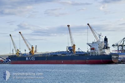
MIM VANGELIS JR
Bulk Carrier
Current Trip
BALTIMORE
| Time Travelled | 7 h, 45 mins |
|---|---|
| Remaining Time | --- |
| Distance Travelled | 21.52 nm |
| Remaining Distance | --- |
| AVG Speed | 11 Knop |
| MAX Speed | 13.4 Knop |
| AVG Wind | 2.4 knots |
| MAX Wind | 5 knots |
| MIN Temp | 0.8°C / 33.44°F |
| MAX Temp | 6.4°C / 43.52°F |
| Djupgående | 8.2 m |
| Position mottagen | 2 m sen |
Current Position
| Longitud | --- |
|---|---|
| Latitude | --- |
| Status | At anchor |
| Fart | |
| Kurs | 182° |
| Område | North Atlantic Ocean |
| Station | T-AIS |
| Position mottagen | 2 m sen |
Info
Information
The current position of MIM VANGELIS JR is in North Atlantic Ocean with coordinates 38.96842° / -76.40657° as reported on 2025-12-07 20:58 by AIS to our vessel tracker app. The vessel's current speed is 0 Knop
The vessel MIM VANGELIS JR (IMO: 9302786, MMSI: 636017521) is a Bulk Carrier that was built in 2005 ( 20 År gammal ). It's sailing under the flag of [LR] Liberia.
In this page you can find informations about the vessels current position, last detected port calls, and current voyage information. If the vessels is not in coverage by AIS you will find the latest position.
The current position of MIM VANGELIS JR is detected by our AIS receivers and we are not responsible for the reliability of the data. The last position was recorded while the vessel was in Coverage by the Ais receivers of our vessel tracking app.
The current draught of MIM VANGELIS JR as reported by AIS is 8.2 meters
Weather
| Temperature | 6.4°C / 43.52°F |
|---|---|
| Wind Speed | 5 knots |
| Direction | 216° SW |
| Pressure | 1018.2 hPa |
| Humidity | 60.2 % |
| Cloud Coverage | 72 % |
Featured Company
Last Port Calls
| Port | Arrival | Departure | Time In Port |
|---|---|---|---|
| 2025-12-06 00:01 | 2025-12-07 08:16 | 1 d | |
| 2025-11-14 07:26 | 2025-11-14 16:57 | 9 h | |
| 2025-11-06 17:13 | 2025-11-11 23:18 | 5 d | |
| 2025-10-22 05:52 | 2025-10-22 15:40 | 9 h | |
| 2025-10-01 02:48 |
Most Visited Ports (Last year)
| Port | Arrivals | |
|---|---|---|
| 4 | ||
| 2 | ||
| 1 | ||
| 1 | ||
| 1 | ||
| 1 |
Last Trips
| Origin | Departure | Destination | Arrival | Distance | |
|---|---|---|---|---|---|
| 2025-11-11 23:18 | 2025-12-06 00:01 | 6193.71 nm | |||
| 2025-11-11 23:18 | 2025-11-14 07:26 | 602.42 nm | |||
| 2025-10-01 02:48 | 2025-11-06 17:13 | 7348.47 nm | |||
| 2025-10-01 02:48 | 2025-10-22 05:52 | 5273.51 nm |
Events
| Tid | Event | Detaljer | Position / Dest | Information |
|---|---|---|---|---|
| 2025-12-07 15:13 | STOPPAR förflyttning | 13.83 nm, North West of SAINT MICHAELS |
38.96438 / -76.40822
BALTIMORE
|
Fart: 0.2 kn Kurs: 32° |
| 2025-12-07 15:13 | Djupgående ändrat | 8.2 5.2 |
38.96463 / -76.40817
BALTIMORE
|
Fart: 0.5 kn Kurs: 36° |
| 2025-12-07 15:13 | ETA ändrat | 2025/12/05 17:00 |
38.96463 / -76.40817
BALTIMORE
|
Fart: 0.5 kn Kurs: 36° |
| 2025-12-07 15:10 | Djupgående ändrat | 5.2 8.2 |
38.96475 / -76.40807
BALTIMORE
|
Fart: 0.6 kn Kurs: 36° |
| 2025-12-07 15:10 | Status ändrad | At anchor Under way using engine |
38.96475 / -76.40807
BALTIMORE
|
Fart: 0.6 kn Kurs: 36° |
| 2025-12-07 13:16 | AVGÅTT HAMN |
|
39.23708 / -76.54847
BALTIMORE
|
Fart: 7.1 kn Kurs: 145° |
| 2025-12-07 13:13 | STARTAR förflyttning |
39.24113 / -76.55200
[US] BALTIMORE
|
Fart: 3.2 kn Kurs: 142° |
|
| 2025-12-07 12:50 | Status ändrad | Under way using engine At anchor |
39.24627 / -76.55190
[US] BALTIMORE
|
Fart: 0.2 kn Kurs: 281° |
| 2025-12-06 12:32 | Status ändrad | At anchor Default |
39.24560 / -76.55587
[US] BALTIMORE
|
Fart: Kurs: 77° |
| 2025-12-06 12:29 | Status ändrad | Default At anchor |
39.24552 / -76.55585
[US] BALTIMORE
|
Fart: Kurs: 75° |