
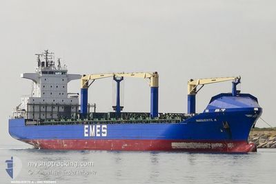
MARGUERITE A
Container Ship
Current Trip
| Time Travelled | 2 days |
|---|---|
| Remaining Time | --- |
| Distance Travelled | 261.91 nm |
| Remaining Distance | 3.47 nm |
| AVG Speed | 12.2 Knop |
| MAX Speed | 16.6 Knop |
| AVG Wind | 7 knots |
| MAX Wind | 28 knots |
| MIN Temp | 15.2°C / 59.36°F |
| MAX Temp | 23.7°C / 74.66°F |
| Djupgående | 8.2 m |
| Position mottagen | 1 h, 38 m sen |
Current Position
| Longitud | 26.93961° |
|---|---|
| Latitude | 38.89842° |
| Status | At anchor |
| Fart | 0.1 Knop |
| Kurs | --- |
| Område | Aegean Sea |
| Station | T-AIS |
| Position mottagen | 1 h, 38 m sen |
Info
Information
The current position of MARGUERITE A is in Aegean Sea with coordinates 38.89842° / 26.93961° as reported on 2024-04-25 11:35 by AIS to our vessel tracker app. The vessel's current speed is 0.1 Knop and is heading at the port of ALIAGA. The estimated time of arrival as calculated by MyShipTracking vessel tracking app is 2024-04-24 02:00 LT
The vessel MARGUERITE A (IMO: 9305893, MMSI: 215416000) is a Container Ship that was built in 2005 ( 19 År gammal ). It's sailing under the flag of [MT] Malta.
In this page you can find informations about the vessels current position, last detected port calls, and current voyage information. If the vessels is not in coverage by AIS you will find the latest position.
The current position of MARGUERITE A is detected by our AIS receivers and we are not responsible for the reliability of the data. The last position was recorded while the vessel was in Coverage by the Ais receivers of our vessel tracking app.
The current draught of MARGUERITE A as reported by AIS is 8.2 meters
Weather
| Temperature | 22.6°C / 72.68°F |
|---|---|
| Wind Speed | 14 knots |
| Direction | 219° SW |
| Pressure | 1005 hPa |
| Humidity | 48.9 % |
| Cloud Coverage | 8 % |
Featured Company
Last Port Calls
| Port | Arrival | Departure | Time In Port |
|---|---|---|---|
| 2024-04-22 16:43 | 2024-04-23 07:32 | 14 h | |
| 2024-04-21 21:11 | 2024-04-22 09:21 | 12 h | |
| 2024-04-20 23:00 | 2024-04-21 16:36 | 17 h | |
| 2024-04-15 14:48 | 2024-04-16 20:23 | 1 d | |
| 2024-04-14 07:29 | 2024-04-15 11:19 | 1 d | |
| 2024-04-11 16:40 | 2024-04-12 16:58 | 1 d | |
| 2024-04-09 00:48 | 2024-04-09 13:05 | 12 h | |
| 2024-04-07 13:56 | 2024-04-08 06:46 | 16 h | |
| 2024-04-05 08:14 | 2024-04-06 17:29 | 1 d | |
| 2024-04-02 21:56 | 2024-04-04 05:38 | 1 d |
Last Trips
| Origin | Departure | Destination | Arrival | Distance | |
|---|---|---|---|---|---|
| 2024-04-22 12:21 | 2024-04-22 19:43 | 57.51 nm | |||
| 2024-04-21 19:36 | 2024-04-22 00:11 | 60.26 nm | |||
| 2024-04-16 22:23 | 2024-04-21 02:00 | 1319.40 nm | |||
| 2024-04-15 13:19 | 2024-04-15 16:48 | 51.69 nm | |||
| 2024-04-12 18:58 | 2024-04-14 09:29 | 373.84 nm | |||
| 2024-04-09 16:05 | 2024-04-11 18:40 | 798.86 nm | |||
| 2024-04-08 09:46 | 2024-04-09 03:48 | 250.96 nm | |||
| 2024-04-06 20:29 | 2024-04-07 16:56 | 50.96 nm | |||
| 2024-04-04 08:38 | 2024-04-05 11:14 | 74.93 nm | |||
| 2024-03-29 12:07 | 2024-04-03 00:56 | 1316.54 nm |
Events
| Tid | Event | Detaljer | Position / Dest | Information |
|---|---|---|---|---|
| 2024-04-25 11:38 | Status ändrad | Default At anchor |
38.89827 / 26.93979
TRALI
|
Fart: 0.1 kn Kurs: 511° |
| 2024-04-25 11:35 | Status ändrad | At anchor Default |
38.89842 / 26.93961
TRALI
|
Fart: 0.3 kn Kurs: -1° |
| 2024-04-25 11:35 | I täckningsområde |
38.89842 / 26.93961
Aegean Sea
|
Fart: 0.1 kn Kurs: 137.5° |
|
| 2024-04-25 11:35 | UTANFÖR täckningsområde |
38.89842 / 26.93961
Aegean Sea
|
Fart: 0.1 kn Kurs: 137.5° |
|
| 2024-04-25 06:47 | Status ändrad | Default At anchor |
38.89521 / 26.93992
TRALI
|
Fart: Kurs: 511° |
| 2024-04-25 06:41 | Status ändrad | At anchor Default |
38.89518 / 26.93995
TRALI
|
Fart: Kurs: -1° |
| 2024-04-25 06:41 | I täckningsområde |
38.89518 / 26.93995
Aegean Sea
|
Fart: Kurs: 203.5° |
|
| 2024-04-25 06:41 | UTANFÖR täckningsområde |
38.89518 / 26.93995
Aegean Sea
|
Fart: Kurs: 203.5° |
|
| 2024-04-25 05:11 | Status ändrad | Default At anchor |
38.89538 / 26.94024
TRALI
|
Fart: Kurs: 511° |
| 2024-04-25 05:05 | UTANFÖR täckningsområde |
38.89535 / 26.94019
Aegean Sea
|
Fart: Kurs: 160.5° |