
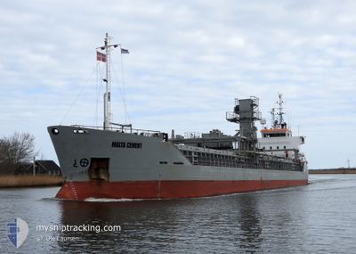
MALTA CEMENT
Cement Carrier
Current Trip
| Trip Time | 5 days |
|---|---|
| Trip Distance | 1111.45 nm |
| AVG Speed | 10.1 Knop |
| MAX Speed | 14.4 Knop |
| Djupgående | 3.8 m |
| AVG Wind | 19 knots |
| MAX Wind | 32 knots |
| MIN Temp | 5.5°C / 41.9°F |
| MAX Temp | 14.8°C / 58.64°F |
| Position mottagen | 3 m sen |
Current Position
| Longitud | 12.10958° |
|---|---|
| Latitude | 54.15006° |
| Status | Moored |
| Fart | |
| Kurs | 341° |
| Område | Baltic Sea |
| Station | T-AIS |
| Position mottagen | 3 m sen |
Info
Information
The current position of MALTA CEMENT is in Baltic Sea with coordinates 54.15006° / 12.10958° as reported on 2024-04-16 04:24 by AIS to our vessel tracker app. The vessel's current speed is 0 Knop and is currently inside the port of ROSTOCK.
The vessel MALTA CEMENT (IMO: 8911841, MMSI: 244090800) is a Cement Carrier that was built in 1991 ( 33 År gammal ). It's sailing under the flag of [NL] Netherlands.
In this page you can find informations about the vessels current position, last detected port calls, and current voyage information. If the vessels is not in coverage by AIS you will find the latest position.
The current position of MALTA CEMENT is detected by our AIS receivers and we are not responsible for the reliability of the data. The last position was recorded while the vessel was in Coverage by the Ais receivers of our vessel tracking app.
The current draught of MALTA CEMENT as reported by AIS is 3.8 meters
Weather
| Temperature | 6°C / 42.8°F |
|---|---|
| Wind Speed | 20 knots |
| Direction | 252° WSW |
| Pressure | 994.4 hPa |
| Humidity | 85.9 % |
| Cloud Coverage | 100 % |
Featured Company
Last Port Calls
| Port | Arrival | Departure | Time In Port |
|---|---|---|---|
| 2024-04-14 22:47 | |||
| 2024-04-07 18:37 | 2024-04-09 03:28 | 1 d | |
| 2024-04-05 07:07 | 2024-04-06 07:58 | 1 d | |
| 2024-04-01 20:43 | 2024-04-03 19:30 | 1 d | |
| 2024-03-26 11:51 | 2024-03-28 00:25 | 1 d | |
| 2024-03-23 18:00 | 2024-03-24 22:15 | 1 d | |
| 2024-03-20 12:00 | 2024-03-22 05:40 | 1 d | |
| 2024-02-22 06:06 | 2024-03-19 17:35 | 26 d | |
| 2024-02-17 22:03 | 2024-02-19 11:58 | 1 d | |
| 2024-02-11 13:01 | 2024-02-13 02:53 | 1 d |
Last Trips
| Origin | Departure | Destination | Arrival | Distance | |
|---|---|---|---|---|---|
| 2024-04-09 05:28 | 2024-04-15 00:47 | 1111.45 nm | |||
| 2024-04-06 09:58 | 2024-04-07 20:37 | 366.64 nm | |||
| 2024-04-03 21:30 | 2024-04-05 09:07 | 366.32 nm | |||
| 2024-03-28 01:25 | 2024-04-01 22:43 | 920.66 nm | |||
| 2024-03-24 23:15 | 2024-03-26 12:51 | 371.06 nm | |||
| 2024-03-22 06:40 | 2024-03-23 19:00 | 365.59 nm | |||
| 2024-03-19 18:35 | 2024-03-20 13:00 | 177.96 nm | |||
| 2024-02-19 12:58 | 2024-02-22 07:06 | 267.51 nm | |||
| 2024-02-13 03:53 | 2024-02-17 23:03 | 880.40 nm | |||
| 2024-02-10 20:46 | 2024-02-11 14:01 | 165.40 nm |
Events
| Tid | Event | Detaljer | Position / Dest | Information |
|---|---|---|---|---|
| 2024-04-15 17:21 | Status ändrad | Moored Default |
54.15010 / 12.10949
[DE] ROSTOCK
|
Fart: Kurs: 341° |
| 2024-04-15 17:18 | Status ändrad | Default Moored |
54.15012 / 12.10950
[DE] ROSTOCK
|
Fart: Kurs: 342° |
| 2024-04-14 23:40 | Status ändrad | Moored Under way using engine |
54.15011 / 12.10949
[DE] ROSTOCK
|
Fart: Kurs: 340° |
| 2024-04-14 23:22 | STOPPAR förflyttning |
54.15012 / 12.10961
[DE] ROSTOCK
|
Fart: 0.2 kn Kurs: 336° |
|
| 2024-04-14 22:47 | ANLÄNDER HAMN |
|
54.18837 / 12.08882
[DE] ROSTOCK
|
Fart: 6.5 kn Kurs: 162.7° |
| 2024-04-14 20:55 | Byter havsområde | German part of the Baltic Sea Danish part of the Baltic Sea |
54.46089 / 12.17353
Baltic Sea
DERSK
|
Fart: 9.2 kn Kurs: 204.8° |
| 2024-04-14 15:37 | Byter havsområde | Danish part of the Baltic Sea Swedish part of the Kattegat |
55.32455 / 12.64020
Baltic Sea
DERSK
|
Fart: 11.2 kn Kurs: 187.7° |
| 2024-04-14 14:49 | Byter havsområde | Swedish part of the Kattegat Danish part of the Kattegat |
55.46659 / 12.68315
Kattegat
DERSK
|
Fart: 11.5 kn Kurs: 192.1° |
| 2024-04-14 10:37 | Byter havsområde | Danish part of the Kattegat Swedish part of the Kattegat |
56.22576 / 12.33339
Kattegat
DERSK
|
Fart: 11.1 kn Kurs: 156° |
| 2024-04-14 09:35 | Byter havsområde | Swedish part of the Kattegat Danish part of the Kattegat |
56.37365 / 12.11388
Kattegat
DERSK
|
Fart: 11.4 kn Kurs: 147.6° |