
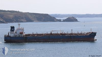
MAGNIFICA
Oil/Chemical Tanker
Current Trip
| Time Travelled | 8 days |
|---|---|
| Remaining Time | 2 days |
| Distance Travelled | 2252.47 nm |
| Remaining Distance | 738.53 nm |
| AVG Speed | 11.4 Knop |
| MAX Speed | 13.1 Knop |
| AVG Wind | 10.2 knots |
| MAX Wind | 28.8 knots |
| MIN Temp | 5.5°C / 41.9°F |
| MAX Temp | 17.9°C / 64.22°F |
| Djupgående | 7.3 m |
| Position mottagen | 2 d sen |
Current Position
| Longitud | 0.16610° |
|---|---|
| Latitude | 36.72943° |
| Status | Under way using engine |
| Fart | 11.1 Knop |
| Kurs | 80° |
| Område | Mediterranean Sea - Western Basin |
| Station | T-AIS |
| Position mottagen | 2 d sen |
Info
Information
The current position of MAGNIFICA is in Mediterranean Sea - Western Basin with coordinates 36.72943° / 0.16610° as reported on 2024-04-23 10:39 by AIS to our vessel tracker app. The vessel's current speed is 11.1 Knop and is heading at the port of PIRAEUS. The estimated time of arrival as calculated by MyShipTracking vessel tracking app is 2024-04-28 00:03 LT
The vessel MAGNIFICA (IMO: 9374234, MMSI: 247271400) is a Oil/Chemical Tanker that was built in 2009 ( 15 År gammal ). It's sailing under the flag of [IT] Italy.
In this page you can find informations about the vessels current position, last detected port calls, and current voyage information. If the vessels is not in coverage by AIS you will find the latest position.
The current position of MAGNIFICA is detected by our AIS receivers and we are not responsible for the reliability of the data. The last position was recorded while the vessel was in Coverage by the Ais receivers of our vessel tracking app.
The current draught of MAGNIFICA as reported by AIS is 7.3 meters
Weather
| Temperature | 15°C / 59°F |
|---|---|
| Wind Speed | 11 knots |
| Direction | 272° W |
| Pressure | 1013.6 hPa |
| Humidity | 68.4 % |
| Cloud Coverage | 33 % |
Featured Company
Last Port Calls
| Port | Arrival | Departure | Time In Port |
|---|---|---|---|
| 2024-04-15 00:30 | 2024-04-17 08:01 | 2 d | |
| 2024-03-28 17:47 | 2024-03-30 12:05 | 1 d | |
| 2024-03-18 14:16 | 2024-03-20 23:39 | 2 d | |
| 2024-03-10 07:00 | 2024-03-11 10:19 | 1 d | |
| 2024-03-02 11:06 | 2024-03-03 16:30 | 1 d | |
| 2024-02-15 09:50 | 2024-02-16 12:07 | 1 d | |
| 2024-02-08 17:04 | 2024-02-10 17:24 | 2 d | |
| 2024-02-05 14:04 | 2024-02-06 16:00 | 1 d |
Most Visited Ports (Last year)
| Port | Arrivals | |
|---|---|---|
| 10 | ||
| 5 | ||
| 2 | ||
| 2 | ||
| 2 | ||
| 2 |
Last Trips
| Origin | Departure | Destination | Arrival | Distance | |
|---|---|---|---|---|---|
| 2024-03-30 14:05 | 2024-04-15 02:30 | 3354.47 nm | |||
| 2024-03-21 00:39 | 2024-03-28 19:47 | 1443.27 nm | |||
| 2024-03-11 11:19 | 2024-03-18 15:16 | 636.29 nm | |||
| 2024-03-03 17:30 | 2024-03-10 08:00 | 1341.42 nm | |||
| 2024-02-16 13:07 | 2024-03-02 12:06 | 1715.18 nm | |||
| 2024-02-10 18:24 | 2024-02-15 10:50 | 300.61 nm | |||
| 2024-02-06 17:00 | 2024-02-08 18:04 | 432.98 nm | |||
| 2024-01-23 18:14 | 2024-02-05 15:04 | 812.83 nm |
Events
| Tid | Event | Detaljer | Position / Dest | Information |
|---|---|---|---|---|
| 2024-04-23 11:02 | Status ändrad | Default Under way using engine |
36.74952 / .28880
GR PIR
|
Fart: 11.1 kn Kurs: 80° |
| 2024-04-23 10:39 | UTANFÖR täckningsområde |
36.72943 / .16610
Mediterranean Sea - Western Basin
GR PIR
|
Fart: 11.1 kn Kurs: 80° |
|
| 2024-04-23 05:06 | Upptäckt i hav | Algerian part of the Mediterranean Sea - Western Basin |
36.54095 / -1.05980
Mediterranean Sea - Western Basin
GR PIR
|
Fart: 10.8 kn Kurs: 78° |
| 2024-04-23 01:35 | Upptäckt i hav | Spanish part of the Mediterranean Sea - Western Basin |
36.41383 / -1.87993
Mediterranean Sea - Western Basin
GR PIR
|
Fart: 12 kn Kurs: 76° |
| 2024-04-23 01:35 | Status ändrad | Under way using engine Default |
36.41383 / -1.87993
GR PIR
|
Fart: 12.3 kn Kurs: 78° |
| 2024-04-23 01:35 | I täckningsområde |
36.41383 / -1.87993
Mediterranean Sea - Western Basin
GR PIR
|
Fart: 12 kn Kurs: 76° |
|
| 2024-04-22 21:57 | Status ändrad | Default Under way using engine |
36.30797 / -2.67207
GR PIR
|
Fart: 10.9 kn Kurs: 83° |
| 2024-04-22 21:33 | UTANFÖR täckningsområde |
36.27523 / -2.94768
Alboran Sea
GR PIR
|
Fart: 10.9 kn Kurs: 83° |
|
| 2024-04-22 20:36 | Status ändrad | Under way using engine Default |
36.27147 / -2.98467
GR PIR
|
Fart: 10.9 kn Kurs: 83° |
| 2024-04-22 20:14 | Status ändrad | Default Under way using engine |
36.26263 / -3.06402
GR PIR
|
Fart: 11 kn Kurs: 81° |