
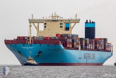
MAERSKMCKINNEYMOLLER
Container Ship
Current Trip
| Time Travelled | 21 days |
|---|---|
| Remaining Time | --- |
| Distance Travelled | 9009.16 nm |
| Remaining Distance | --- |
| AVG Speed | 17.7 Knop |
| MAX Speed | 20.5 Knop |
| AVG Wind | 15.4 knots |
| MAX Wind | 31 knots |
| MIN Temp | 8.4°C / 47.12°F |
| MAX Temp | 29.5°C / 85.1°F |
| Djupgående | 15.2 m |
| Position mottagen | 1 d sen |
Current Position
| Longitud | 55.76228° |
|---|---|
| Latitude | -20.35848° |
| Status | Under way using engine |
| Fart | 19.3 Knop |
| Kurs | 62° |
| Område | Indian Ocean |
| Station | T-AIS |
| Position mottagen | 1 d sen |
Info
Information
The current position of MAERSKMCKINNEYMOLLER is in Indian Ocean with coordinates -20.35848° / 55.76228° as reported on 2024-04-18 01:51 by AIS to our vessel tracker app. The vessel's current speed is 19.3 Knop and is heading at the port of TANJUNG PELEPAS. The estimated time of arrival as calculated by MyShipTracking vessel tracking app is 2024-04-25 18:30 LT
The vessel MAERSKMCKINNEYMOLLER (IMO: 9619907, MMSI: 219018271) is a Container Ship that was built in 2013 ( 11 År gammal ). It's sailing under the flag of [DK] Denmark.
In this page you can find informations about the vessels current position, last detected port calls, and current voyage information. If the vessels is not in coverage by AIS you will find the latest position.
The current position of MAERSKMCKINNEYMOLLER is detected by our AIS receivers and we are not responsible for the reliability of the data. The last position was recorded while the vessel was in Coverage by the Ais receivers of our vessel tracking app.
The current draught of MAERSKMCKINNEYMOLLER as reported by AIS is 15.2 meters
Weather
| Temperature | 28.6°C / 83.48°F |
|---|---|
| Wind Speed | 15 knots |
| Direction | 96° E |
| Pressure | 1011.6 hPa |
| Humidity | 75.2 % |
| Cloud Coverage | 7 % |
Featured Company
Last Port Calls
| Port | Arrival | Departure | Time In Port |
|---|---|---|---|
| 2024-03-27 21:14 | 2024-03-29 14:57 | 1 d | |
| 2024-03-24 21:39 | 2024-03-26 08:30 | 1 d | |
| 2024-03-19 12:10 | 2024-03-22 14:47 | 3 d | |
| 2024-03-14 12:08 | 2024-03-16 05:47 | 1 d | |
| 2024-03-07 05:55 | 2024-03-08 10:20 | 1 d | |
| 2024-02-08 17:53 | 2024-02-09 23:14 | 1 d | |
| 2024-02-02 07:06 | 2024-02-03 05:02 | 21 h |
Most Visited Ports (Last year)
| Port | Arrivals | |
|---|---|---|
| 6 | ||
| 5 | ||
| 4 | ||
| 4 | ||
| 3 | ||
| 3 |
Last Trips
| Origin | Departure | Destination | Arrival | Distance | |
|---|---|---|---|---|---|
| 2024-03-26 09:30 | 2024-03-27 22:14 | 309.05 nm | |||
| 2024-03-22 15:47 | 2024-03-24 22:39 | 915.16 nm | |||
| 2024-03-16 06:47 | 2024-03-19 13:10 | 928.31 nm | |||
| 2024-03-08 11:20 | 2024-03-14 13:08 | 1899.88 nm | |||
| 2024-02-10 07:14 | 2024-03-07 06:55 | 10748.67 nm | |||
| 2024-02-03 13:02 | 2024-02-09 01:53 | 1490.54 nm | |||
| 2024-01-27 08:04 | 2024-02-02 15:06 | 1250.62 nm |
Events
| Tid | Event | Detaljer | Position / Dest | Information |
|---|---|---|---|---|
| 2024-04-18 01:55 | Status ändrad | Default Under way using engine |
-20.34725 / 55.78397
NLROT>>>MYTPP
|
Fart: 19.3 kn Kurs: 62° |
| 2024-04-18 01:51 | UTANFÖR täckningsområde |
-20.35848 / 55.76228
Indian Ocean
NLROT>>>MYTPP
|
Fart: 19.3 kn Kurs: 62° |
|
| 2024-04-18 01:45 | Status ändrad | Under way using engine Default |
-20.37208 / 55.73578
NLROT>>>MYTPP
|
Fart: 19.2 kn Kurs: 61° |
| 2024-04-18 01:42 | Status ändrad | Default Under way using engine |
-20.38030 / 55.71977
NLROT>>>MYTPP
|
Fart: 19.1 kn Kurs: 61.4° |
| 2024-04-17 21:17 | Byter havsområde | R�union part of the Indian Ocean South African part of the South Atlantic Ocean |
-21.13252 / 54.44667
Indian Ocean
NLROT>>>MYTPP
|
Fart: 18.7 kn Kurs: 50.4° |
| 2024-04-17 21:17 | Status ändrad | Under way using engine Default |
-21.13252 / 54.44667
NLROT>>>MYTPP
|
Fart: 18.7 kn Kurs: 51° |
| 2024-04-17 21:11 | I täckningsområde |
-21.13252 / 54.44667
Indian Ocean
NLROT>>>MYTPP
|
Fart: 18.7 kn Kurs: 50.4° |
|
| 2024-04-13 00:52 | Status ändrad | Default Under way using engine |
-34.81893 / 18.57477
NLROT>>>MYTPP
|
Fart: 17.6 kn Kurs: 108.6° |
| 2024-04-13 00:47 | UTANFÖR täckningsområde |
-34.81050 / 18.54415
South Atlantic Ocean
NLROT>>>MYTPP
|
Fart: 17.6 kn Kurs: 108.6° |
|
| 2024-04-12 22:24 | Status ändrad | Under way using engine Default |
-34.45758 / 17.88720
NLROT>>>MYTPP
|
Fart: 15 kn Kurs: 144° |