
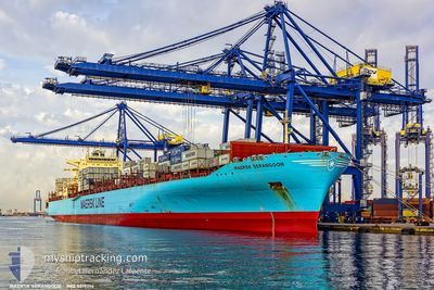
MAERSK SERANGOON
Container Ship
Current Trip
| Time Travelled | 3 days |
|---|---|
| Remaining Time | --- |
| Distance Travelled | 610.22 nm |
| Remaining Distance | --- |
| AVG Speed | 13.3 Knop |
| MAX Speed | 17.3 Knop |
| AVG Wind | 9 knots |
| MAX Wind | 31.3 knots |
| MIN Temp | 12.5°C / 54.5°F |
| MAX Temp | 23.7°C / 74.66°F |
| Djupgående | 12.6 m |
| Position mottagen | 3 m sen |
Current Position
| Longitud | 2.28595° |
|---|---|
| Latitude | 41.05013° |
| Status | Under way using engine |
| Fart | 0.8 Knop |
| Kurs | 232° |
| Område | Balearic Sea |
| Station | T-AIS |
| Position mottagen | 3 m sen |
Info
Information
The current position of MAERSK SERANGOON is in Balearic Sea with coordinates 41.05013° / 2.28595° as reported on 2024-04-19 05:26 by AIS to our vessel tracker app. The vessel's current speed is 0.8 Knop
The vessel MAERSK SERANGOON (IMO: 9315214, MMSI: 565449000) is a Container Ship that was built in 2007 ( 17 År gammal ). It's sailing under the flag of [SG] Singapore.
In this page you can find informations about the vessels current position, last detected port calls, and current voyage information. If the vessels is not in coverage by AIS you will find the latest position.
The current position of MAERSK SERANGOON is detected by our AIS receivers and we are not responsible for the reliability of the data. The last position was recorded while the vessel was in Coverage by the Ais receivers of our vessel tracking app.
The current draught of MAERSK SERANGOON as reported by AIS is 12.6 meters
Weather
| Temperature | 14.4°C / 57.92°F |
|---|---|
| Wind Speed | 16 knots |
| Direction | 294° WNW |
| Pressure | 1022.1 hPa |
| Humidity | 69.8 % |
| Cloud Coverage | 10 % |
Featured Company
Last Port Calls
| Port | Arrival | Departure | Time In Port |
|---|---|---|---|
| 2024-04-14 17:15 | 2024-04-15 16:28 | 23 h | |
| 2024-04-02 07:55 | 2024-04-05 01:15 | 2 d | |
| 2024-03-22 22:33 | 2024-03-24 23:48 | 2 d | |
| 2024-03-18 01:53 | 2024-03-19 17:50 | 1 d | |
| 2024-03-11 02:37 | 2024-03-12 15:28 | 1 d | |
| 2024-03-10 14:01 | |||
| 2024-02-25 08:33 | 2024-02-25 19:29 | 10 h | |
| 2024-02-22 06:06 | 2024-02-23 00:23 | 18 h | |
| 2024-02-19 14:42 | 2024-02-20 21:49 | 1 d | |
| 2024-02-18 05:29 | 2024-02-19 00:47 | 19 h |
Last Trips
| Origin | Departure | Destination | Arrival | Distance | |
|---|---|---|---|---|---|
| 2024-04-04 21:15 | 2024-04-14 19:15 | 3805.77 nm | |||
| 2024-03-24 18:48 | 2024-04-02 03:55 | 1268.51 nm | |||
| 2024-03-19 11:50 | 2024-03-22 17:33 | 500.36 nm | |||
| 2024-03-12 11:28 | 2024-03-17 19:53 | 1327.28 nm | |||
| 2024-03-10 10:01 | 2024-03-10 22:37 | 103.10 nm | |||
| 2024-02-23 01:23 | 2024-02-25 08:33 | 421.16 nm | |||
| 2024-02-20 22:49 | 2024-02-22 07:06 | 440.58 nm | |||
| 2024-02-19 01:47 | 2024-02-19 15:42 | 172.37 nm | |||
| 2024-02-16 23:30 | 2024-02-18 06:29 | 387.10 nm | |||
| 2024-02-13 17:20 | 2024-02-15 04:57 | 352.35 nm |
Events
| Tid | Event | Detaljer | Position / Dest | Information |
|---|---|---|---|---|
| 2024-04-19 04:21 | I täckningsområde |
41.06267 / 2.28433
Balearic Sea
|
Fart: 0.4 kn Kurs: 174.8° |
|
| 2024-04-19 02:43 | UTANFÖR täckningsområde |
41.07720 / 2.28252
Balearic Sea
|
Fart: 0.6 kn Kurs: 196.5° |
|
| 2024-04-19 01:54 | STOPPAR förflyttning | 16.64 nm, South of BARCELONA |
41.08108 / 2.28589
ESALG>ESBCN
|
Fart: 0.2 kn Kurs: 199° |
| 2024-04-18 18:51 | I täckningsområde |
41.06762 / 2.42300
Balearic Sea
|
Fart: 1.5 kn Kurs: 283° |
|
| 2024-04-18 16:38 | UTANFÖR täckningsområde |
41.04575 / 2.51934
Balearic Sea
|
Fart: 2.5 kn Kurs: 277° |
|
| 2024-04-18 13:53 | STARTAR förflyttning | 15.81 nm, South of BARCELONA |
41.09569 / 2.28588
ESALG>ESBCN
|
Fart: 3.1 kn Kurs: 86° |
| 2024-04-18 04:06 | STOPPAR förflyttning | 18.12 nm, South East of BARCELONA |
41.11398 / 2.43258
ESALG>ESBCN
|
Fart: 0.3 kn Kurs: 159° |
| 2024-04-17 22:09 | Status ändrad | Under way using engine Default |
41.03656 / 2.53075
ESALG>ESBCN
|
Fart: 1.6 kn Kurs: 80° |
| 2024-04-17 21:57 | Status ändrad | Default Under way using engine |
41.03521 / 2.53731
ESALG>ESBCN
|
Fart: 1.6 kn Kurs: 80° |
| 2024-04-17 21:53 | Status ändrad | Under way using engine Default |
41.03473 / 2.53986
ESALG>ESBCN
|
Fart: 1.5 kn Kurs: 82° |