
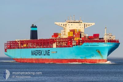
MAERSK HORSBURGH
Cargo A
Current Trip
LKCMBCT>MAPTM02
| Time Travelled | 19 days |
|---|---|
| Remaining Time | --- |
| Distance Travelled | 9229.09 nm |
| Remaining Distance | --- |
| AVG Speed | 19.9 Knop |
| MAX Speed | 24 Knop |
| AVG Wind | 10.9 knots |
| MAX Wind | 30.2 knots |
| MIN Temp | 16.6°C / 61.88°F |
| MAX Temp | 29.9°C / 85.82°F |
| Djupgående | 16.8 m |
| Position mottagen | 1 m sen |
Current Position
| Longitud | -10.95393° |
|---|---|
| Latitude | 31.31948° |
| Status | Under way using engine |
| Fart | 18.6 Knop |
| Kurs | 33.7° |
| Område | North Atlantic Ocean |
| Station | T-AIS |
| Position mottagen | 1 m sen |
Info
Information
The current position of MAERSK HORSBURGH is in North Atlantic Ocean with coordinates 31.31948° / -10.95393° as reported on 2024-04-24 01:21 by AIS to our vessel tracker app. The vessel's current speed is 18.6 Knop
The vessel MAERSK HORSBURGH (IMO: 9784269, MMSI: 563026700) is a Cargo A It's sailing under the flag of [SG] Singapore.
In this page you can find informations about the vessels current position, last detected port calls, and current voyage information. If the vessels is not in coverage by AIS you will find the latest position.
The current position of MAERSK HORSBURGH is detected by our AIS receivers and we are not responsible for the reliability of the data. The last position was recorded while the vessel was in Coverage by the Ais receivers of our vessel tracking app.
The current draught of MAERSK HORSBURGH as reported by AIS is 16.8 meters
Weather
| Temperature | 19°C / 66.2°F |
|---|---|
| Wind Speed | 22 knots |
| Direction | 26° NNE |
| Pressure | 1013.6 hPa |
| Humidity | 76.5 % |
| Cloud Coverage | --- |
Featured Company
Last Port Calls
| Port | Arrival | Departure | Time In Port |
|---|---|---|---|
| 2024-04-03 14:21 | 2024-04-04 18:13 | 1 d | |
| 2024-03-29 02:06 | 2024-03-31 07:37 | 2 d | |
| 2024-03-27 15:37 | 2024-03-28 23:53 | 1 d | |
| 2024-02-24 10:06 | 2024-02-24 22:23 | 12 h | |
| 2024-02-19 15:11 | 2024-02-21 06:22 | 1 d | |
| 2024-02-15 05:54 | 2024-02-17 13:51 | 2 d | |
| 2024-02-07 04:23 | 2024-02-08 17:44 | 1 d | |
| 2024-02-02 17:18 | 2024-02-04 09:49 | 1 d |
Most Visited Ports (Last year)
| Port | Arrivals | |
|---|---|---|
| 8 | ||
| 7 | ||
| 6 | ||
| 4 | ||
| 3 | ||
| 3 |
Last Trips
| Origin | Departure | Destination | Arrival | Distance | |
|---|---|---|---|---|---|
| 2024-03-31 15:37 | 2024-04-03 19:51 | 1610.84 nm | |||
| 2024-03-29 07:53 | 2024-03-29 10:06 | 20.95 nm | |||
| 2024-02-24 23:23 | 2024-03-27 23:37 | 10819.06 nm | |||
| 2024-02-21 07:22 | 2024-02-24 11:06 | 1036.34 nm | |||
| 2024-02-17 14:51 | 2024-02-19 16:11 | 696.86 nm | |||
| 2024-02-08 18:44 | 2024-02-15 06:54 | 286.28 nm | |||
| 2024-01-05 20:58 | 2024-02-07 05:23 | 14101.51 nm | |||
| 2024-01-05 20:58 | 2024-02-02 19:18 | 12759.53 nm |
Events
| Tid | Event | Detaljer | Position / Dest | Information |
|---|---|---|---|---|
| 2024-04-23 23:46 | Byter havsområde | Moroccan part of the North Atlantic Ocean Spanish (Canary Islands) part of the North Atlantic Ocean |
30.91737 / -11.26588
North Atlantic Ocean
LKCMBCT>MAPTM02
|
Fart: 18.3 kn Kurs: 33.8° |
| 2024-04-23 23:45 | Status ändrad | Under way using engine Default |
30.91272 / -11.26950
LKCMBCT>MAPTM02
|
Fart: 18 kn Kurs: 34° |
| 2024-04-23 23:40 | I täckningsområde |
30.91737 / -11.26588
North Atlantic Ocean
LKCMBCT>MAPTM02
|
Fart: 18.3 kn Kurs: 33.8° |
|
| 2024-04-23 20:50 | Status ändrad | Default Under way using engine |
30.17145 / -11.84085
LKCMBCT>MAPTM02
|
Fart: 18.4 kn Kurs: 33.2° |
| 2024-04-23 20:43 | UTANFÖR täckningsområde |
30.13912 / -11.86570
North Atlantic Ocean
LKCMBCT>MAPTM02
|
Fart: 18.4 kn Kurs: 33.2° |
|
| 2024-04-23 20:37 | Status ändrad | Under way using engine Default |
30.11322 / -11.88567
LKCMBCT>MAPTM02
|
Fart: 18.5 kn Kurs: 34° |
| 2024-04-23 20:18 | I täckningsområde |
30.11622 / -11.88340
North Atlantic Ocean
LKCMBCT>MAPTM02
|
Fart: 18.4 kn Kurs: 33.4° |
|
| 2024-04-23 17:19 | Status ändrad | Default Under way using engine |
29.25833 / -12.53833
LKCMBCT>MAPTM02
|
Fart: 18.4 kn Kurs: 34.2° |
| 2024-04-23 17:17 | UTANFÖR täckningsområde |
29.25320 / -12.54283
North Atlantic Ocean
LKCMBCT>MAPTM02
|
Fart: 18.4 kn Kurs: 34.2° |
|
| 2024-04-23 17:16 | Status ändrad | Under way using engine Default |
29.24887 / -12.54618
LKCMBCT>MAPTM02
|
Fart: 18 kn Kurs: 34° |