
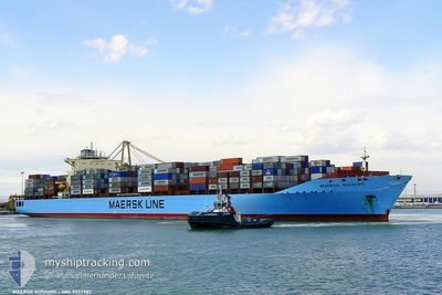
MAERSK COLUMBUS
Container Ship
Current Trip
| Time Travelled | 6 days |
|---|---|
| Remaining Time | --- |
| Distance Travelled | 2965.45 nm |
| Remaining Distance | --- |
| AVG Speed | 19 Knop |
| MAX Speed | 21.2 Knop |
| AVG Wind | 9.9 knots |
| MAX Wind | 20.4 knots |
| MIN Temp | 13.5°C / 56.3°F |
| MAX Temp | 29.5°C / 85.1°F |
| Djupgående | 14.1 m |
| Position mottagen | 3 d sen |
Current Position
| Longitud | -19.38607° |
|---|---|
| Latitude | 19.37630° |
| Status | Under way using engine |
| Fart | 20.7 Knop |
| Kurs | 178.8° |
| Område | North Atlantic Ocean |
| Station | T-AIS |
| Position mottagen | 3 d sen |
Info
Information
The current position of MAERSK COLUMBUS is in North Atlantic Ocean with coordinates 19.37630° / -19.38607° as reported on 2024-04-21 15:42 by AIS to our vessel tracker app. The vessel's current speed is 20.7 Knop and is heading at the port of SALALAH. The estimated time of arrival as calculated by MyShipTracking vessel tracking app is 2024-05-09 16:00 LT
The vessel MAERSK COLUMBUS (IMO: 9332987, MMSI: 338525000) is a Container Ship that was built in 2007 ( 17 År gammal ). It's sailing under the flag of [US] USA.
In this page you can find informations about the vessels current position, last detected port calls, and current voyage information. If the vessels is not in coverage by AIS you will find the latest position.
The current position of MAERSK COLUMBUS is detected by our AIS receivers and we are not responsible for the reliability of the data. The last position was recorded while the vessel was in Coverage by the Ais receivers of our vessel tracking app.
The current draught of MAERSK COLUMBUS as reported by AIS is 14.1 meters
Weather
| Temperature | 28°C / 82.4°F |
|---|---|
| Wind Speed | 17 knots |
| Direction | 136° SE |
| Pressure | 1010 hPa |
| Humidity | 77.6 % |
| Cloud Coverage | 100 % |
Featured Company
Last Port Calls
| Port | Arrival | Departure | Time In Port |
|---|---|---|---|
| 2024-04-18 00:07 | 2024-04-18 21:27 | 21 h | |
| 2024-04-08 08:50 | 2024-04-09 11:17 | 1 d | |
| 2024-04-06 07:26 | 2024-04-07 08:53 | 1 d | |
| 2024-04-03 12:32 | 2024-04-04 16:04 | 1 d | |
| 2024-03-29 17:08 | 2024-03-31 14:51 | 1 d | |
| 2024-03-24 23:13 | 2024-03-25 23:21 | 1 d | |
| 2024-03-22 13:17 | 2024-03-23 02:24 | 13 h | |
| 2024-03-14 00:50 | 2024-03-15 00:13 | 23 h | |
| 2024-02-18 16:26 | 2024-02-20 11:43 | 1 d |
Most Visited Ports (Last year)
| Port | Arrivals | |
|---|---|---|
| 10 | ||
| 10 | ||
| 7 | ||
| 6 | ||
| 5 | ||
| 5 |
Last Trips
| Origin | Departure | Destination | Arrival | Distance | |
|---|---|---|---|---|---|
| 2024-04-09 07:17 | 2024-04-18 02:07 | 3242.91 nm | |||
| 2024-04-07 04:53 | 2024-04-08 04:50 | 294.14 nm | |||
| 2024-04-04 12:04 | 2024-04-06 03:26 | 536.75 nm | |||
| 2024-03-31 09:51 | 2024-04-03 08:32 | 1392.71 nm | |||
| 2024-03-25 19:21 | 2024-03-29 12:08 | 1453.48 nm | |||
| 2024-03-22 22:24 | 2024-03-24 19:13 | 630.47 nm | |||
| 2024-03-15 01:13 | 2024-03-22 09:17 | 3365.14 nm | |||
| 2024-02-20 15:43 | 2024-03-14 01:50 | 10052.41 nm | |||
| 2024-01-27 13:33 | 2024-02-18 20:26 | 9798.39 nm |
Events
| Tid | Event | Detaljer | Position / Dest | Information |
|---|---|---|---|---|
| 2024-04-21 15:49 | Status ändrad | Default Under way using engine |
19.33504 / -19.38543
OMSLL
|
Fart: 20.7 kn Kurs: 178.8° |
| 2024-04-21 15:42 | Status ändrad | Under way using engine Default |
19.37630 / -19.38607
OMSLL
|
Fart: 21 kn Kurs: 179° |
| 2024-04-21 15:42 | UTANFÖR täckningsområde |
19.37630 / -19.38607
North Atlantic Ocean
OMSLL
|
Fart: 20.7 kn Kurs: 178.8° |
|
| 2024-04-21 15:18 | Status ändrad | Default Under way using engine |
19.51667 / -19.38833
OMSLL
|
Fart: 20.6 kn Kurs: 180.4° |
| 2024-04-21 15:05 | Status ändrad | Under way using engine Default |
19.58830 / -19.38938
OMSLL
|
Fart: 21 kn Kurs: 181° |
| 2024-04-21 15:05 | I täckningsområde |
19.57630 / -19.38920
North Atlantic Ocean
OMSLL
|
Fart: 20.4 kn Kurs: 179.8° |
|
| 2024-04-21 02:10 | Status ändrad | Default Under way using engine |
23.67184 / -17.76127
OMSLL
|
Fart: 20.6 kn Kurs: 207.7° |
| 2024-04-21 02:04 | Byter havsområde | Western Saharan part of the North Atlantic Ocean Moroccan part of the North Atlantic Ocean |
23.69874 / -17.74597
North Atlantic Ocean
OMSLL
|
Fart: 20.6 kn Kurs: 207.7° |
| 2024-04-21 02:04 | Status ändrad | Under way using engine Default |
23.69874 / -17.74597
OMSLL
|
Fart: 21 kn Kurs: 209° |
| 2024-04-21 02:04 | UTANFÖR täckningsområde |
23.69874 / -17.74597
North Atlantic Ocean
OMSLL
|
Fart: 20.6 kn Kurs: 207.7° |