
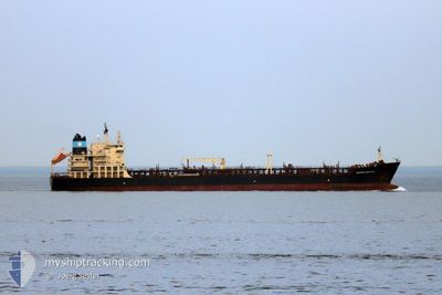
MAERSK BRISTOL
Oil/Chemical Tanker
Current Trip
CO SMR
| Time Travelled | 3 h, 29 mins |
|---|---|
| Remaining Time | --- |
| Distance Travelled | 12.64 nm |
| Remaining Distance | --- |
| AVG Speed | 13.4 Knop |
| MAX Speed | 14 Knop |
| AVG Wind | 3.5 knots |
| MAX Wind | 10 knots |
| MIN Temp | 25.8°C / 78.44°F |
| MAX Temp | 26.4°C / 79.52°F |
| Djupgående | 7.6 m |
| Position mottagen | 1 d sen |
Current Position
| Longitud | -74.23137° |
|---|---|
| Latitude | 11.23470° |
| Status | At anchor |
| Fart | |
| Kurs | 18° |
| Område | North Atlantic Ocean |
| Station | T-AIS |
| Position mottagen | 1 d sen |
Info
Information
The current position of MAERSK BRISTOL is in North Atlantic Ocean with coordinates 11.23470° / -74.23137° as reported on 2024-04-21 18:52 by AIS to our vessel tracker app. The vessel's current speed is 0 Knop
The vessel MAERSK BRISTOL (IMO: 9299434, MMSI: 219124000) is a Oil/Chemical Tanker that was built in 2005 ( 19 År gammal ). It's sailing under the flag of [DK] Denmark.
In this page you can find informations about the vessels current position, last detected port calls, and current voyage information. If the vessels is not in coverage by AIS you will find the latest position.
The current position of MAERSK BRISTOL is detected by our AIS receivers and we are not responsible for the reliability of the data. The last position was recorded while the vessel was in Coverage by the Ais receivers of our vessel tracking app.
The current draught of MAERSK BRISTOL as reported by AIS is 7.6 meters
Weather
| Temperature | 26.7°C / 80.06°F |
|---|---|
| Wind Speed | 14 knots |
| Direction | 78° ENE |
| Pressure | 1013.8 hPa |
| Humidity | 82.7 % |
| Cloud Coverage | 100 % |
Featured Company
Last Port Calls
| Port | Arrival | Departure | Time In Port |
|---|---|---|---|
| 2024-04-22 00:44 | 2024-04-23 12:29 | 1 d | |
| 2024-04-11 10:40 | 2024-04-13 10:00 | 1 d | |
| 2024-04-04 19:08 | 2024-04-07 13:39 | 2 d | |
| 2024-02-13 04:58 | 2024-02-13 22:38 | 17 h | |
| 2024-02-06 12:45 | 2024-02-07 07:33 | 18 h |
Most Visited Ports (Last year)
| Port | Arrivals | |
|---|---|---|
| 5 | ||
| 2 | ||
| 2 | ||
| 1 | ||
| 1 | ||
| 1 |
Last Trips
| Origin | Departure | Destination | Arrival | Distance | |
|---|---|---|---|---|---|
| 2024-04-13 06:00 | 2024-04-21 19:44 | 1695.18 nm | |||
| 2024-04-07 09:39 | 2024-04-11 06:40 | 60.20 nm | |||
| 2024-02-14 06:38 | 2024-04-04 15:08 | 9446.29 nm | |||
| 2024-02-07 15:33 | 2024-02-13 12:58 | 411.87 nm | |||
| 2024-01-21 23:54 | 2024-02-06 20:45 | 3792.83 nm |
Events
| Tid | Event | Detaljer | Position / Dest | Information |
|---|---|---|---|---|
| 2024-04-23 12:29 | STARTAR förflyttning | 0.32 nm, North West of SANTA MARTA |
11.24722 / -74.22476
CO SMR
|
Fart: 6.3 kn Kurs: 255° |
| 2024-04-23 12:29 | AVGÅTT HAMN |
|
11.24722 / -74.22476
CO SMR
|
Fart: 2 kn Kurs: -1° |
| 2024-04-22 01:03 | STOPPAR förflyttning |
11.25167 / -74.21500
[CO] SANTA MARTA
|
Fart: Kurs: -1° |
|
| 2024-04-22 00:44 | ANLÄNDER HAMN |
|
11.25039 / -74.21625
[CO] SANTA MARTA
|
Fart: 3 kn Kurs: -1° |
| 2024-04-22 00:27 | STARTAR förflyttning | 0.4 nm, West of SANTA MARTA |
11.24333 / -74.22667
CO SMR
|
Fart: 4 kn Kurs: -1° |
| 2024-04-21 18:59 | Status ändrad | Default At anchor |
11.23500 / -74.23167
CO SMR
|
Fart: Kurs: 18° |
| 2024-04-21 18:52 | UTANFÖR täckningsområde |
11.23470 / -74.23137
North Atlantic Ocean
|
Fart: Kurs: 18° |
|
| 2024-04-21 18:37 | Status ändrad | At anchor Default |
11.23470 / -74.23140
CO SMR
|
Fart: Kurs: -1° |
| 2024-04-21 18:32 | Status ändrad | Default At anchor |
11.23500 / -74.23167
CO SMR
|
Fart: Kurs: 31° |
| 2024-04-21 18:19 | Status ändrad | At anchor Default |
11.23475 / -74.23152
CO SMR
|
Fart: Kurs: -1° |